Jühnde elevation
Jühnde (Lower Saxony), Germany elevation is 321 meters and Jühnde elevation in feet is 1053 ft above sea level [src 1]. Jühnde is a seat of a fourth-order administrative division (feature code) with elevation that is 63 meters (207 ft) bigger than average city elevation in Germany.
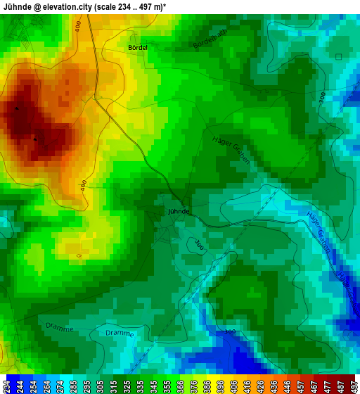
Below is the Elevation map of Jühnde, which displays elevation range with different colors. Scale of the first map is from 234 to 497 m (768 to 1631 ft) with average elevation of 334.4 meters (=1097 ft) [note 1]
These maps also provides idea of topography and contour of this city, they are displayed at different zoom levels. More info about maps, scale and edge coordinates you can find below images.
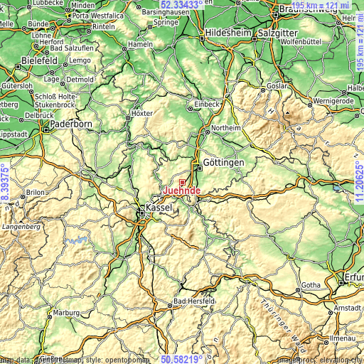
| \ | Map #1 | Topo.Map |
| Scale [m] | 234..497 m | × |
| Scale [ft] | 768..1631 ft | × |
| Average | 334.4 m = 1097 ft | × |
| Width | 6.09 km = 3.8 mi | 194.8 km = 121 mi |
| Height | 6.09 km = 3.8 mi | 194.8 km = 121 mi |
| ↑Max Latitude | 51.494038° | 52.33433° |
| Latitude at center | 51.46667° | 51.46667° |
| ↓Min Latitude | 51.439285° | 50.58219° |
| ← Min Longitude | 9.756055° | 8.39375° |
| Longitude center | 9.8° | 9.8° |
| →Max Longitude | 9.843945° | 11.20625° |
Nearby cities:
Cities around Jühnde sort by population:
• Göttingen elevation 153 m
11.9 km,  50°
50°
• Hannoversch Münden 129 m
11.8 km,  241°
241°
• Witzenhausen 151 m
14.5 km,  164°
164°
• Bovenden 142 m
16 km,  31°
31°
• Friedland 181 m
9.7 km,  122°
122°
• Fuldatal 172 m
18.6 km, 240°
• Rosdorf 168 m
7.9 km,  61°
61°
• Gemeinde Friedland 255 m
10.8 km, 121°
• Adelebsen 185 m
13.3 km,  346°
346°
• Dransfeld 309 m
4.5 km,  323°
323°
• Scheden 236 m
5 km,  248°
248°
• Arenshausen 204 m
15.4 km,  130°
130°
Multilingual:
 En español:
Jühnde elevación 321 m.
 En France:
Barlissen élévation 321 m.


Sources and notes:
- [note 1] Map square and city borders are not equal. Map elevation data is calculated only from area inside that square.
- [src 1] Elevation data from geonames database provided with same terms of usage.
- [src 2] The elevation map of Jühnde is generated using elevation data from NASA's 3 arcsec (90m) resolution SRTM data.
- [src 3] Base (background) map © OpenStreetMap contributors tiles are generated by Geofabrik and OpenTopoMap.
Copyright & License:
This Jühnde Elevation Map is licensed under CC BY-SA. You may reuse any part from this page, if you give a proper credit by linking to this URL:
 More info on terms of use page.