Linkenheim-Hochstetten elevation
Linkenheim-Hochstetten (Baden-Württemberg, Karlsruhe Region), Germany elevation is 106 meters and Linkenheim-Hochstetten elevation in feet is 348 ft above sea level [src 1]. Linkenheim-Hochstetten is a seat of a fourth-order administrative division (feature code) with elevation that is 152 meters (499 ft) smaller than average city elevation in Germany.
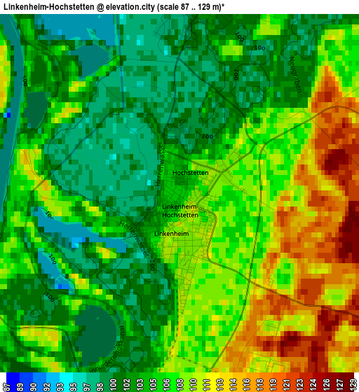
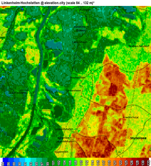
Below is the Elevation map of Linkenheim-Hochstetten, which displays elevation range with different colors. Scale of the first map is from 87 to 129 m (285 to 423 ft) with average elevation of 105.7 meters (=347 ft) [note 1]
These maps also provides idea of topography and contour of this city, they are displayed at different zoom levels. More info about maps, scale and edge coordinates you can find below images.
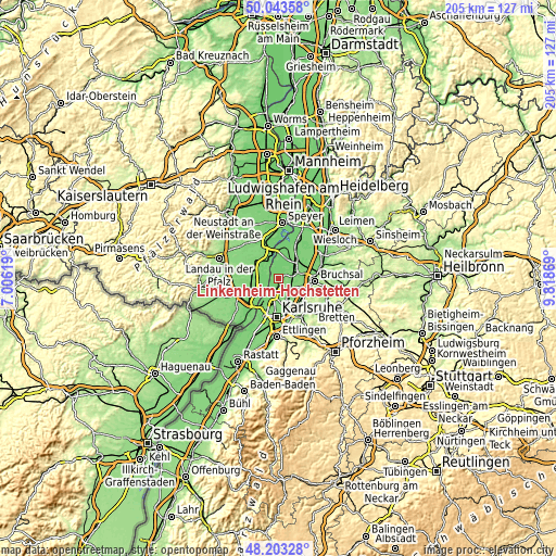
| \ | Map #1 | Map #2 | Topo.Map |
| Scale [m] | 87..129 m | 84..132 m | × |
| Scale [ft] | 285..423 ft | 276..433 ft | × |
| Average | 105.7 m = 347 ft | 106.5 m = 349 ft | × |
| Width | 6.39 km = 4 mi | 12.79 km = 7.9 mi | 204.6 km = 127.1 mi |
| Height | 6.39 km = 4 mi | 12.79 km = 7.9 mi | 204.6 km = 127.1 mi |
| ↑Max Latitude | 49.160716° | 49.189445° | 50.04358° |
| Latitude at center | 49.13197° | 49.13197° | 49.13197° |
| ↓Min Latitude | 49.103207° | 49.074428° | 48.20328° |
| ← Min Longitude | 8.368495° | 8.324549° | 7.00619° |
| Longitude center | 8.41244° | 8.41244° | 8.41244° |
| →Max Longitude | 8.456385° | 8.500331° | 9.81869° |
Nearby cities:
Cities around Linkenheim-Hochstetten sort by population:
• Germersheim elevation 99 m
10.7 km,  340°
340°
• Eggenstein-Leopoldshafen 110 m
4.8 km,  192°
192°
• Graben-Neudorf 109 m
7 km,  56°
56°
• Karlsdorf-Neuthard 110 m
8.6 km,  87°
87°
• Rülzheim 109 m
9 km,  285°
285°
• Jockgrim 114 m
10.9 km,  246°
246°
• Hambrücken 107 m
11.3 km, 55°
• Rheinzabern 113 m
9.9 km,  261°
261°
• Leimersheim 103 m
5 km, 259°
• Hördt 111 m
7.3 km,  301°
301°
• Kuhardt 111 m
7.3 km,  282°
282°
• Neupotz 104 m
6.9 km, 256°
Multilingual:
 En español:
Linkenheim-Hochstetten elevación 106 m.
 En France:
Linkenheim-Hochstetten élévation 106 m.
 Auf Deutsch:
Linkenheim-Hochstetten höhe über dem Meeresspiegel ist 106 m.
 На русском:
Линкенхайм-Хохштеттен высота над уровнем моря 106 м
Sources and notes:
- [note 1] Map square and city borders are not equal. Map elevation data is calculated only from area inside that square.
- [src 1] Elevation data from geonames database provided with same terms of usage.
- [src 2] The elevation map of Linkenheim-Hochstetten is generated using elevation data from NASA's 3 arcsec (90m) resolution SRTM data.
- [src 3] Base (background) map © OpenStreetMap contributors tiles are generated by Geofabrik and OpenTopoMap.
Copyright & License:
This Linkenheim-Hochstetten Elevation Map is licensed under CC BY-SA. You may reuse any part from this page, if you give a proper credit by linking to this URL:
 More info on terms of use page.