Asbach-Bäumenheim elevation
Asbach-Bäumenheim (Bavaria, Swabia), Germany elevation is 405 meters and Asbach-Bäumenheim elevation in feet is 1329 ft above sea level [src 1]. Asbach-Bäumenheim is a seat of a fourth-order administrative division (feature code) with elevation that is 147 meters (482 ft) bigger than average city elevation in Germany.
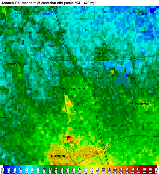
Below is the Elevation map of Asbach-Bäumenheim, which displays elevation range with different colors. Scale of the first map is from 394 to 420 m (1293 to 1378 ft) with average elevation of 402 meters (=1319 ft) [note 1]
These maps also provides idea of topography and contour of this city, they are displayed at different zoom levels. More info about maps, scale and edge coordinates you can find below images.
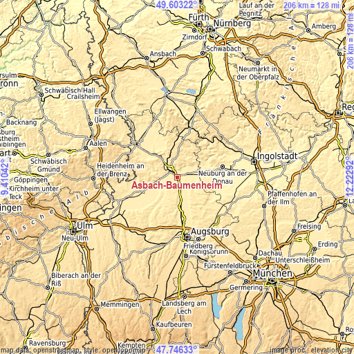
| \ | Map #1 | Map #2 | Topo.Map |
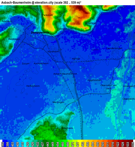
| Scale [m] | 394..420 m | 392..539 m | × |
| Scale [ft] | 1293..1378 ft | 1286..1768 ft | × |
| Average | 402 m = 1319 ft | 412.5 m = 1353 ft | × |
| Width | 6.45 km = 4 mi | 12.9 km = 8 mi | 206.5 km = 128.3 mi |
| Height | 6.45 km = 4 mi | 12.9 km = 8 mi | 206.5 km = 128.3 mi |
| ↑Max Latitude | 48.712335° | 48.741324° | 49.60322° |
| Latitude at center | 48.68333° | 48.68333° | 48.68333° |
| ↓Min Latitude | 48.654308° | 48.625269° | 47.74633° |
| ← Min Longitude | 10.772725° | 10.728779° | 9.41042° |
| Longitude center | 10.81667° | 10.81667° | 10.81667° |
| →Max Longitude | 10.860615° | 10.904561° | 12.22292° |
Nearby cities:
Cities around Asbach-Bäumenheim sort by population:
• Donauwörth elevation 410 m
4.7 km,  324°
324°
• Rain 410 m
7.3 km,  83°
83°
• Kaisheim 475 m
9.5 km,  350°
350°
• Tapfheim 414 m
9.8 km,  263°
263°
• Mertingen 412 m
3 km,  195°
195°
• Oberndorf 408 m
4 km,  112°
112°
• Nordendorf 422 m
9.9 km,  173°
173°
• Buchdorf 539 m
11.2 km,  6°
6°
• Niederschönenfeld 394 m
9.3 km,  66°
66°
• Genderkingen 398 m
5.2 km, 69°
• Ehingen 448 m
9.3 km,  187°
187°
• Ellgau 420 m
10 km,  158°
158°
Multilingual:
 En español:
Asbach-Bäumenheim elevación 405 m.
 En France:
Asbach-Bäumenheim élévation 405 m.
 Auf Deutsch:
Asbach-Bäumenheim höhe über dem Meeresspiegel ist 405 m.

Sources and notes:
- [note 1] Map square and city borders are not equal. Map elevation data is calculated only from area inside that square.
- [src 1] Elevation data from geonames database provided with same terms of usage.
- [src 2] The elevation map of Asbach-Bäumenheim is generated using elevation data from NASA's 3 arcsec (90m) resolution SRTM data.
- [src 3] Base (background) map © OpenStreetMap contributors tiles are generated by Geofabrik and OpenTopoMap.
Copyright & License:
This Asbach-Bäumenheim Elevation Map is licensed under CC BY-SA. You may reuse any part from this page, if you give a proper credit by linking to this URL:
 More info on terms of use page.