Tapfheim elevation
Tapfheim (Bavaria, Swabia), Germany elevation is 414 meters and Tapfheim elevation in feet is 1358 ft above sea level [src 1]. Tapfheim is a seat of a fourth-order administrative division (feature code) with elevation that is 156 meters (512 ft) bigger than average city elevation in Germany.
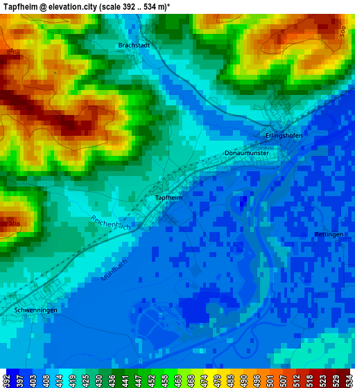
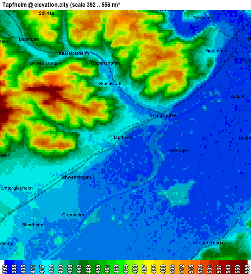
Below is the Elevation map of Tapfheim, which displays elevation range with different colors. Scale of the first map is from 392 to 534 m (1286 to 1752 ft) with average elevation of 429.2 meters (=1408 ft) [note 1]
These maps also provides idea of topography and contour of this city, they are displayed at different zoom levels. More info about maps, scale and edge coordinates you can find below images.
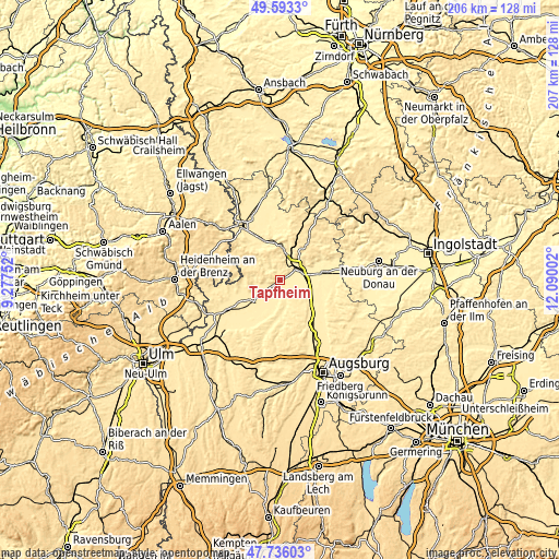
| \ | Map #1 | Map #2 | Topo.Map |
| Scale [m] | 392..534 m | 392..556 m | × |
| Scale [ft] | 1286..1752 ft | 1286..1824 ft | × |
| Average | 429.2 m = 1408 ft | 432.2 m = 1418 ft | × |
| Width | 6.45 km = 4 mi | 12.91 km = 8 mi | 206.5 km = 128.3 mi |
| Height | 6.45 km = 4 mi | 12.91 km = 8 mi | 206.5 km = 128.3 mi |
| ↑Max Latitude | 48.702231° | 48.731225° | 49.5933° |
| Latitude at center | 48.67322° | 48.67322° | 48.67322° |
| ↓Min Latitude | 48.644192° | 48.615148° | 47.73603° |
| ← Min Longitude | 10.639825° | 10.595879° | 9.27752° |
| Longitude center | 10.68377° | 10.68377° | 10.68377° |
| →Max Longitude | 10.727715° | 10.771661° | 12.09002° |
Nearby cities:
Cities around Tapfheim sort by population:
• Donauwörth elevation 410 m
8.6 km,  54°
54°
• Wertingen 428 m
12.2 km,  180°
180°
• Höchstädt an der Donau 418 m
10.9 km,  230°
230°
• Buttenwiesen 409 m
8.5 km,  163°
163°
• Harburg 411 m
12.6 km,  1°
1°
• Asbach-Bäumenheim 405 m
9.8 km,  83°
83°
• Mertingen 412 m
9.1 km,  101°
101°
• Bissingen 443 m
6.9 km,  315°
315°
• Blindheim 416 m
6.6 km, 225°
• Schwenningen 410 m
3.6 km,  223°
223°
• Binswangen 421 m
13.2 km,  193°
193°
• Ehingen 448 m
11.8 km,  133°
133°
Multilingual:
 En español:
Tapfheim elevación 414 m.
 En France:
Tapfheim élévation 414 m.
 Auf Deutsch:
Tapfheim höhe über dem Meeresspiegel ist 414 m.

Sources and notes:
- [note 1] Map square and city borders are not equal. Map elevation data is calculated only from area inside that square.
- [src 1] Elevation data from geonames database provided with same terms of usage.
- [src 2] The elevation map of Tapfheim is generated using elevation data from NASA's 3 arcsec (90m) resolution SRTM data.
- [src 3] Base (background) map © OpenStreetMap contributors tiles are generated by Geofabrik and OpenTopoMap.
Copyright & License:
This Tapfheim Elevation Map is licensed under CC BY-SA. You may reuse any part from this page, if you give a proper credit by linking to this URL:
 More info on terms of use page.