Kaisheim elevation
Kaisheim (Bavaria, Swabia), Germany elevation is 475 meters and Kaisheim elevation in feet is 1558 ft above sea level [src 1]. Kaisheim is a populated place (feature code) with elevation that is 217 meters (712 ft) bigger than average city elevation in Germany.
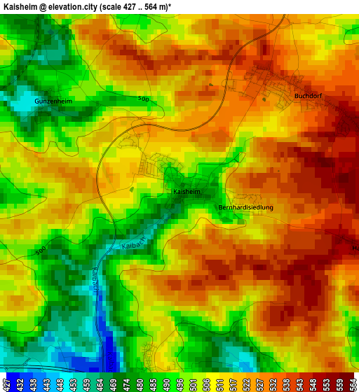
Below is the Elevation map of Kaisheim, which displays elevation range with different colors. Scale of the first map is from 427 to 564 m (1401 to 1850 ft) with average elevation of 509.6 meters (=1672 ft) [note 1]
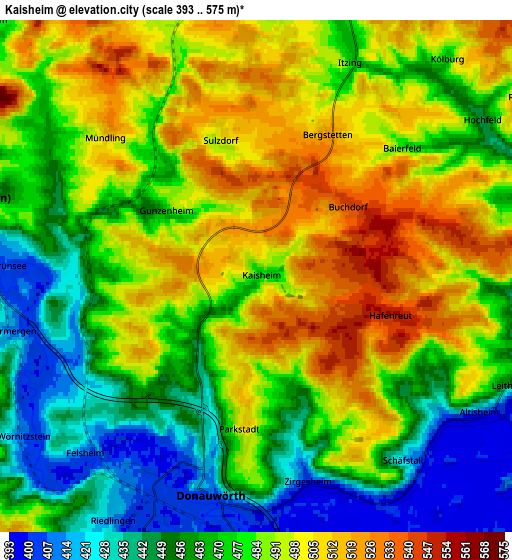
These maps also provides idea of topography and contour of this city, they are displayed at different zoom levels. More info about maps, scale and edge coordinates you can find below images.
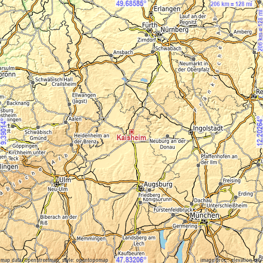
| \ | Map #1 | Map #2 | Topo.Map |
| Scale [m] | 427..564 m | 393..575 m | × |
| Scale [ft] | 1401..1850 ft | 1289..1886 ft | × |
| Average | 509.6 m = 1672 ft | 479 m = 1572 ft | × |
| Width | 6.44 km = 4 mi | 12.88 km = 8 mi | 206.1 km = 128.1 mi |
| Height | 6.44 km = 4 mi | 12.88 km = 8 mi | 206.1 km = 128.1 mi |
| ↑Max Latitude | 48.796467° | 48.825407° | 49.68585° |
| Latitude at center | 48.76751° | 48.76751° | 48.76751° |
| ↓Min Latitude | 48.738537° | 48.709546° | 47.83206° |
| ← Min Longitude | 10.752445° | 10.708499° | 9.39014° |
| Longitude center | 10.79639° | 10.79639° | 10.79639° |
| →Max Longitude | 10.840335° | 10.884281° | 12.20264° |
Nearby cities:
Cities around Kaisheim sort by population:
• Donauwörth elevation 410 m
5.6 km,  192°
192°
• Rain 410 m
12.3 km,  134°
134°
• Harburg 411 m
8.1 km,  285°
285°
• Monheim 497 m
9.6 km,  28°
28°
• Asbach-Bäumenheim 405 m
9.5 km,  170°
170°
• Marxheim 407 m
11.3 km,  104°
104°
• Oberndorf 408 m
12.1 km,  154°
154°
• Huisheim 446 m
9.4 km,  313°
313°
• Buchdorf 539 m
3.2 km,  56°
56°
• Niederschönenfeld 394 m
11.5 km,  119°
119°
• Fünfstetten 501 m
7.5 km,  342°
342°
• Genderkingen 398 m
9.8 km,  139°
139°
Multilingual:
 En español:
Kaisheim elevación 475 m.
 En France:
Kaisheim élévation 475 m.
 Auf Deutsch:
Kaisheim höhe über dem Meeresspiegel ist 475 m.

Sources and notes:
- [note 1] Map square and city borders are not equal. Map elevation data is calculated only from area inside that square.
- [src 1] Elevation data from geonames database provided with same terms of usage.
- [src 2] The elevation map of Kaisheim is generated using elevation data from NASA's 3 arcsec (90m) resolution SRTM data.
- [src 3] Base (background) map © OpenStreetMap contributors tiles are generated by Geofabrik and OpenTopoMap.
Copyright & License:
This Kaisheim Elevation Map is licensed under CC BY-SA. You may reuse any part from this page, if you give a proper credit by linking to this URL:
 More info on terms of use page.