Ahrbrück elevation
Ahrbrück (Rheinland-Pfalz), Germany elevation is 202 meters and Ahrbrück elevation in feet is 663 ft above sea level [src 1]. Ahrbrück is a seat of a fourth-order administrative division (feature code) with elevation that is 56 meters (184 ft) smaller than average city elevation in Germany.
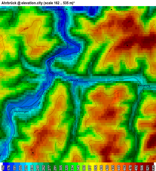
Below is the Elevation map of Ahrbrück, which displays elevation range with different colors. Scale of the first map is from 162 to 535 m (531 to 1755 ft) with average elevation of 345.1 meters (=1132 ft) [note 1]
These maps also provides idea of topography and contour of this city, they are displayed at different zoom levels. More info about maps, scale and edge coordinates you can find below images.
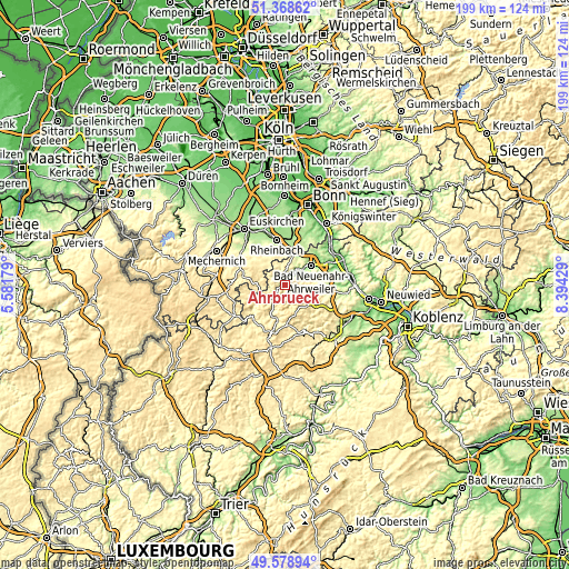
| \ | Map #1 | Topo.Map |
| Scale [m] | 162..535 m | × |
| Scale [ft] | 531..1755 ft | × |
| Average | 345.1 m = 1132 ft | × |
| Width | 6.22 km = 3.9 mi | 199 km = 123.7 mi |
| Height | 6.22 km = 3.9 mi | 199 km = 123.7 mi |
| ↑Max Latitude | 50.510205° | 51.36862° |
| Latitude at center | 50.48225° | 50.48225° |
| ↓Min Latitude | 50.454279° | 49.57894° |
| ← Min Longitude | 6.944095° | 5.58179° |
| Longitude center | 6.98804° | 6.98804° |
| →Max Longitude | 7.031985° | 8.39429° |
Nearby cities:
Cities around Ahrbrück sort by population:
• Bad Neuenahr-Ahrweiler elevation 101 m
11 km,  52°
52°
• Rheinbach 182 m
16.2 km,  350°
350°
• Meckenheim 185 m
16 km,  10°
10°
• Adenau 309 m
11.8 km,  199°
199°
• Niederzissen 203 m
16.5 km,  99°
99°
• Dernau 121 m
7.2 km,  37°
37°
• Kempenich 480 m
11.4 km,  127°
127°
• Altenahr 169 m
3.9 km,  4°
4°
• Weibern 434 m
13.9 km, 126°
• Berg 362 m
8.6 km,  341°
341°
• Oberzissen 291 m
15.4 km, 103°
• Niederdürenbach 302 m
14.3 km, 104°
Multilingual:
 En español:
Ahrbrück elevación 202 m.
 En France:
Ahrbrück élévation 202 m.
 Auf Deutsch:
Ahrbrück höhe über dem Meeresspiegel ist 202 m.

Sources and notes:
- [note 1] Map square and city borders are not equal. Map elevation data is calculated only from area inside that square.
- [src 1] Elevation data from geonames database provided with same terms of usage.
- [src 2] The elevation map of Ahrbrück is generated using elevation data from NASA's 3 arcsec (90m) resolution SRTM data.
- [src 3] Base (background) map © OpenStreetMap contributors tiles are generated by Geofabrik and OpenTopoMap.
Copyright & License:
This Ahrbrück Elevation Map is licensed under CC BY-SA. You may reuse any part from this page, if you give a proper credit by linking to this URL:
 More info on terms of use page.