Rheinbach elevation
Rheinbach (North Rhine-Westphalia, Regierungsbezirk Köln), Germany elevation is 182 meters and Rheinbach elevation in feet is 597 ft above sea level [src 1]. Rheinbach is a populated place (feature code) with elevation that is 76 meters (249 ft) smaller than average city elevation in Germany.
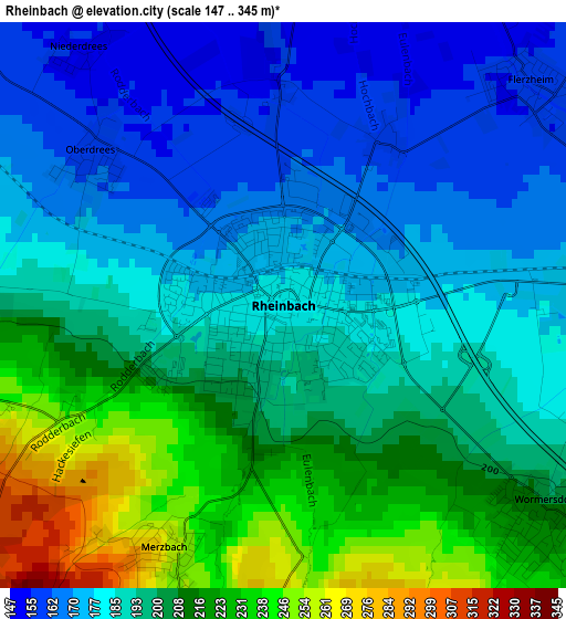
Below is the Elevation map of Rheinbach, which displays elevation range with different colors. Scale of the first map is from 147 to 345 m (482 to 1132 ft) with average elevation of 195 meters (=640 ft) [note 1]
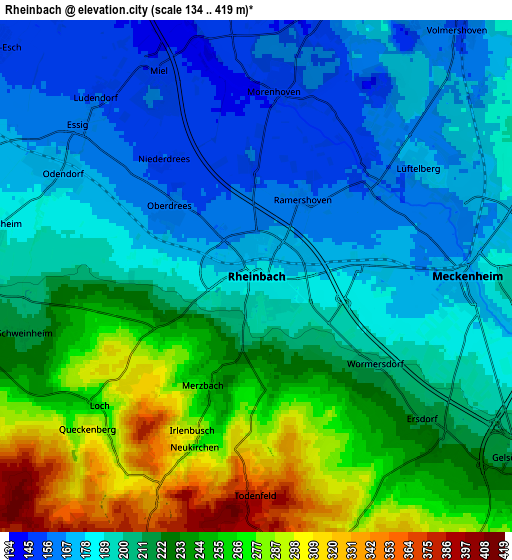
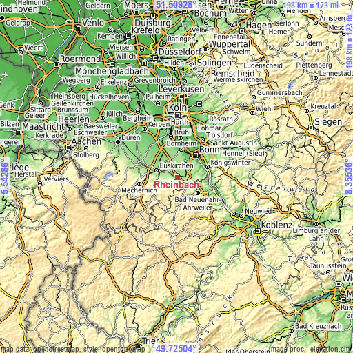
These maps also provides idea of topography and contour of this city, they are displayed at different zoom levels. More info about maps, scale and edge coordinates you can find below images.
| \ | Map #1 | Map #2 | Topo.Map |
| Scale [m] | 147..345 m | 134..419 m | × |
| Scale [ft] | 482..1132 ft | 440..1375 ft | × |
| Average | 195 m = 640 ft | 213 m = 699 ft | × |
| Width | 6.2 km = 3.9 mi | 12.4 km = 7.7 mi | 198.4 km = 123.3 mi |
| Height | 6.2 km = 3.9 mi | 12.4 km = 7.7 mi | 198.4 km = 123.3 mi |
| ↑Max Latitude | 50.65349° | 50.681343° | 51.50928° |
| Latitude at center | 50.62562° | 50.62562° | 50.62562° |
| ↓Min Latitude | 50.597733° | 50.56983° | 49.72504° |
| ← Min Longitude | 6.905165° | 6.861219° | 5.54286° |
| Longitude center | 6.94911° | 6.94911° | 6.94911° |
| →Max Longitude | 6.993055° | 7.037001° | 8.35536° |
Nearby cities:
Cities around Rheinbach sort by population:
• Bonn elevation 64 m
15.9 km,  40°
40°
• Euskirchen 164 m
12.1 km,  288°
288°
• Bornheim 62 m
15.6 km,  10°
10°
• Bad Neuenahr-Ahrweiler 101 m
14.7 km,  128°
128°
• Meckenheim 185 m
5.7 km,  91°
91°
• Alfter 85 m
12.9 km,  21°
21°
• Wachtberg 194 m
10.7 km, 85°
• Bad Münstereifel 283 m
15.1 km,  239°
239°
• Weilerswist 120 m
15.9 km,  332°
332°
• Dernau 121 m
12.5 km,  145°
145°
• Altenahr 169 m
12.5 km,  165°
165°
• Berg 362 m
7.8 km,  180°
180°
Multilingual:
 En español:
Rheinbach elevación 182 m.
 En France:
Rheinbach élévation 182 m.
 Auf Deutsch:
Rheinbach höhe über dem Meeresspiegel ist 182 m.

Sources and notes:
- [note 1] Map square and city borders are not equal. Map elevation data is calculated only from area inside that square.
- [src 1] Elevation data from geonames database provided with same terms of usage.
- [src 2] The elevation map of Rheinbach is generated using elevation data from NASA's 3 arcsec (90m) resolution SRTM data.
- [src 3] Base (background) map © OpenStreetMap contributors tiles are generated by Geofabrik and OpenTopoMap.
Copyright & License:
This Rheinbach Elevation Map is licensed under CC BY-SA. You may reuse any part from this page, if you give a proper credit by linking to this URL:
 More info on terms of use page.