Lauchringen elevation
Lauchringen (Baden-Württemberg, Freiburg Region), Germany elevation is 349 meters and Lauchringen elevation in feet is 1145 ft above sea level [src 1]. Lauchringen is a seat of a fourth-order administrative division (feature code) with elevation that is 91 meters (299 ft) bigger than average city elevation in Germany.
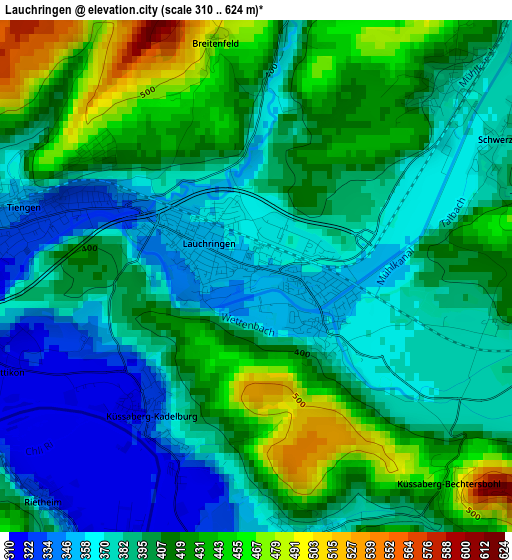
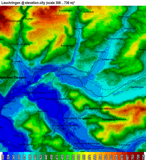
Below is the Elevation map of Lauchringen, which displays elevation range with different colors. Scale of the first map is from 310 to 624 m (1017 to 2047 ft) with average elevation of 398.5 meters (=1307 ft) [note 1]
These maps also provides idea of topography and contour of this city, they are displayed at different zoom levels. More info about maps, scale and edge coordinates you can find below images.
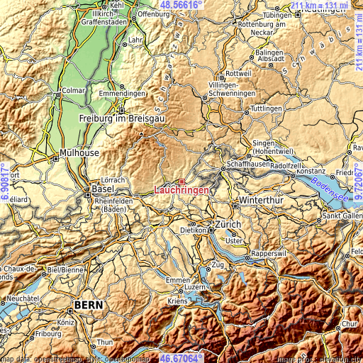
| \ | Map #1 | Map #2 | Topo.Map |
| Scale [m] | 310..624 m | 308..736 m | × |
| Scale [ft] | 1017..2047 ft | 1010..2415 ft | × |
| Average | 398.5 m = 1307 ft | 443.5 m = 1455 ft | × |
| Width | 6.59 km = 4.1 mi | 13.17 km = 8.2 mi | 210.8 km = 131 mi |
| Height | 6.59 km = 4.1 mi | 13.17 km = 8.2 mi | 210.7 km = 130.9 mi |
| ↑Max Latitude | 47.656599° | 47.686191° | 48.56616° |
| Latitude at center | 47.62699° | 47.62699° | 47.62699° |
| ↓Min Latitude | 47.597364° | 47.567722° | 46.67064° |
| ← Min Longitude | 8.270475° | 8.226529° | 6.90817° |
| Longitude center | 8.31442° | 8.31442° | 8.31442° |
| →Max Longitude | 8.358365° | 8.402311° | 9.72067° |
Nearby cities:
Cities around Lauchringen sort by population:
• Waldshut-Tiengen elevation 341 m
7.3 km,  266°
266°
• Staufen 942 m
16.4 km,  331°
331°
• Albbruck 315 m
14.4 km,  253°
253°
• Wutöschingen 387 m
5.4 km,  47°
47°
• Stühlingen 454 m
16.6 km,  37°
37°
• Ühlingen-Birkendorf 637 m
10 km,  0°
0°
• Hohentengen 374 m
10.9 km,  125°
125°
• Weilheim 669 m
7.5 km,  305°
305°
• Höchenschwand 994 m
16.2 km,  316°
316°
• Dogern 326 m
11.2 km,  260°
260°
• Eggingen 434 m
10.3 km, 38°
• Dettighofen 488 m
12.8 km,  91°
91°
Multilingual:
 En español:
Lauchringen elevación 349 m.
 En France:
Lauchringen élévation 349 m.
 Auf Deutsch:
Lauchringen höhe über dem Meeresspiegel ist 349 m.

Sources and notes:
- [note 1] Map square and city borders are not equal. Map elevation data is calculated only from area inside that square.
- [src 1] Elevation data from geonames database provided with same terms of usage.
- [src 2] The elevation map of Lauchringen is generated using elevation data from NASA's 3 arcsec (90m) resolution SRTM data.
- [src 3] Base (background) map © OpenStreetMap contributors tiles are generated by Geofabrik and OpenTopoMap.
Copyright & License:
This Lauchringen Elevation Map is licensed under CC BY-SA. You may reuse any part from this page, if you give a proper credit by linking to this URL:
 More info on terms of use page.