Staufen elevation
Staufen (Baden-Württemberg, Freiburg Region), Germany elevation is 942 meters and Staufen elevation in feet is 3091 ft above sea level [src 1]. Staufen is a populated place (feature code) with elevation that is 684 meters (2244 ft) bigger than average city elevation in Germany.
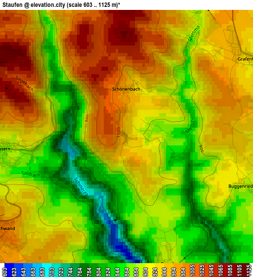
Below is the Elevation map of Staufen, which displays elevation range with different colors. Scale of the first map is from 603 to 1125 m (1978 to 3691 ft) with average elevation of 916.3 meters (=3006 ft) [note 1]
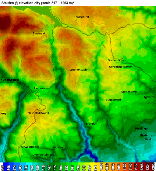
These maps also provides idea of topography and contour of this city, they are displayed at different zoom levels. More info about maps, scale and edge coordinates you can find below images.
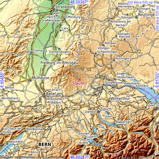
| \ | Map #1 | Map #2 | Topo.Map |
| Scale [m] | 603..1125 m | 517..1263 m | × |
| Scale [ft] | 1978..3691 ft | 1696..4144 ft | × |
| Average | 916.3 m = 3006 ft | 900.5 m = 2954 ft | × |
| Width | 6.57 km = 4.1 mi | 13.14 km = 8.2 mi | 210.2 km = 130.6 mi |
| Height | 6.57 km = 4.1 mi | 13.14 km = 8.2 mi | 210.2 km = 130.6 mi |
| ↑Max Latitude | 47.786395° | 47.815913° | 48.69367° |
| Latitude at center | 47.75686° | 47.75686° | 47.75686° |
| ↓Min Latitude | 47.727308° | 47.697739° | 46.80287° |
| ← Min Longitude | 8.166835° | 8.122889° | 6.80453° |
| Longitude center | 8.21078° | 8.21078° | 8.21078° |
| →Max Longitude | 8.254725° | 8.298671° | 9.61703° |
Nearby cities:
Cities around Staufen sort by population:
• Waldshut-Tiengen elevation 341 m
14.9 km,  178°
178°
• Bonndorf 834 m
11.9 km,  54°
54°
• Ühlingen-Birkendorf 637 m
9.1 km,  119°
119°
• Lenzkirch 810 m
12.4 km,  357°
357°
• Sankt Blasien 765 m
6.3 km,  275°
275°
• Weilheim 669 m
10.2 km,  170°
170°
• Schluchsee 943 m
7 km,  342°
342°
• Höchenschwand 994 m
4.2 km,  231°
231°
• Todtmoos 809 m
15.7 km,  263°
263°
• Bernau 916 m
13.8 km,  290°
290°
• Eggingen 434 m
15.5 km,  114°
114°
• Häusern 886 m
3.4 km, 256°
Multilingual:
 En español:
Staufen elevación 942 m.
 En France:
Staufen élévation 942 m.


Sources and notes:
- [note 1] Map square and city borders are not equal. Map elevation data is calculated only from area inside that square.
- [src 1] Elevation data from geonames database provided with same terms of usage.
- [src 2] The elevation map of Staufen is generated using elevation data from NASA's 3 arcsec (90m) resolution SRTM data.
- [src 3] Base (background) map © OpenStreetMap contributors tiles are generated by Geofabrik and OpenTopoMap.
Copyright & License:
This Staufen Elevation Map is licensed under CC BY-SA. You may reuse any part from this page, if you give a proper credit by linking to this URL:
 More info on terms of use page.