Alfdorf elevation
Alfdorf (Baden-Württemberg, Regierungsbezirk Stuttgart), Germany elevation is 488 meters and Alfdorf elevation in feet is 1601 ft above sea level [src 1]. Alfdorf is a seat of a fourth-order administrative division (feature code) with elevation that is 230 meters (755 ft) bigger than average city elevation in Germany.
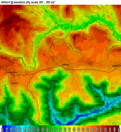
Below is the Elevation map of Alfdorf, which displays elevation range with different colors. Scale of the first map is from 307 to 553 m (1007 to 1814 ft) with average elevation of 456.3 meters (=1497 ft) [note 1]
These maps also provides idea of topography and contour of this city, they are displayed at different zoom levels. More info about maps, scale and edge coordinates you can find below images.
| \ | Map #1 | Map #2 | Topo.Map |
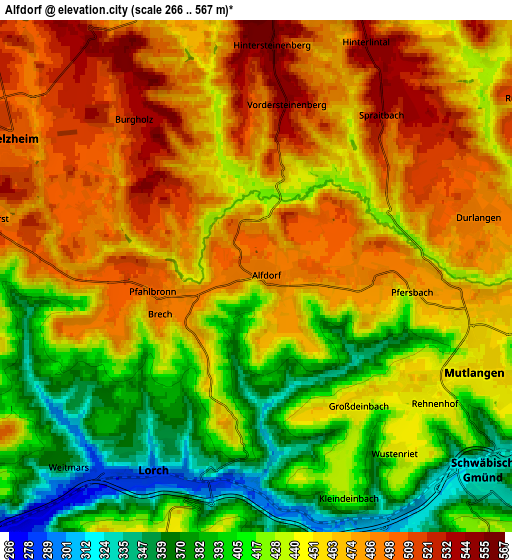
| Scale [m] | 307..553 m | 266..567 m | × |
| Scale [ft] | 1007..1814 ft | 873..1860 ft | × |
| Average | 456.3 m = 1497 ft | 447.6 m = 1469 ft | × |
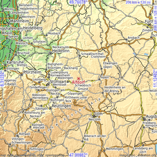
| Width | 6.43 km = 4 mi | 12.86 km = 8 mi | 205.8 km = 127.9 mi |
| Height | 6.43 km = 4 mi | 12.86 km = 8 mi | 205.8 km = 127.9 mi |
| ↑Max Latitude | 48.872763° | 48.901659° | 49.76078° |
| Latitude at center | 48.84385° | 48.84385° | 48.84385° |
| ↓Min Latitude | 48.814921° | 48.785975° | 47.90982° |
| ← Min Longitude | 9.674625° | 9.630679° | 8.31232° |
| Longitude center | 9.71857° | 9.71857° | 9.71857° |
| →Max Longitude | 9.762515° | 9.806461° | 11.12482° |
Nearby cities:
Cities around Alfdorf sort by population:
• Schwäbisch Gmünd elevation 325 m
7.6 km,  130°
130°
• Lorch 288 m
5.4 km,  201°
201°
• Welzheim 508 m
7.2 km,  300°
300°
• Plüderhausen 270 m
10.3 km,  240°
240°
• Urbach 271 m
10.8 km,  253°
253°
• Mutlangen 452 m
6.1 km,  109°
109°
• Gschwend 473 m
10.1 km,  10°
10°
• Wäschenbeuren 415 m
9.6 km,  193°
193°
• Spraitbach 540 m
5.2 km,  37°
37°
• Durlangen 489 m
5.9 km,  76°
76°
• Ruppertshofen 509 m
8.3 km,  58°
58°
• Täferrot 408 m
8.8 km,  85°
85°
Multilingual:
 En español:
Alfdorf elevación 488 m.
 En France:
Alfdorf élévation 488 m.


Sources and notes:
- [note 1] Map square and city borders are not equal. Map elevation data is calculated only from area inside that square.
- [src 1] Elevation data from geonames database provided with same terms of usage.
- [src 2] The elevation map of Alfdorf is generated using elevation data from NASA's 3 arcsec (90m) resolution SRTM data.
- [src 3] Base (background) map © OpenStreetMap contributors tiles are generated by Geofabrik and OpenTopoMap.
Copyright & License:
This Alfdorf Elevation Map is licensed under CC BY-SA. You may reuse any part from this page, if you give a proper credit by linking to this URL:
 More info on terms of use page.