Gschwend elevation
Gschwend (Baden-Württemberg, Regierungsbezirk Stuttgart), Germany elevation is 473 meters and Gschwend elevation in feet is 1552 ft above sea level [src 1]. Gschwend is a seat of a fourth-order administrative division (feature code) with elevation that is 215 meters (705 ft) bigger than average city elevation in Germany.
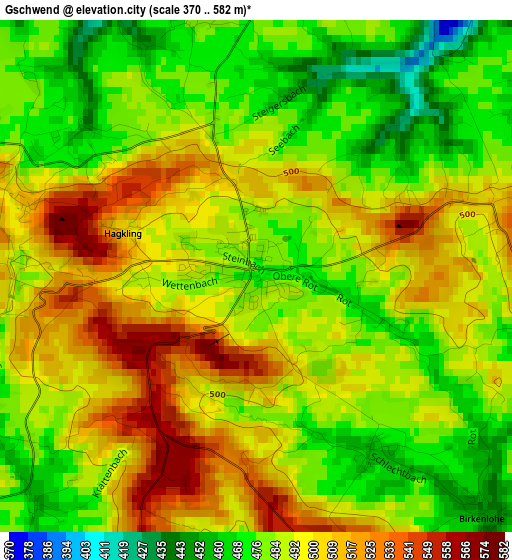
Below is the Elevation map of Gschwend, which displays elevation range with different colors. Scale of the first map is from 370 to 582 m (1214 to 1909 ft) with average elevation of 491.5 meters (=1613 ft) [note 1]
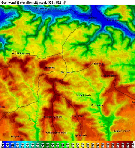
These maps also provides idea of topography and contour of this city, they are displayed at different zoom levels. More info about maps, scale and edge coordinates you can find below images.
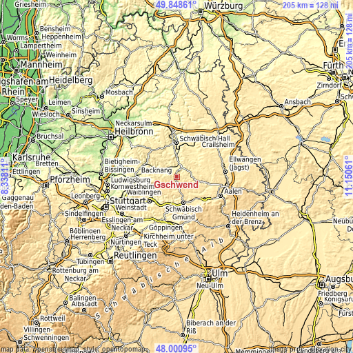
| \ | Map #1 | Map #2 | Topo.Map |
| Scale [m] | 370..582 m | 324..582 m | × |
| Scale [ft] | 1214..1909 ft | 1063..1909 ft | × |
| Average | 491.5 m = 1613 ft | 475.4 m = 1560 ft | × |
| Width | 6.42 km = 4 mi | 12.84 km = 8 mi | 205.4 km = 127.6 mi |
| Height | 6.42 km = 4 mi | 12.84 km = 8 mi | 205.4 km = 127.6 mi |
| ↑Max Latitude | 48.962191° | 48.991035° | 49.84861° |
| Latitude at center | 48.93333° | 48.93333° | 48.93333° |
| ↓Min Latitude | 48.904452° | 48.875558° | 48.00095° |
| ← Min Longitude | 9.700415° | 9.656469° | 8.33811° |
| Longitude center | 9.74436° | 9.74436° | 9.74436° |
| →Max Longitude | 9.788305° | 9.832251° | 11.15061° |
Nearby cities:
Cities around Gschwend sort by population:
• Gaildorf elevation 337 m
7.7 km,  13°
13°
• Welzheim 508 m
10.2 km,  231°
231°
• Alfdorf 488 m
10.1 km,  190°
190°
• Mutlangen 452 m
12.6 km,  162°
162°
• Oberrot 358 m
10.6 km,  328°
328°
• Spraitbach 540 m
6 km,  167°
167°
• Durlangen 489 m
9.4 km, 155°
• Fichtenberg 345 m
6.3 km,  338°
338°
• Kaisersbach 569 m
7.7 km,  267°
267°
• Eschach 493 m
10.5 km,  118°
118°
• Ruppertshofen 509 m
7.6 km,  137°
137°
• Täferrot 408 m
11.6 km, 143°
Multilingual:
 En español:
Gschwend elevación 473 m.
 En France:
Gschwend élévation 473 m.
 Auf Deutsch:
Gschwend höhe über dem Meeresspiegel ist 473 m.

Sources and notes:
- [note 1] Map square and city borders are not equal. Map elevation data is calculated only from area inside that square.
- [src 1] Elevation data from geonames database provided with same terms of usage.
- [src 2] The elevation map of Gschwend is generated using elevation data from NASA's 3 arcsec (90m) resolution SRTM data.
- [src 3] Base (background) map © OpenStreetMap contributors tiles are generated by Geofabrik and OpenTopoMap.
Copyright & License:
This Gschwend Elevation Map is licensed under CC BY-SA. You may reuse any part from this page, if you give a proper credit by linking to this URL:
 More info on terms of use page.