Althütte elevation
Althütte (Baden-Württemberg, Regierungsbezirk Stuttgart), Germany elevation is 497 meters and Althütte elevation in feet is 1631 ft above sea level [src 1]. Althütte is a seat of a fourth-order administrative division (feature code) with elevation that is 239 meters (784 ft) bigger than average city elevation in Germany.
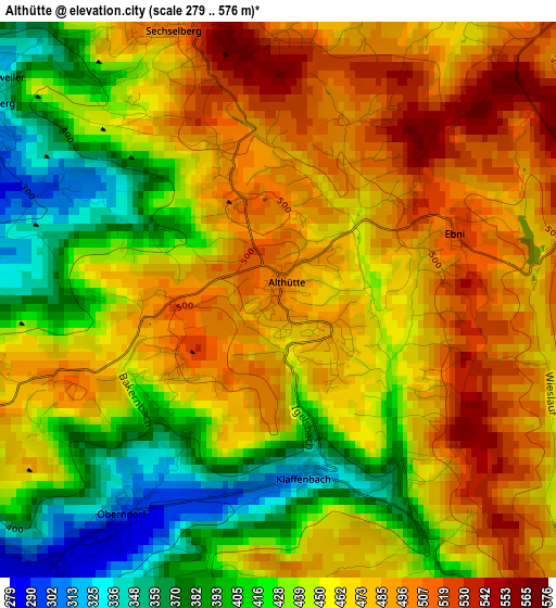
Below is the Elevation map of Althütte, which displays elevation range with different colors. Scale of the first map is from 279 to 576 m (915 to 1890 ft) with average elevation of 454.9 meters (=1492 ft) [note 1]
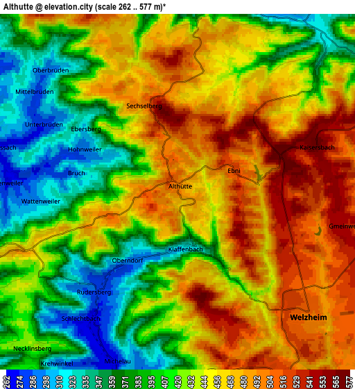
These maps also provides idea of topography and contour of this city, they are displayed at different zoom levels. More info about maps, scale and edge coordinates you can find below images.
| \ | Map #1 | Map #2 | Topo.Map |
| Scale [m] | 279..576 m | 262..577 m | × |
| Scale [ft] | 915..1890 ft | 860..1893 ft | × |
| Average | 454.9 m = 1492 ft | 434.7 m = 1426 ft | × |
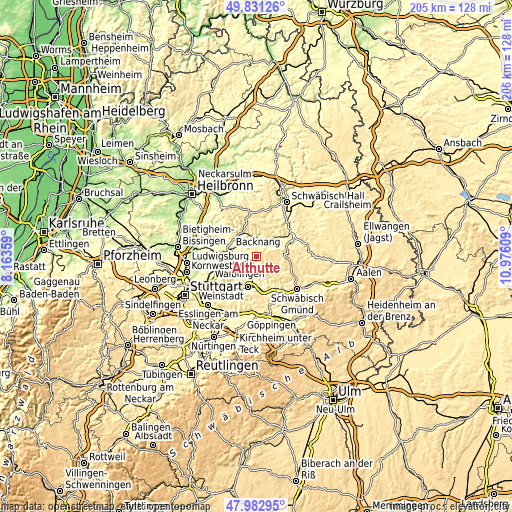
| Width | 6.42 km = 4 mi | 12.84 km = 8 mi | 205.5 km = 127.7 mi |
| Height | 6.42 km = 4 mi | 12.84 km = 8 mi | 205.5 km = 127.7 mi |
| ↑Max Latitude | 48.944521° | 48.973376° | 49.83126° |
| Latitude at center | 48.91565° | 48.91565° | 48.91565° |
| ↓Min Latitude | 48.886762° | 48.857858° | 47.98295° |
| ← Min Longitude | 9.525895° | 9.481949° | 8.16359° |
| Longitude center | 9.56984° | 9.56984° | 9.56984° |
| →Max Longitude | 9.613785° | 9.657731° | 10.97609° |
Nearby cities:
Cities around Althütte sort by population:
• Schorndorf elevation 259 m
12.7 km,  194°
194°
• Backnang 245 m
10.3 km,  290°
290°
• Murrhardt 286 m
7.4 km,  0°
0°
• Rudersberg 280 m
4.5 km,  221°
221°
• Welzheim 508 m
6.4 km,  132°
132°
• Urbach 271 m
11 km,  177°
177°
• Sulzbach an der Murr 278 m
11 km,  332°
332°
• Gschwend 473 m
12.9 km,  81°
81°
• Allmersbach im Tal 287 m
7.5 km,  262°
262°
• Oppenweiler 264 m
11 km,  312°
312°
• Fichtenberg 345 m
13 km,  52°
52°
• Kaisersbach 569 m
5.3 km,  72°
72°
Multilingual:
 En español:
Althütte elevación 497 m.
 En France:
Althütte élévation 497 m.
 Auf Deutsch:
Althütte höhe über dem Meeresspiegel ist 497 m.

Sources and notes:
- [note 1] Map square and city borders are not equal. Map elevation data is calculated only from area inside that square.
- [src 1] Elevation data from geonames database provided with same terms of usage.
- [src 2] The elevation map of Althütte is generated using elevation data from NASA's 3 arcsec (90m) resolution SRTM data.
- [src 3] Base (background) map © OpenStreetMap contributors tiles are generated by Geofabrik and OpenTopoMap.
Copyright & License:
This Althütte Elevation Map is licensed under CC BY-SA. You may reuse any part from this page, if you give a proper credit by linking to this URL:
 More info on terms of use page.