Schorndorf elevation
Schorndorf (Baden-Württemberg, Regierungsbezirk Stuttgart), Germany elevation is 259 meters and Schorndorf elevation in feet is 850 ft above sea level [src 1]. Schorndorf is a populated place (feature code) with elevation that is 1 meters (3 ft) bigger than average city elevation in Germany.
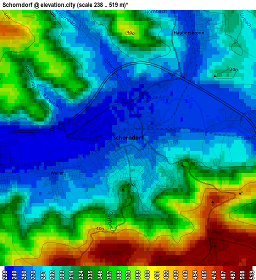
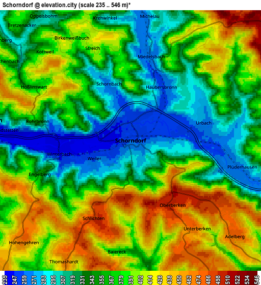
Below is the Elevation map of Schorndorf, which displays elevation range with different colors. Scale of the first map is from 238 to 519 m (781 to 1703 ft) with average elevation of 321.3 meters (=1054 ft) [note 1]
These maps also provides idea of topography and contour of this city, they are displayed at different zoom levels. More info about maps, scale and edge coordinates you can find below images.
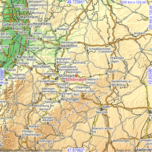
| \ | Map #1 | Map #2 | Topo.Map |
| Scale [m] | 238..519 m | 235..546 m | × |
| Scale [ft] | 781..1703 ft | 771..1791 ft | × |
| Average | 321.3 m = 1054 ft | 369.1 m = 1211 ft | × |
| Width | 6.44 km = 4 mi | 12.87 km = 8 mi | 206 km = 128 mi |
| Height | 6.44 km = 4 mi | 12.87 km = 8 mi | 206 km = 128 mi |
| ↑Max Latitude | 48.834305° | 48.863223° | 49.72301° |
| Latitude at center | 48.80537° | 48.80537° | 48.80537° |
| ↓Min Latitude | 48.776418° | 48.74745° | 47.87062° |
| ← Min Longitude | 9.483265° | 9.439319° | 8.12096° |
| Longitude center | 9.52721° | 9.52721° | 9.52721° |
| →Max Longitude | 9.571155° | 9.615101° | 10.93346° |
Nearby cities:
Cities around Schorndorf sort by population:
• Ebersbach an der Fils elevation 280 m
9.9 km,  181°
181°
• Rudersberg 280 m
8.9 km,  0°
0°
• Welzheim 508 m
11.2 km,  44°
44°
• Plüderhausen 270 m
5.1 km,  98°
98°
• Urbach 271 m
3.9 km,  70°
70°
• Reichenbach an der Fils 261 m
11.6 km,  203°
203°
• Winterbach 243 m
3.6 km,  258°
258°
• Baltmannsweiler 456 m
9.1 km,  219°
219°
• Wangen 382 m
10.5 km,  143°
143°
• Adelberg 477 m
7.2 km,  131°
131°
• Birenbach 367 m
11.7 km,  123°
123°
• Börtlingen 450 m
9.6 km, 126°
Multilingual:
 En español:
Schorndorf elevación 259 m.
 En France:
Schorndorf élévation 259 m.
 Auf Deutsch:
Schorndorf höhe über dem Meeresspiegel ist 259 m.

Sources and notes:
- [note 1] Map square and city borders are not equal. Map elevation data is calculated only from area inside that square.
- [src 1] Elevation data from geonames database provided with same terms of usage.
- [src 2] The elevation map of Schorndorf is generated using elevation data from NASA's 3 arcsec (90m) resolution SRTM data.
- [src 3] Base (background) map © OpenStreetMap contributors tiles are generated by Geofabrik and OpenTopoMap.
Copyright & License:
This Schorndorf Elevation Map is licensed under CC BY-SA. You may reuse any part from this page, if you give a proper credit by linking to this URL:
 More info on terms of use page.