Bad Mergentheim elevation
Bad Mergentheim (Baden-Württemberg, Regierungsbezirk Stuttgart), Germany elevation is 211 meters and Bad Mergentheim elevation in feet is 692 ft above sea level [src 1]. Bad Mergentheim is a populated place (feature code) with elevation that is 47 meters (154 ft) smaller than average city elevation in Germany.
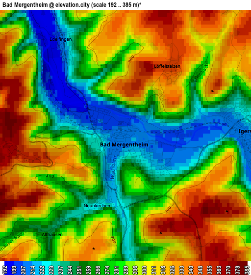
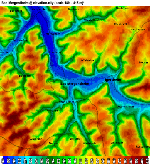
Below is the Elevation map of Bad Mergentheim, which displays elevation range with different colors. Scale of the first map is from 192 to 385 m (630 to 1263 ft) with average elevation of 288.7 meters (=947 ft) [note 1]
These maps also provides idea of topography and contour of this city, they are displayed at different zoom levels. More info about maps, scale and edge coordinates you can find below images.
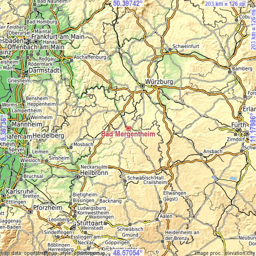
| \ | Map #1 | Map #2 | Topo.Map |
| Scale [m] | 192..385 m | 189..415 m | × |
| Scale [ft] | 630..1263 ft | 620..1362 ft | × |
| Average | 288.7 m = 947 ft | 309.8 m = 1016 ft | × |
| Width | 6.35 km = 3.9 mi | 12.7 km = 7.9 mi | 203.1 km = 126.2 mi |
| Height | 6.35 km = 3.9 mi | 12.7 km = 7.9 mi | 203.1 km = 126.2 mi |
| ↑Max Latitude | 49.521036° | 49.549556° | 50.39742° |
| Latitude at center | 49.4925° | 49.4925° | 49.4925° |
| ↓Min Latitude | 49.463947° | 49.435378° | 48.57054° |
| ← Min Longitude | 9.729665° | 9.685719° | 8.36736° |
| Longitude center | 9.77361° | 9.77361° | 9.77361° |
| →Max Longitude | 9.817555° | 9.861501° | 11.17986° |
Nearby cities:
Cities around Bad Mergentheim sort by population:
• Lauda-Königshofen elevation 195 m
9.4 km,  329°
329°
• Weikersheim 237 m
9.2 km,  99°
99°
• Boxberg 272 m
9.8 km,  261°
261°
• Igersheim 220 m
3.1 km,  86°
86°
• Niederstetten 311 m
14.7 km,  134°
134°
• Krautheim 305 m
15.3 km,  220°
220°
• Grünsfeld 245 m
13.1 km,  351°
351°
• Dörzbach 244 m
13 km,  201°
201°
• Buch am Ahorn 373 m
16.6 km,  288°
288°
• Assamstadt 331 m
9.6 km, 221°
• Röttingen 242 m
14.4 km,  82°
82°
• Bütthard 285 m
14.1 km,  32°
32°
Multilingual:
 En español:
Bad Mergentheim elevación 211 m.
 En France:
Bad Mergentheim élévation 211 m.
 Auf Deutsch:
Bad Mergentheim höhe über dem Meeresspiegel ist 211 m.

Sources and notes:
- [note 1] Map square and city borders are not equal. Map elevation data is calculated only from area inside that square.
- [src 1] Elevation data from geonames database provided with same terms of usage.
- [src 2] The elevation map of Bad Mergentheim is generated using elevation data from NASA's 3 arcsec (90m) resolution SRTM data.
- [src 3] Base (background) map © OpenStreetMap contributors tiles are generated by Geofabrik and OpenTopoMap.
Copyright & License:
This Bad Mergentheim Elevation Map is licensed under CC BY-SA. You may reuse any part from this page, if you give a proper credit by linking to this URL:
 More info on terms of use page.