Dörzbach elevation
Dörzbach (Baden-Württemberg, Regierungsbezirk Stuttgart), Germany elevation is 244 meters and Dörzbach elevation in feet is 801 ft above sea level [src 1]. Dörzbach is a seat of a fourth-order administrative division (feature code) with elevation that is 14 meters (46 ft) smaller than average city elevation in Germany.
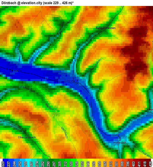
Below is the Elevation map of Dörzbach, which displays elevation range with different colors. Scale of the first map is from 229 to 426 m (751 to 1398 ft) with average elevation of 334.1 meters (=1096 ft) [note 1]
These maps also provides idea of topography and contour of this city, they are displayed at different zoom levels. More info about maps, scale and edge coordinates you can find below images.
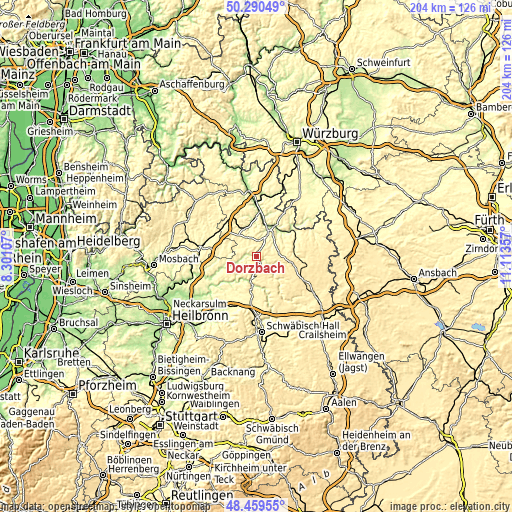
| \ | Map #1 | Topo.Map |
| Scale [m] | 229..426 m | × |
| Scale [ft] | 751..1398 ft | × |
| Average | 334.1 m = 1096 ft | × |
| Width | 6.36 km = 4 mi | 203.6 km = 126.5 mi |
| Height | 6.36 km = 4 mi | 203.6 km = 126.5 mi |
| ↑Max Latitude | 49.41215° | 50.29049° |
| Latitude at center | 49.38355° | 49.38355° |
| ↓Min Latitude | 49.354934° | 48.45955° |
| ← Min Longitude | 9.663375° | 8.30107° |
| Longitude center | 9.70732° | 9.70732° |
| →Max Longitude | 9.751265° | 11.11357° |
Nearby cities:
Cities around Dörzbach sort by population:
• Bad Mergentheim elevation 211 m
13 km,  21°
21°
• Künzelsau 220 m
11.4 km,  188°
188°
• Boxberg 272 m
11.7 km,  335°
335°
• Ingelfingen 213 m
10.1 km,  203°
203°
• Igersheim 220 m
14.7 km,  32°
32°
• Niederstetten 311 m
15.5 km,  83°
83°
• Forchtenberg 197 m
15 km,  225°
225°
• Krautheim 305 m
5.2 km,  275°
275°
• Niedernhall 208 m
11.8 km,  213°
213°
• Mulfingen 274 m
8.3 km,  125°
125°
• Assamstadt 331 m
5.2 km, 342°
• Weißbach 205 m
12.6 km,  220°
220°
Multilingual:
 En español:
Dörzbach elevación 244 m.
 En France:
Dörzbach élévation 244 m.
 Auf Deutsch:
Dörzbach höhe über dem Meeresspiegel ist 244 m.

Sources and notes:
- [note 1] Map square and city borders are not equal. Map elevation data is calculated only from area inside that square.
- [src 1] Elevation data from geonames database provided with same terms of usage.
- [src 2] The elevation map of Dörzbach is generated using elevation data from NASA's 3 arcsec (90m) resolution SRTM data.
- [src 3] Base (background) map © OpenStreetMap contributors tiles are generated by Geofabrik and OpenTopoMap.
Copyright & License:
This Dörzbach Elevation Map is licensed under CC BY-SA. You may reuse any part from this page, if you give a proper credit by linking to this URL:
 More info on terms of use page.