Bayreuth elevation
Bayreuth (Bavaria, Upper Franconia), Germany elevation is 338 meters and Bayreuth elevation in feet is 1109 ft above sea level [src 1]. Bayreuth is a seat of a second-order administrative division (feature code) with elevation that is 80 meters (262 ft) bigger than average city elevation in Germany.
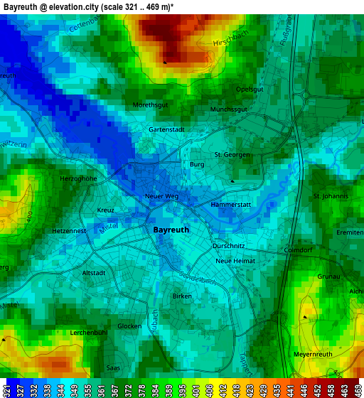
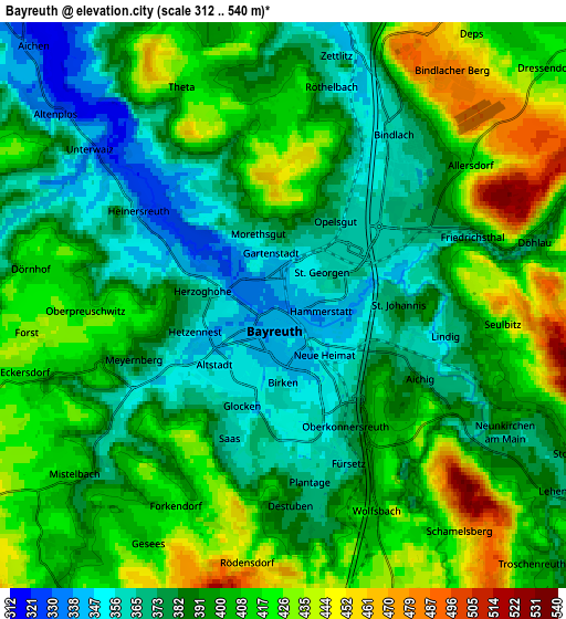
Below is the Elevation map of Bayreuth, which displays elevation range with different colors. Scale of the first map is from 321 to 469 m (1053 to 1539 ft) with average elevation of 363.8 meters (=1194 ft) [note 1]
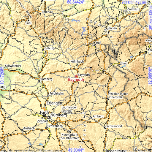
These maps also provides idea of topography and contour of this city, they are displayed at different zoom levels. More info about maps, scale and edge coordinates you can find below images.
| \ | Map #1 | Map #2 | Topo.Map |
| Scale [m] | 321..469 m | 312..540 m | × |
| Scale [ft] | 1053..1539 ft | 1024..1772 ft | × |
| Average | 363.8 m = 1194 ft | 396.9 m = 1302 ft | × |
| Width | 6.29 km = 3.9 mi | 12.58 km = 7.8 mi | 201.2 km = 125 mi |
| Height | 6.29 km = 3.9 mi | 12.58 km = 7.8 mi | 201.2 km = 125 mi |
| ↑Max Latitude | 49.97609° | 50.004343° | 50.84424° |
| Latitude at center | 49.94782° | 49.94782° | 49.94782° |
| ↓Min Latitude | 49.919534° | 49.89123° | 49.0344° |
| ← Min Longitude | 11.534985° | 11.491039° | 10.17268° |
| Longitude center | 11.57893° | 11.57893° | 11.57893° |
| →Max Longitude | 11.622875° | 11.666821° | 12.98518° |
Nearby cities:
Cities around Bayreuth sort by population:
• Neunkirchen am Main elevation 386 m
5.7 km,  119°
119°
• Bindlach 360 m
4.5 km,  33°
33°
• Creußen 430 m
11.9 km,  163°
163°
• Neudrossenfeld 344 m
9.5 km,  323°
323°
• Mistelgau 438 m
9 km,  244°
244°
• Goldkronach 443 m
10.5 km,  47°
47°
• Glashütten 423 m
11.5 km,  234°
234°
• Seybothenreuth 425 m
10.9 km, 123°
• Reuth 510 m
9.6 km,  60°
60°
• Gesees 428 m
11.3 km, 33°
• Emtmannsberg 480 m
7.8 km,  142°
142°
• Harsdorf 398 m
9.5 km,  354°
354°
Multilingual:
 En español:
Bayreuth elevación 338 m.
 En France:
Bayreuth élévation 338 m.
 Auf Deutsch:
Bayreuth höhe über dem Meeresspiegel ist 338 m.

Sources and notes:
- [note 1] Map square and city borders are not equal. Map elevation data is calculated only from area inside that square.
- [src 1] Elevation data from geonames database provided with same terms of usage.
- [src 2] The elevation map of Bayreuth is generated using elevation data from NASA's 3 arcsec (90m) resolution SRTM data.
- [src 3] Base (background) map © OpenStreetMap contributors tiles are generated by Geofabrik and OpenTopoMap.
Copyright & License:
This Bayreuth Elevation Map is licensed under CC BY-SA. You may reuse any part from this page, if you give a proper credit by linking to this URL:
 More info on terms of use page.