Creußen elevation
Creußen (Bavaria, Upper Franconia), Germany elevation is 430 meters and Creußen elevation in feet is 1411 ft above sea level [src 1]. Creußen is a populated place (feature code) with elevation that is 172 meters (564 ft) bigger than average city elevation in Germany.
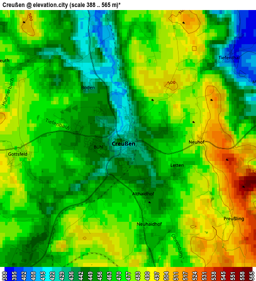
Below is the Elevation map of Creußen, which displays elevation range with different colors. Scale of the first map is from 388 to 565 m (1273 to 1854 ft) with average elevation of 468.4 meters (=1537 ft) [note 1]
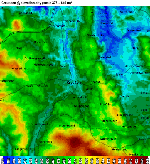
These maps also provides idea of topography and contour of this city, they are displayed at different zoom levels. More info about maps, scale and edge coordinates you can find below images.
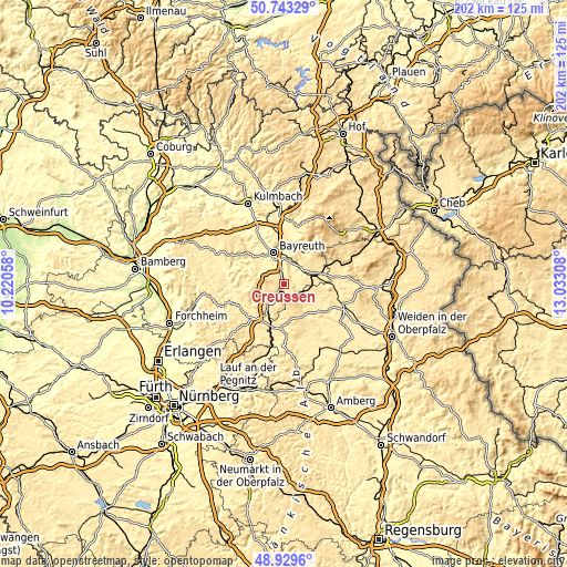
| \ | Map #1 | Map #2 | Topo.Map |
| Scale [m] | 388..565 m | 373..649 m | × |
| Scale [ft] | 1273..1854 ft | 1224..2129 ft | × |
| Average | 468.4 m = 1537 ft | 475.5 m = 1560 ft | × |
| Width | 6.3 km = 3.9 mi | 12.6 km = 7.8 mi | 201.7 km = 125.3 mi |
| Height | 6.3 km = 3.9 mi | 12.6 km = 7.8 mi | 201.6 km = 125.3 mi |
| ↑Max Latitude | 49.87328° | 49.901594° | 50.74329° |
| Latitude at center | 49.84495° | 49.84495° | 49.84495° |
| ↓Min Latitude | 49.816603° | 49.78824° | 48.9296° |
| ← Min Longitude | 11.582885° | 11.538939° | 10.22058° |
| Longitude center | 11.62683° | 11.62683° | 11.62683° |
| →Max Longitude | 11.670775° | 11.714721° | 13.03308° |
Nearby cities:
Cities around Creußen sort by population:
• Bayreuth elevation 338 m
11.9 km,  343°
343°
• Pegnitz 433 m
12 km,  210°
210°
• Neunkirchen am Main 386 m
8.8 km,  9°
9°
• Speichersdorf 464 m
11.4 km,  75°
75°
• Mistelgau 438 m
13.8 km,  303°
303°
• Kirchenthumbach 464 m
12.8 km,  146°
146°
• Glashütten 423 m
13.6 km,  290°
290°
• Kirchenpingarten 578 m
14.9 km,  48°
48°
• Seybothenreuth 425 m
7.8 km, 46°
• Prebitz 426 m
4.3 km,  107°
107°
• Emtmannsberg 480 m
5.4 km, 13°
• Vorbach 455 m
8.3 km, 108°
Multilingual:
 En español:
Creußen elevación 430 m.
 En France:
Creußen élévation 430 m.


Sources and notes:
- [note 1] Map square and city borders are not equal. Map elevation data is calculated only from area inside that square.
- [src 1] Elevation data from geonames database provided with same terms of usage.
- [src 2] The elevation map of Creußen is generated using elevation data from NASA's 3 arcsec (90m) resolution SRTM data.
- [src 3] Base (background) map © OpenStreetMap contributors tiles are generated by Geofabrik and OpenTopoMap.
Copyright & License:
This Creußen Elevation Map is licensed under CC BY-SA. You may reuse any part from this page, if you give a proper credit by linking to this URL:
 More info on terms of use page.