Speichersdorf elevation
Speichersdorf (Bavaria, Upper Franconia), Germany elevation is 464 meters and Speichersdorf elevation in feet is 1522 ft above sea level [src 1]. Speichersdorf is a seat of a fourth-order administrative division (feature code) with elevation that is 206 meters (676 ft) bigger than average city elevation in Germany.
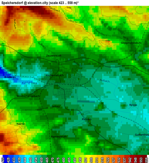
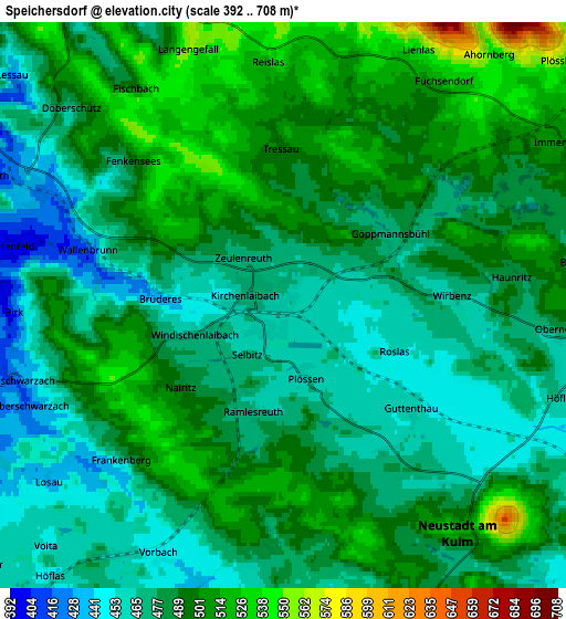
Below is the Elevation map of Speichersdorf, which displays elevation range with different colors. Scale of the first map is from 423 to 558 m (1388 to 1831 ft) with average elevation of 478.4 meters (=1570 ft) [note 1]
These maps also provides idea of topography and contour of this city, they are displayed at different zoom levels. More info about maps, scale and edge coordinates you can find below images.
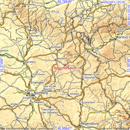
| \ | Map #1 | Map #2 | Topo.Map |
| Scale [m] | 423..558 m | 392..708 m | × |
| Scale [ft] | 1388..1831 ft | 1286..2323 ft | × |
| Average | 478.4 m = 1570 ft | 485.8 m = 1594 ft | × |
| Width | 6.3 km = 3.9 mi | 12.6 km = 7.8 mi | 201.6 km = 125.3 mi |
| Height | 6.3 km = 3.9 mi | 12.6 km = 7.8 mi | 201.5 km = 125.2 mi |
| ↑Max Latitude | 49.899645° | 49.927943° | 50.76918° |
| Latitude at center | 49.87133° | 49.87133° | 49.87133° |
| ↓Min Latitude | 49.842999° | 49.814651° | 48.95647° |
| ← Min Longitude | 11.737285° | 11.693339° | 10.37498° |
| Longitude center | 11.78123° | 11.78123° | 11.78123° |
| →Max Longitude | 11.825175° | 11.869121° | 13.18748° |
Nearby cities:
Cities around Speichersdorf sort by population:
• Neunkirchen am Main elevation 386 m
11.1 km,  301°
301°
• Kemnath 462 m
7.9 km,  91°
91°
• Plößberg 550 m
8.3 km,  49°
49°
• Kulmain 500 m
9.1 km,  69°
69°
• Immenreuth 502 m
6.9 km,  62°
62°
• Kastl 477 m
9.5 km,  116°
116°
• Kirchenpingarten 578 m
6.9 km,  1°
1°
• Seybothenreuth 425 m
6 km,  294°
294°
• Speinshart 430 m
9.4 km,  163°
163°
• Prebitz 426 m
8.2 km,  238°
238°
• Emtmannsberg 480 m
10.1 km,  283°
283°
• Vorbach 455 m
6.4 km,  210°
210°
Multilingual:
 En español:
Speichersdorf elevación 464 m.
 En France:
Speichersdorf élévation 464 m.
 Auf Deutsch:
Speichersdorf höhe über dem Meeresspiegel ist 464 m.

Sources and notes:
- [note 1] Map square and city borders are not equal. Map elevation data is calculated only from area inside that square.
- [src 1] Elevation data from geonames database provided with same terms of usage.
- [src 2] The elevation map of Speichersdorf is generated using elevation data from NASA's 3 arcsec (90m) resolution SRTM data.
- [src 3] Base (background) map © OpenStreetMap contributors tiles are generated by Geofabrik and OpenTopoMap.
Copyright & License:
This Speichersdorf Elevation Map is licensed under CC BY-SA. You may reuse any part from this page, if you give a proper credit by linking to this URL:
 More info on terms of use page.