Kemnath elevation
Kemnath (Bavaria, Upper Palatinate), Germany elevation is 462 meters and Kemnath elevation in feet is 1516 ft above sea level [src 1]. Kemnath is a populated place (feature code) with elevation that is 204 meters (669 ft) bigger than average city elevation in Germany.
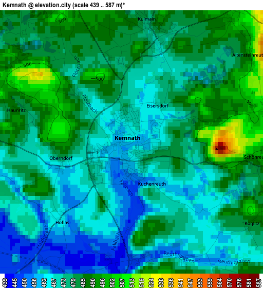
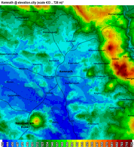
Below is the Elevation map of Kemnath, which displays elevation range with different colors. Scale of the first map is from 439 to 587 m (1440 to 1926 ft) with average elevation of 477 meters (=1565 ft) [note 1]
These maps also provides idea of topography and contour of this city, they are displayed at different zoom levels. More info about maps, scale and edge coordinates you can find below images.
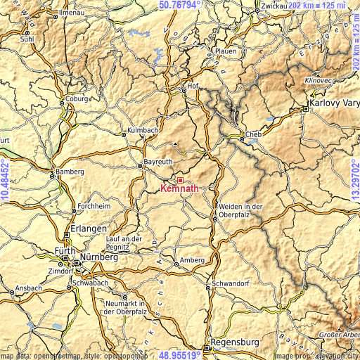
| \ | Map #1 | Map #2 | Topo.Map |
| Scale [m] | 439..587 m | 433..726 m | × |
| Scale [ft] | 1440..1926 ft | 1421..2382 ft | × |
| Average | 477 m = 1565 ft | 508.8 m = 1669 ft | × |
| Width | 6.3 km = 3.9 mi | 12.6 km = 7.8 mi | 201.6 km = 125.3 mi |
| Height | 6.3 km = 3.9 mi | 12.6 km = 7.8 mi | 201.5 km = 125.2 mi |
| ↑Max Latitude | 49.898385° | 49.926684° | 50.76794° |
| Latitude at center | 49.87007° | 49.87007° | 49.87007° |
| ↓Min Latitude | 49.841738° | 49.813389° | 48.95519° |
| ← Min Longitude | 11.846825° | 11.802879° | 10.48452° |
| Longitude center | 11.89077° | 11.89077° | 11.89077° |
| →Max Longitude | 11.934715° | 11.978661° | 13.29702° |
Nearby cities:
Cities around Kemnath sort by population:
• Speichersdorf elevation 464 m
7.9 km,  271°
271°
• Plößberg 550 m
5.7 km,  344°
344°
• Kulmain 500 m
3.4 km,  11°
11°
• Neusorg 561 m
8.9 km,  37°
37°
• Pullenreuth 544 m
10.5 km,  48°
48°
• Immenreuth 502 m
3.7 km,  332°
332°
• Kastl 477 m
4.1 km,  170°
170°
• Trabitz 443 m
7.8 km,  175°
175°
• Kirchenpingarten 578 m
10.4 km,  312°
312°
• Ebnath 569 m
9.4 km,  18°
18°
• Brand 590 m
10.1 km, 8°
• Speinshart 430 m
10.3 km,  209°
209°
Multilingual:
 En español:
Kemnath elevación 462 m.
 En France:
Kemnath élévation 462 m.


Sources and notes:
- [note 1] Map square and city borders are not equal. Map elevation data is calculated only from area inside that square.
- [src 1] Elevation data from geonames database provided with same terms of usage.
- [src 2] The elevation map of Kemnath is generated using elevation data from NASA's 3 arcsec (90m) resolution SRTM data.
- [src 3] Base (background) map © OpenStreetMap contributors tiles are generated by Geofabrik and OpenTopoMap.
Copyright & License:
This Kemnath Elevation Map is licensed under CC BY-SA. You may reuse any part from this page, if you give a proper credit by linking to this URL:
 More info on terms of use page.