Beilstein elevation
Beilstein (Baden-Württemberg, Regierungsbezirk Stuttgart), Germany elevation is 254 meters and Beilstein elevation in feet is 833 ft above sea level [src 1]. Beilstein is a populated place (feature code) with elevation that is 4 meters (13 ft) smaller than average city elevation in Germany.
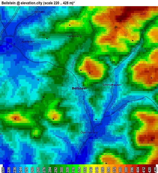
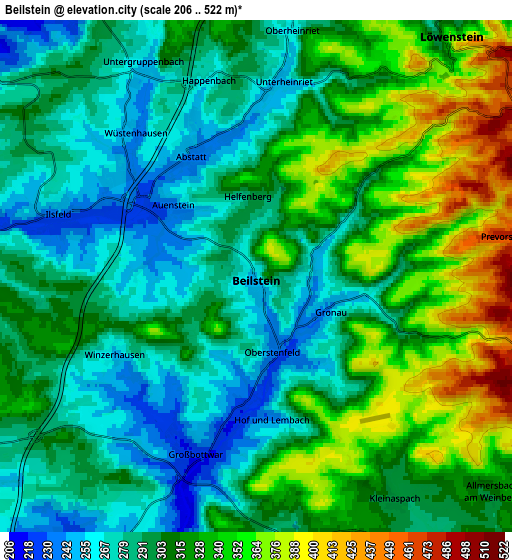
Below is the Elevation map of Beilstein, which displays elevation range with different colors. Scale of the first map is from 220 to 428 m (722 to 1404 ft) with average elevation of 285.2 meters (=936 ft) [note 1]
These maps also provides idea of topography and contour of this city, they are displayed at different zoom levels. More info about maps, scale and edge coordinates you can find below images.
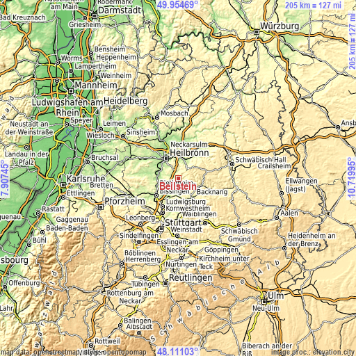
| \ | Map #1 | Map #2 | Topo.Map |
| Scale [m] | 220..428 m | 206..522 m | × |
| Scale [ft] | 722..1404 ft | 676..1713 ft | × |
| Average | 285.2 m = 936 ft | 309.6 m = 1016 ft | × |
| Width | 6.41 km = 4 mi | 12.81 km = 8 mi | 205 km = 127.4 mi |
| Height | 6.41 km = 4 mi | 12.81 km = 8 mi | 205 km = 127.4 mi |
| ↑Max Latitude | 49.070198° | 49.09898° | 49.95469° |
| Latitude at center | 49.0414° | 49.0414° | 49.0414° |
| ↓Min Latitude | 49.012585° | 48.983753° | 48.11103° |
| ← Min Longitude | 9.269755° | 9.225809° | 7.90745° |
| Longitude center | 9.3137° | 9.3137° | 9.3137° |
| →Max Longitude | 9.357645° | 9.401591° | 10.71995° |
Nearby cities:
Cities around Beilstein sort by population:
• Steinheim am der Murr elevation 212 m
8.6 km,  198°
198°
• Großbottwar 222 m
4.7 km, 198°
• Ilsfeld 243 m
5.2 km,  287°
287°
• Oberstenfeld 231 m
1.8 km,  163°
163°
• Untergruppenbach 254 m
6 km,  332°
332°
• Murr 207 m
9.7 km, 204°
• Talheim 205 m
9.9 km,  297°
297°
• Abstatt 239 m
3.4 km, 330°
• Neckarwestheim 257 m
9 km,  273°
273°
• Mundelsheim 198 m
8.9 km,  239°
239°
• Löwenstein 367 m
7.7 km,  38°
38°
• Spiegelberg 352 m
9.5 km,  90°
90°
Multilingual:
 En español:
Beilstein elevación 254 m.
 En France:
Beilstein élévation 254 m.
 Auf Deutsch:
Beilstein höhe über dem Meeresspiegel ist 254 m.

Sources and notes:
- [note 1] Map square and city borders are not equal. Map elevation data is calculated only from area inside that square.
- [src 1] Elevation data from geonames database provided with same terms of usage.
- [src 2] The elevation map of Beilstein is generated using elevation data from NASA's 3 arcsec (90m) resolution SRTM data.
- [src 3] Base (background) map © OpenStreetMap contributors tiles are generated by Geofabrik and OpenTopoMap.
Copyright & License:
This Beilstein Elevation Map is licensed under CC BY-SA. You may reuse any part from this page, if you give a proper credit by linking to this URL:
 More info on terms of use page.