Neckarwestheim elevation
Neckarwestheim (Baden-Württemberg, Regierungsbezirk Stuttgart), Germany elevation is 257 meters and Neckarwestheim elevation in feet is 843 ft above sea level [src 1]. Neckarwestheim is a seat of a fourth-order administrative division (feature code) with elevation that is 1 meters (3 ft) smaller than average city elevation in Germany.
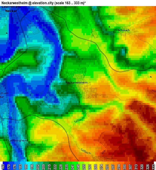
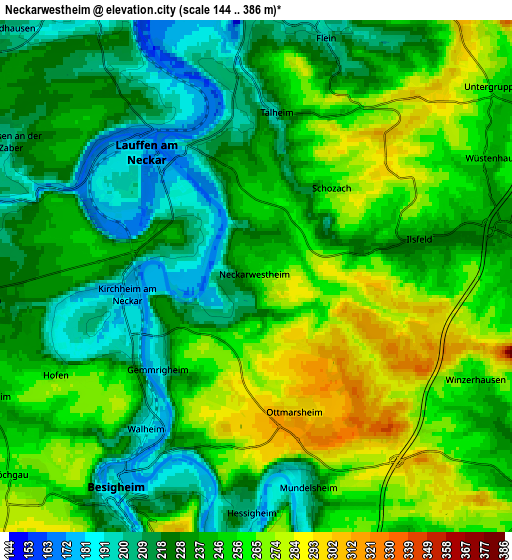
Below is the Elevation map of Neckarwestheim, which displays elevation range with different colors. Scale of the first map is from 163 to 333 m (535 to 1093 ft) with average elevation of 241.6 meters (=793 ft) [note 1]
These maps also provides idea of topography and contour of this city, they are displayed at different zoom levels. More info about maps, scale and edge coordinates you can find below images.
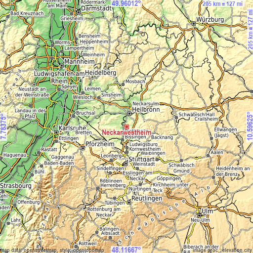
| \ | Map #1 | Map #2 | Topo.Map |
| Scale [m] | 163..333 m | 144..386 m | × |
| Scale [ft] | 535..1093 ft | 472..1266 ft | × |
| Average | 241.6 m = 793 ft | 241.6 m = 793 ft | × |
| Width | 6.41 km = 4 mi | 12.81 km = 8 mi | 205 km = 127.4 mi |
| Height | 6.41 km = 4 mi | 12.81 km = 8 mi | 205 km = 127.4 mi |
| ↑Max Latitude | 49.075735° | 49.104514° | 49.96012° |
| Latitude at center | 49.04694° | 49.04694° | 49.04694° |
| ↓Min Latitude | 49.018128° | 48.9893° | 48.11667° |
| ← Min Longitude | 9.146055° | 9.102109° | 7.78375° |
| Longitude center | 9.19° | 9.19° | 9.19° |
| →Max Longitude | 9.233945° | 9.277891° | 10.59625° |
Nearby cities:
Cities around Neckarwestheim sort by population:
• Besigheim elevation 195 m
6.4 km,  212°
212°
• Lauffen am Neckar 186 m
4.4 km,  312°
312°
• Ilsfeld 243 m
4.2 km,  76°
76°
• Bönnigheim 224 m
7 km,  263°
263°
• Flein 191 m
6.4 km,  13°
13°
• Kirchheim am Neckar 186 m
3.5 km,  266°
266°
• Talheim 205 m
4.1 km,  3°
3°
• Gemmrigheim 190 m
3.3 km,  230°
230°
• Mundelsheim 198 m
5.3 km,  165°
165°
• Walheim 192 m
4.6 km,  217°
217°
• Erligheim 246 m
7.3 km,  248°
248°
• Hessigheim 204 m
5.9 km,  182°
182°
Multilingual:
 En español:
Neckarwestheim elevación 257 m.
 En France:
Neckarwestheim élévation 257 m.
 Auf Deutsch:
Neckarwestheim höhe über dem Meeresspiegel ist 257 m.

Sources and notes:
- [note 1] Map square and city borders are not equal. Map elevation data is calculated only from area inside that square.
- [src 1] Elevation data from geonames database provided with same terms of usage.
- [src 2] The elevation map of Neckarwestheim is generated using elevation data from NASA's 3 arcsec (90m) resolution SRTM data.
- [src 3] Base (background) map © OpenStreetMap contributors tiles are generated by Geofabrik and OpenTopoMap.
Copyright & License:
This Neckarwestheim Elevation Map is licensed under CC BY-SA. You may reuse any part from this page, if you give a proper credit by linking to this URL:
 More info on terms of use page.