Mundelsheim elevation
Mundelsheim (Baden-Württemberg, Regierungsbezirk Stuttgart), Germany elevation is 198 meters and Mundelsheim elevation in feet is 650 ft above sea level [src 1]. Mundelsheim is a seat of a fourth-order administrative division (feature code) with elevation that is 60 meters (197 ft) smaller than average city elevation in Germany.
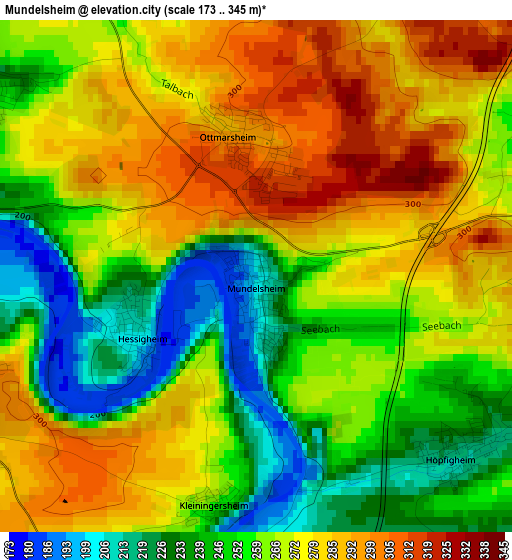
Below is the Elevation map of Mundelsheim, which displays elevation range with different colors. Scale of the first map is from 173 to 345 m (568 to 1132 ft) with average elevation of 264.8 meters (=869 ft) [note 1]
These maps also provides idea of topography and contour of this city, they are displayed at different zoom levels. More info about maps, scale and edge coordinates you can find below images.
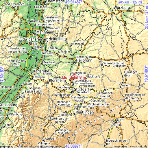
| \ | Map #1 | Topo.Map |
| Scale [m] | 173..345 m | × |
| Scale [ft] | 568..1132 ft | × |
| Average | 264.8 m = 869 ft | × |
| Width | 6.41 km = 4 mi | 205.2 km = 127.5 mi |
| Height | 6.41 km = 4 mi | 205.1 km = 127.4 mi |
| ↑Max Latitude | 49.029652° | 49.91487° |
| Latitude at center | 49.00083° | 49.00083° |
| ↓Min Latitude | 48.971991° | 48.06971° |
| ← Min Longitude | 9.163835° | 7.80153° |
| Longitude center | 9.20778° | 9.20778° |
| →Max Longitude | 9.251725° | 10.61403° |
Nearby cities:
Cities around Mundelsheim sort by population:
• Besigheim elevation 195 m
4.8 km,  266°
266°
• Steinheim am der Murr 212 m
6.2 km,  125°
125°
• Großbottwar 222 m
6.3 km,  89°
89°
• Ilsfeld 243 m
6.7 km,  24°
24°
• Pleidelsheim 199 m
4.6 km,  184°
184°
• Murr 207 m
5.7 km,  138°
138°
• Benningen am Neckar 209 m
6.5 km,  157°
157°
• Kirchheim am Neckar 186 m
6.9 km,  315°
315°
• Gemmrigheim 190 m
4.9 km,  308°
308°
• Neckarwestheim 257 m
5.3 km,  345°
345°
• Walheim 192 m
4.4 km,  289°
289°
• Hessigheim 204 m
1.7 km,  244°
244°
Multilingual:
 En español:
Mundelsheim elevación 198 m.
 En France:
Mundelsheim élévation 198 m.
 Auf Deutsch:
Mundelsheim höhe über dem Meeresspiegel ist 198 m.

Sources and notes:
- [note 1] Map square and city borders are not equal. Map elevation data is calculated only from area inside that square.
- [src 1] Elevation data from geonames database provided with same terms of usage.
- [src 2] The elevation map of Mundelsheim is generated using elevation data from NASA's 3 arcsec (90m) resolution SRTM data.
- [src 3] Base (background) map © OpenStreetMap contributors tiles are generated by Geofabrik and OpenTopoMap.
Copyright & License:
This Mundelsheim Elevation Map is licensed under CC BY-SA. You may reuse any part from this page, if you give a proper credit by linking to this URL:
 More info on terms of use page.