Flein elevation
Flein (Baden-Württemberg, Regierungsbezirk Stuttgart), Germany elevation is 191 meters and Flein elevation in feet is 627 ft above sea level [src 1]. Flein is a seat of a fourth-order administrative division (feature code) with elevation that is 67 meters (220 ft) smaller than average city elevation in Germany.
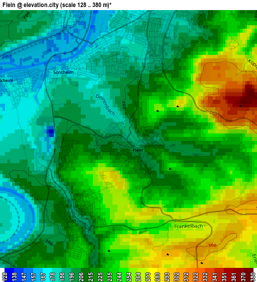
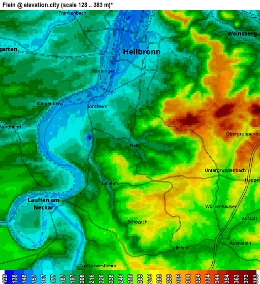
Below is the Elevation map of Flein, which displays elevation range with different colors. Scale of the first map is from 128 to 380 m (420 to 1247 ft) with average elevation of 222.5 meters (=730 ft) [note 1]
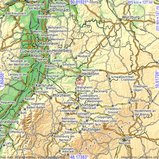
These maps also provides idea of topography and contour of this city, they are displayed at different zoom levels. More info about maps, scale and edge coordinates you can find below images.
| \ | Map #1 | Map #2 | Topo.Map |
| Scale [m] | 128..380 m | 128..383 m | × |
| Scale [ft] | 420..1247 ft | 420..1257 ft | × |
| Average | 222.5 m = 730 ft | 224.7 m = 737 ft | × |
| Width | 6.4 km = 4 mi | 12.8 km = 8 mi | 204.7 km = 127.2 mi |
| Height | 6.4 km = 4 mi | 12.8 km = 8 mi | 204.7 km = 127.2 mi |
| ↑Max Latitude | 49.131823° | 49.160569° | 50.01521° |
| Latitude at center | 49.10306° | 49.10306° | 49.10306° |
| ↓Min Latitude | 49.074281° | 49.045485° | 48.17383° |
| ← Min Longitude | 9.166885° | 9.122939° | 7.80458° |
| Longitude center | 9.21083° | 9.21083° | 9.21083° |
| →Max Longitude | 9.254775° | 9.298721° | 10.61708° |
Nearby cities:
Cities around Flein sort by population:
• Heilbronn elevation 173 m
4.2 km,  9°
9°
• Weinsberg 203 m
7.7 km,  46°
46°
• Lauffen am Neckar 186 m
5.8 km,  235°
235°
• Leingarten 171 m
8.4 km,  305°
305°
• Ilsfeld 243 m
5.9 km,  154°
154°
• Untergruppenbach 254 m
4.9 km,  107°
107°
• Nordheim 181 m
6.1 km,  275°
275°
• Kirchheim am Neckar 186 m
8.2 km,  217°
217°
• Erlenbach 184 m
8.8 km,  28°
28°
• Talheim 205 m
2.5 km,  210°
210°
• Abstatt 239 m
7 km,  123°
123°
• Neckarwestheim 257 m
6.4 km,  193°
193°
Multilingual:
 En español:
Flein elevación 191 m.
 En France:
Flein élévation 191 m.


Sources and notes:
- [note 1] Map square and city borders are not equal. Map elevation data is calculated only from area inside that square.
- [src 1] Elevation data from geonames database provided with same terms of usage.
- [src 2] The elevation map of Flein is generated using elevation data from NASA's 3 arcsec (90m) resolution SRTM data.
- [src 3] Base (background) map © OpenStreetMap contributors tiles are generated by Geofabrik and OpenTopoMap.
Copyright & License:
This Flein Elevation Map is licensed under CC BY-SA. You may reuse any part from this page, if you give a proper credit by linking to this URL:
 More info on terms of use page.