Bräunlingen elevation
Bräunlingen (Baden-Württemberg, Freiburg Region), Germany elevation is 694 meters and Bräunlingen elevation in feet is 2277 ft above sea level [src 1]. Bräunlingen is a populated place (feature code) with elevation that is 436 meters (1430 ft) bigger than average city elevation in Germany.
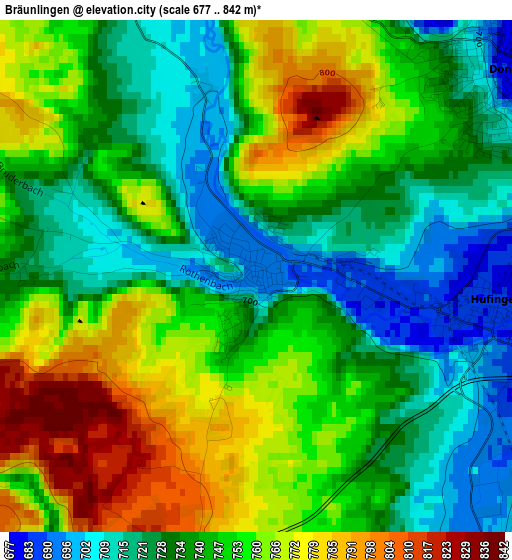
Below is the Elevation map of Bräunlingen, which displays elevation range with different colors. Scale of the first map is from 677 to 842 m (2221 to 2762 ft) with average elevation of 744.6 meters (=2443 ft) [note 1]
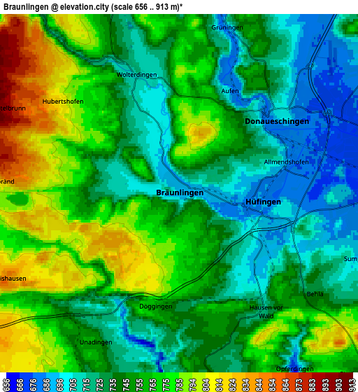
These maps also provides idea of topography and contour of this city, they are displayed at different zoom levels. More info about maps, scale and edge coordinates you can find below images.
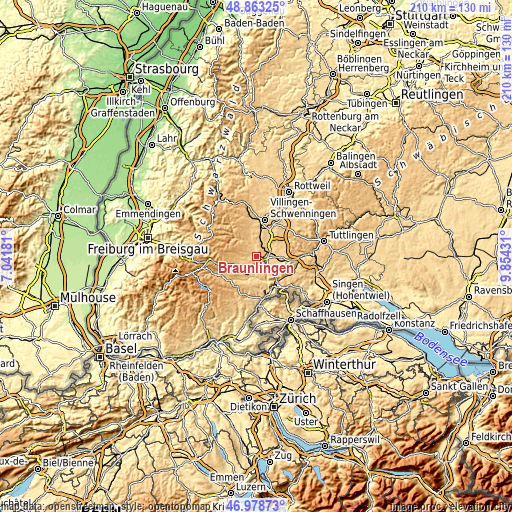
| \ | Map #1 | Map #2 | Topo.Map |
| Scale [m] | 677..842 m | 656..913 m | × |
| Scale [ft] | 2221..2762 ft | 2152..2995 ft | × |
| Average | 744.6 m = 2443 ft | 749.9 m = 2460 ft | × |
| Width | 6.55 km = 4.1 mi | 13.1 km = 8.1 mi | 209.5 km = 130.2 mi |
| Height | 6.55 km = 4.1 mi | 13.1 km = 8.1 mi | 209.5 km = 130.2 mi |
| ↑Max Latitude | 47.959007° | 47.988427° | 48.86325° |
| Latitude at center | 47.92957° | 47.92957° | 47.92957° |
| ↓Min Latitude | 47.900116° | 47.870646° | 46.97873° |
| ← Min Longitude | 8.404115° | 8.360169° | 7.04181° |
| Longitude center | 8.44806° | 8.44806° | 8.44806° |
| →Max Longitude | 8.492005° | 8.535951° | 9.85431° |
Nearby cities:
Cities around Bräunlingen sort by population:
• Villingen-Schwenningen elevation 757 m
15.1 km,  12°
12°
• Donaueschingen 701 m
4.6 km,  52°
52°
• Bad Dürrheim 700 m
11.9 km,  31°
31°
• Blumberg 699 m
11.8 km,  147°
147°
• Löffingen 801 m
9.3 km,  236°
236°
• Hüfingen 687 m
3 km,  98°
98°
• Bonndorf 834 m
14.7 km,  212°
212°
• Geisingen 680 m
15.1 km,  91°
91°
• Vöhrenbach 874 m
17.3 km,  320°
320°
• Tuningen 759 m
16.2 km,  44°
44°
• Eisenbach 946 m
13.9 km,  284°
284°
• Friedenweiler 904 m
14.4 km,  264°
264°
Multilingual:
 En español:
Bräunlingen elevación 694 m.
 En France:
Bräunlingen élévation 694 m.
 Auf Deutsch:
Bräunlingen höhe über dem Meeresspiegel ist 694 m.

Sources and notes:
- [note 1] Map square and city borders are not equal. Map elevation data is calculated only from area inside that square.
- [src 1] Elevation data from geonames database provided with same terms of usage.
- [src 2] The elevation map of Bräunlingen is generated using elevation data from NASA's 3 arcsec (90m) resolution SRTM data.
- [src 3] Base (background) map © OpenStreetMap contributors tiles are generated by Geofabrik and OpenTopoMap.
Copyright & License:
This Bräunlingen Elevation Map is licensed under CC BY-SA. You may reuse any part from this page, if you give a proper credit by linking to this URL:
 More info on terms of use page.