Brühl elevation
Brühl (Baden-Württemberg, Karlsruhe Region), Germany elevation is 100 meters and Brühl elevation in feet is 328 ft above sea level [src 1]. Brühl is a seat of a fourth-order administrative division (feature code) with elevation that is 158 meters (518 ft) smaller than average city elevation in Germany.
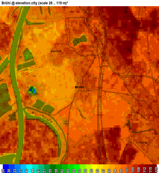
Below is the Elevation map of Brühl, which displays elevation range with different colors. Scale of the first map is from 26 to 119 m (85 to 390 ft) with average elevation of 99.8 meters (=327 ft) [note 1]
These maps also provides idea of topography and contour of this city, they are displayed at different zoom levels. More info about maps, scale and edge coordinates you can find below images.
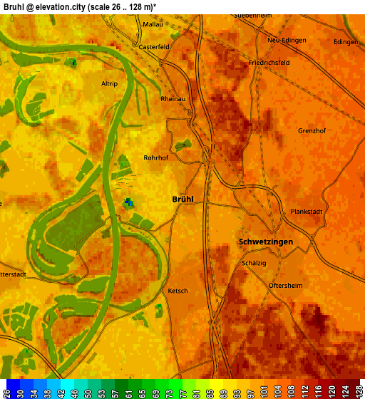
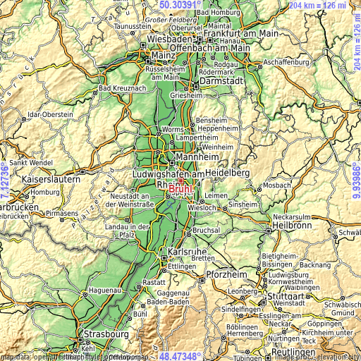
| \ | Map #1 | Map #2 | Topo.Map |
| Scale [m] | 26..119 m | 26..128 m | × |
| Scale [ft] | 85..390 ft | 85..420 ft | × |
| Average | 99.8 m = 327 ft | 100.1 m = 328 ft | × |
| Width | 6.36 km = 4 mi | 12.72 km = 7.9 mi | 203.5 km = 126.4 mi |
| Height | 6.36 km = 4 mi | 12.72 km = 7.9 mi | 203.5 km = 126.4 mi |
| ↑Max Latitude | 49.425812° | 49.454387° | 50.30391° |
| Latitude at center | 49.39722° | 49.39722° | 49.39722° |
| ↓Min Latitude | 49.368612° | 49.339986° | 48.47348° |
| ← Min Longitude | 8.489665° | 8.445719° | 7.12736° |
| Longitude center | 8.53361° | 8.53361° | 8.53361° |
| →Max Longitude | 8.577555° | 8.621501° | 9.93986° |
Nearby cities:
Cities around Brühl sort by population:
• Schwetzingen elevation 101 m
3.9 km,  115°
115°
• Hockenheim 104 m
8.3 km,  170°
170°
• Eppelheim 111 m
7.5 km,  85°
85°
• Edingen-Neckarhausen 105 m
8.5 km,  38°
38°
• Ketsch 101 m
3.3 km,  183°
183°
• Oftersheim 103 m
5 km,  134°
134°
• Plankstadt 103 m
4.5 km, 93°
• Altrip 97 m
5.1 km,  326°
326°
• Ilvesheim 100 m
8.9 km,  15°
15°
• Neuhofen 97 m
8.6 km,  293°
293°
• Waldsee 102 m
6.8 km,  268°
268°
• Otterstadt 99 m
6.8 km,  245°
245°
Multilingual:
 En español:
Brühl elevación 100 m.
 En France:
Brühl élévation 100 m.


Sources and notes:
- [note 1] Map square and city borders are not equal. Map elevation data is calculated only from area inside that square.
- [src 1] Elevation data from geonames database provided with same terms of usage.
- [src 2] The elevation map of Brühl is generated using elevation data from NASA's 3 arcsec (90m) resolution SRTM data.
- [src 3] Base (background) map © OpenStreetMap contributors tiles are generated by Geofabrik and OpenTopoMap.
Copyright & License:
This Brühl Elevation Map is licensed under CC BY-SA. You may reuse any part from this page, if you give a proper credit by linking to this URL:
 More info on terms of use page.