Otterstadt elevation
Otterstadt (Rheinland-Pfalz), Germany elevation is 99 meters and Otterstadt elevation in feet is 325 ft above sea level [src 1]. Otterstadt is a seat of a fourth-order administrative division (feature code) with elevation that is 159 meters (522 ft) smaller than average city elevation in Germany.
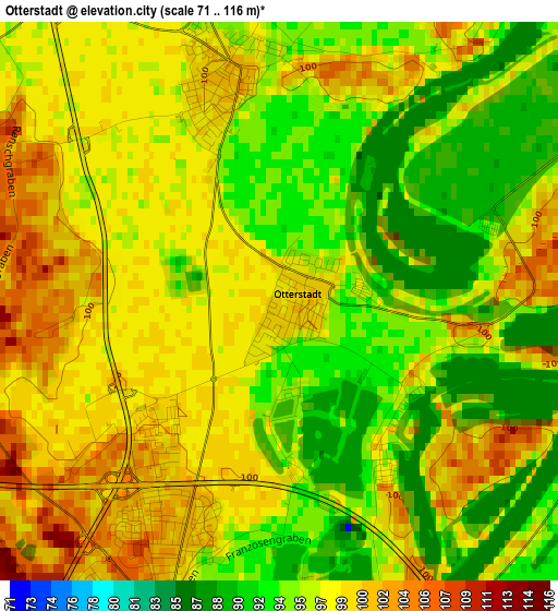
Below is the Elevation map of Otterstadt, which displays elevation range with different colors. Scale of the first map is from 71 to 116 m (233 to 381 ft) with average elevation of 97.2 meters (=319 ft) [note 1]
These maps also provides idea of topography and contour of this city, they are displayed at different zoom levels. More info about maps, scale and edge coordinates you can find below images.
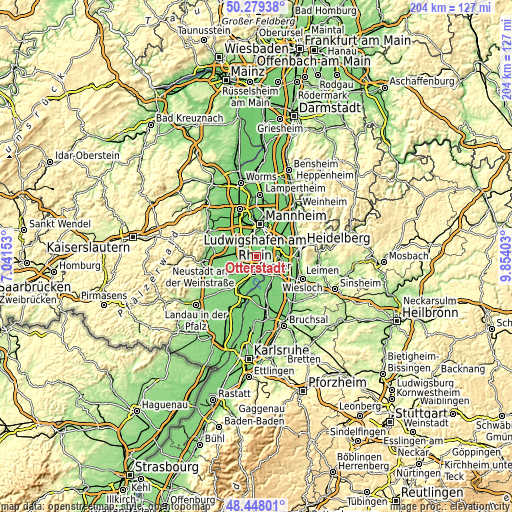
| \ | Map #1 | Topo.Map |
| Scale [m] | 71..116 m | × |
| Scale [ft] | 233..381 ft | × |
| Average | 97.2 m = 319 ft | × |
| Width | 6.36 km = 4 mi | 203.6 km = 126.5 mi |
| Height | 6.36 km = 4 mi | 203.6 km = 126.5 mi |
| ↑Max Latitude | 49.400826° | 50.27938° |
| Latitude at center | 49.37222° | 49.37222° |
| ↓Min Latitude | 49.343597° | 48.44801° |
| ← Min Longitude | 8.403835° | 7.04153° |
| Longitude center | 8.44778° | 8.44778° |
| →Max Longitude | 8.491725° | 9.85403° |
Nearby cities:
Cities around Otterstadt sort by population:
• Speyer elevation 111 m
5.8 km,  191°
191°
• Hockenheim 104 m
9.3 km,  125°
125°
• Schifferstadt 104 m
5.3 km,  284°
284°
• Brühl 100 m
6.8 km,  65°
65°
• Ketsch 101 m
6.1 km,  94°
94°
• Limburgerhof 99 m
7.1 km,  325°
325°
• Altrip 97 m
7.8 km,  25°
25°
• Neuhofen 97 m
6.4 km,  344°
344°
• Neulußheim 101 m
9.7 km,  148°
148°
• Dudenhofen 105 m
7.3 km,  215°
215°
• Waldsee 102 m
2.6 km,  348°
348°
• Altlußheim 102 m
8.7 km, 154°
Multilingual:
 En español:
Otterstadt elevación 99 m.
 En France:
Otterstadt élévation 99 m.
 Auf Deutsch:
Otterstadt höhe über dem Meeresspiegel ist 99 m.

Sources and notes:
- [note 1] Map square and city borders are not equal. Map elevation data is calculated only from area inside that square.
- [src 1] Elevation data from geonames database provided with same terms of usage.
- [src 2] The elevation map of Otterstadt is generated using elevation data from NASA's 3 arcsec (90m) resolution SRTM data.
- [src 3] Base (background) map © OpenStreetMap contributors tiles are generated by Geofabrik and OpenTopoMap.
Copyright & License:
This Otterstadt Elevation Map is licensed under CC BY-SA. You may reuse any part from this page, if you give a proper credit by linking to this URL:
 More info on terms of use page.