Speyer elevation
Speyer (Rheinland-Pfalz), Germany elevation is 111 meters and Speyer elevation in feet is 364 ft above sea level [src 1]. Speyer is a seat of a third-order administrative division (feature code) with elevation that is 147 meters (482 ft) smaller than average city elevation in Germany.
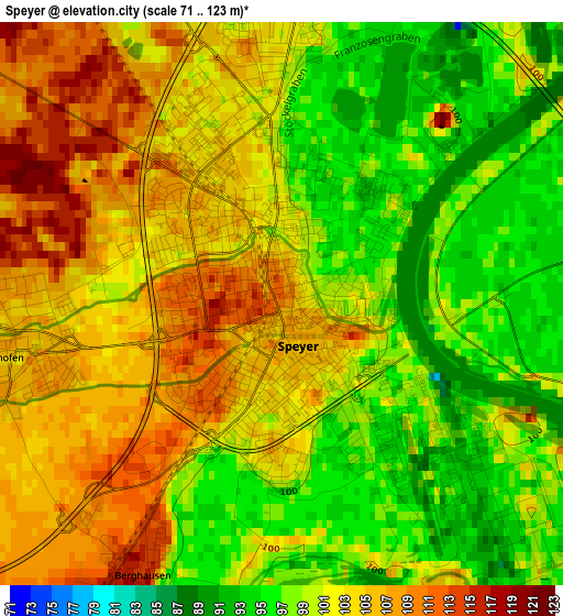
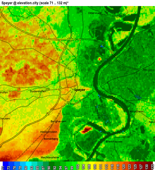
Below is the Elevation map of Speyer, which displays elevation range with different colors. Scale of the first map is from 71 to 123 m (233 to 404 ft) with average elevation of 101.5 meters (=333 ft) [note 1]
These maps also provides idea of topography and contour of this city, they are displayed at different zoom levels. More info about maps, scale and edge coordinates you can find below images.
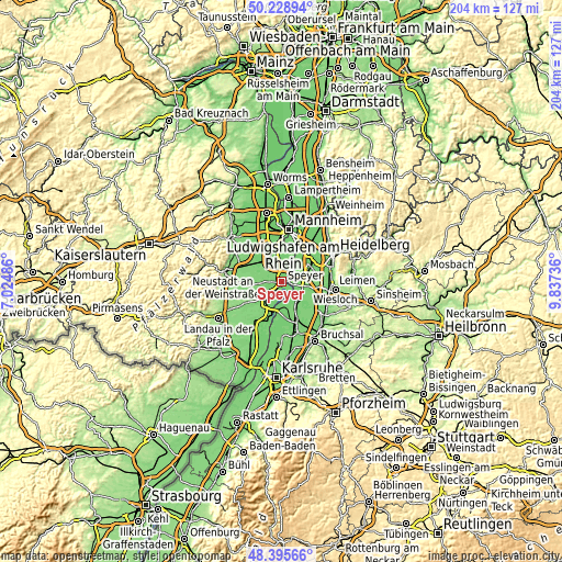
| \ | Map #1 | Map #2 | Topo.Map |
| Scale [m] | 71..123 m | 71..132 m | × |
| Scale [ft] | 233..404 ft | 233..433 ft | × |
| Average | 101.5 m = 333 ft | 102.1 m = 335 ft | × |
| Width | 6.37 km = 4 mi | 12.74 km = 7.9 mi | 203.8 km = 126.6 mi |
| Height | 6.37 km = 4 mi | 12.74 km = 7.9 mi | 203.8 km = 126.6 mi |
| ↑Max Latitude | 49.349466° | 49.378086° | 50.22894° |
| Latitude at center | 49.32083° | 49.32083° | 49.32083° |
| ↓Min Latitude | 49.292177° | 49.263508° | 48.39566° |
| ← Min Longitude | 8.387165° | 8.343219° | 7.02486° |
| Longitude center | 8.43111° | 8.43111° | 8.43111° |
| →Max Longitude | 8.475055° | 8.519001° | 9.83736° |
Nearby cities:
Cities around Speyer sort by population:
• Hockenheim elevation 104 m
8.8 km,  88°
88°
• Schifferstadt 104 m
8 km,  331°
331°
• Ketsch 101 m
8.9 km,  54°
54°
• Oberhausen-Rheinhausen 96 m
6 km,  150°
150°
• Neulußheim 101 m
6.8 km,  111°
111°
• Dudenhofen 105 m
3.1 km,  265°
265°
• Waldsee 102 m
8.3 km,  4°
4°
• Altlußheim 102 m
5.4 km, 113°
• Otterstadt 99 m
5.8 km,  11°
11°
• Harthausen 110 m
6.9 km,  244°
244°
• Schwegenheim 115 m
9.3 km,  232°
232°
• Hanhofen 107 m
6.6 km, 265°
Multilingual:
 En español:
Espira elevación 111 m.
 En France:
Spire élévation 111 m.


Sources and notes:
- [note 1] Map square and city borders are not equal. Map elevation data is calculated only from area inside that square.
- [src 1] Elevation data from geonames database provided with same terms of usage.
- [src 2] The elevation map of Speyer is generated using elevation data from NASA's 3 arcsec (90m) resolution SRTM data.
- [src 3] Base (background) map © OpenStreetMap contributors tiles are generated by Geofabrik and OpenTopoMap.
Copyright & License:
This Speyer Elevation Map is licensed under CC BY-SA. You may reuse any part from this page, if you give a proper credit by linking to this URL:
 More info on terms of use page.