Oftersheim elevation
Oftersheim (Baden-Württemberg, Karlsruhe Region), Germany elevation is 103 meters and Oftersheim elevation in feet is 338 ft above sea level [src 1]. Oftersheim is a seat of a fourth-order administrative division (feature code) with elevation that is 155 meters (509 ft) smaller than average city elevation in Germany.
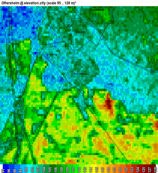
Below is the Elevation map of Oftersheim, which displays elevation range with different colors. Scale of the first map is from 95 to 128 m (312 to 420 ft) with average elevation of 106.2 meters (=348 ft) [note 1]
These maps also provides idea of topography and contour of this city, they are displayed at different zoom levels. More info about maps, scale and edge coordinates you can find below images.
| \ | Map #1 | Map #2 | Topo.Map |
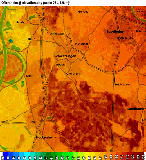
| Scale [m] | 95..128 m | 26..128 m | × |
| Scale [ft] | 312..420 ft | 85..420 ft | × |
| Average | 106.2 m = 348 ft | 104.7 m = 344 ft | × |
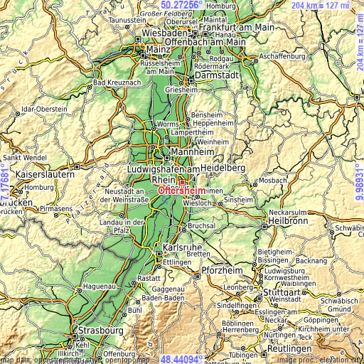
| Width | 6.36 km = 4 mi | 12.73 km = 7.9 mi | 203.7 km = 126.6 mi |
| Height | 6.36 km = 4 mi | 12.73 km = 7.9 mi | 203.6 km = 126.5 mi |
| ↑Max Latitude | 49.39389° | 49.422484° | 50.27256° |
| Latitude at center | 49.36528° | 49.36528° | 49.36528° |
| ↓Min Latitude | 49.336653° | 49.308009° | 48.44094° |
| ← Min Longitude | 8.539115° | 8.495169° | 7.17681° |
| Longitude center | 8.58306° | 8.58306° | 8.58306° |
| →Max Longitude | 8.627005° | 8.670951° | 9.98931° |
Nearby cities:
Cities around Oftersheim sort by population:
• Heidelberg elevation 115 m
9.1 km,  58°
58°
• Leimen 112 m
7.8 km,  104°
104°
• Schwetzingen 101 m
1.9 km,  358°
358°
• Hockenheim 104 m
5.2 km,  205°
205°
• Walldorf 105 m
7.8 km,  146°
146°
• Sandhausen 109 m
6.1 km,  114°
114°
• Brühl 100 m
5 km,  314°
314°
• Eppelheim 111 m
5.6 km,  43°
43°
• Ketsch 101 m
3.8 km,  274°
274°
• Plankstadt 103 m
3.4 km,  16°
16°
• Reilingen 102 m
7.6 km,  190°
190°
• Neulußheim 101 m
8.8 km, 212°
Multilingual:
 En español:
Oftersheim elevación 103 m.
 En France:
Oftersheim élévation 103 m.
 Auf Deutsch:
Oftersheim höhe über dem Meeresspiegel ist 103 m.

Sources and notes:
- [note 1] Map square and city borders are not equal. Map elevation data is calculated only from area inside that square.
- [src 1] Elevation data from geonames database provided with same terms of usage.
- [src 2] The elevation map of Oftersheim is generated using elevation data from NASA's 3 arcsec (90m) resolution SRTM data.
- [src 3] Base (background) map © OpenStreetMap contributors tiles are generated by Geofabrik and OpenTopoMap.
Copyright & License:
This Oftersheim Elevation Map is licensed under CC BY-SA. You may reuse any part from this page, if you give a proper credit by linking to this URL:
 More info on terms of use page.