Calbe elevation
Calbe (Saxony-Anhalt), Germany elevation is 58 meters and Calbe elevation in feet is 190 ft above sea level [src 1]. Calbe is a populated place (feature code) with elevation that is 200 meters (656 ft) smaller than average city elevation in Germany.
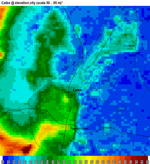
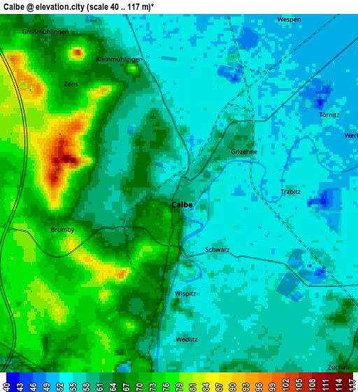
Below is the Elevation map of Calbe, which displays elevation range with different colors. Scale of the first map is from 50 to 95 m (164 to 312 ft) with average elevation of 59.3 meters (=195 ft) [note 1]
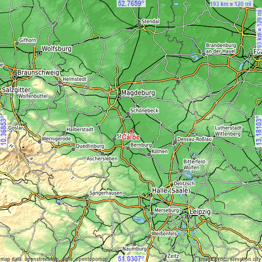
These maps also provides idea of topography and contour of this city, they are displayed at different zoom levels. More info about maps, scale and edge coordinates you can find below images.
| \ | Map #1 | Map #2 | Topo.Map |
| Scale [m] | 50..95 m | 40..117 m | × |
| Scale [ft] | 164..312 ft | 131..384 ft | × |
| Average | 59.3 m = 195 ft | 61.9 m = 203 ft | × |
| Width | 6.03 km = 3.7 mi | 12.06 km = 7.5 mi | 192.9 km = 119.9 mi |
| Height | 6.03 km = 3.7 mi | 12.06 km = 7.5 mi | 192.9 km = 119.9 mi |
| ↑Max Latitude | 51.933784° | 51.960871° | 52.7659° |
| Latitude at center | 51.90668° | 51.90668° | 51.90668° |
| ↓Min Latitude | 51.87956° | 51.852424° | 51.0307° |
| ← Min Longitude | 11.730835° | 11.686889° | 10.36853° |
| Longitude center | 11.77478° | 11.77478° | 11.77478° |
| →Max Longitude | 11.818725° | 11.862671° | 13.18103° |
Nearby cities:
Cities around Calbe sort by population:
• Schönebeck elevation 53 m
12.6 km,  346°
346°
• Bernburg 86 m
12.7 km,  190°
190°
• Barby 52 m
10 km,  47°
47°
• Nienburg/Saale 69 m
7.7 km,  182°
182°
• Biere 93 m
11.2 km,  312°
312°
• Förderstedt 77 m
9.8 km,  263°
263°
• Groß Rosenburg 53 m
8.1 km,  81°
81°
• Atzendorf 84 m
12.1 km,  276°
276°
• Eggersdorf 55 m
8.9 km,  330°
330°
• Eickendorf 81 m
8.2 km,  303°
303°
• Glöthe 73 m
6.9 km,  273°
273°
• Brumby 71 m
4.1 km,  253°
253°
Multilingual:
 En español:
Calbe elevación 58 m.
 En France:
Calbe élévation 58 m.
 Auf Deutsch:
Calbe an der Saale, Calbe höhe über dem Meeresspiegel ist 58 m.

Sources and notes:
- [note 1] Map square and city borders are not equal. Map elevation data is calculated only from area inside that square.
- [src 1] Elevation data from geonames database provided with same terms of usage.
- [src 2] The elevation map of Calbe is generated using elevation data from NASA's 3 arcsec (90m) resolution SRTM data.
- [src 3] Base (background) map © OpenStreetMap contributors tiles are generated by Geofabrik and OpenTopoMap.
Copyright & License:
This Calbe Elevation Map is licensed under CC BY-SA. You may reuse any part from this page, if you give a proper credit by linking to this URL:
 More info on terms of use page.