Schönebeck elevation
Schönebeck (Saxony-Anhalt), Germany elevation is 53 meters and Schönebeck elevation in feet is 174 ft above sea level [src 1]. Schönebeck is a populated place (feature code) with elevation that is 205 meters (673 ft) smaller than average city elevation in Germany.
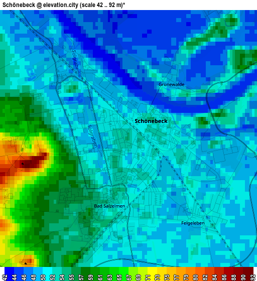
Below is the Elevation map of Schönebeck, which displays elevation range with different colors. Scale of the first map is from 42 to 92 m (138 to 302 ft) with average elevation of 51.8 meters (=170 ft) [note 1]
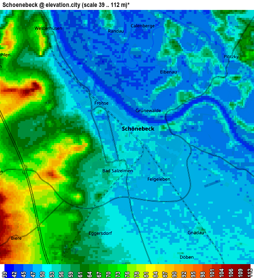
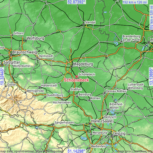
These maps also provides idea of topography and contour of this city, they are displayed at different zoom levels. More info about maps, scale and edge coordinates you can find below images.
| \ | Map #1 | Map #2 | Topo.Map |
| Scale [m] | 42..92 m | 39..112 m | × |
| Scale [ft] | 138..302 ft | 128..367 ft | × |
| Average | 51.8 m = 170 ft | 56.4 m = 185 ft | × |
| Width | 6.01 km = 3.7 mi | 12.03 km = 7.5 mi | 192.5 km = 119.6 mi |
| Height | 6.01 km = 3.7 mi | 12.03 km = 7.5 mi | 192.4 km = 119.6 mi |
| ↑Max Latitude | 52.043857° | 52.070878° | 52.87392° |
| Latitude at center | 52.01682° | 52.01682° | 52.01682° |
| ↓Min Latitude | 51.989767° | 51.962697° | 51.14298° |
| ← Min Longitude | 11.686755° | 11.642809° | 10.32445° |
| Longitude center | 11.7307° | 11.7307° | 11.7307° |
| →Max Longitude | 11.774645° | 11.818591° | 13.13695° |
Nearby cities:
Cities around Schönebeck sort by population:
• Calbe elevation 58 m
12.6 km,  166°
166°
• Gommern 56 m
9 km,  44°
44°
• Barby 52 m
11.8 km,  117°
117°
• Biere 93 m
7 km,  227°
227°
• Welsleben 77 m
6.5 km,  256°
256°
• Borne 91 m
14 km,  237°
237°
• Eggersdorf 55 m
4.7 km,  197°
197°
• Eickendorf 81 m
8.6 km,  206°
206°
• Glöthe 73 m
12.5 km, 197°
• Brumby 71 m
13.4 km,  183°
183°
• Plötzky 53 m
6.3 km,  51°
51°
• Wahlitz 48 m
10.2 km,  19°
19°
Multilingual:
 En español:
Schönebeck elevación 53 m.
 En France:
Schönebeck élévation 53 m.
 Auf Deutsch:
Schönebeck (Elbe) höhe über dem Meeresspiegel ist 53 m.

Sources and notes:
- [note 1] Map square and city borders are not equal. Map elevation data is calculated only from area inside that square.
- [src 1] Elevation data from geonames database provided with same terms of usage.
- [src 2] The elevation map of Schönebeck is generated using elevation data from NASA's 3 arcsec (90m) resolution SRTM data.
- [src 3] Base (background) map © OpenStreetMap contributors tiles are generated by Geofabrik and OpenTopoMap.
Copyright & License:
This Schönebeck Elevation Map is licensed under CC BY-SA. You may reuse any part from this page, if you give a proper credit by linking to this URL:
 More info on terms of use page.