Dassel elevation
Dassel (Lower Saxony), Germany elevation is 171 meters and Dassel elevation in feet is 561 ft above sea level [src 1]. Dassel is a populated place (feature code) with elevation that is 87 meters (285 ft) smaller than average city elevation in Germany.
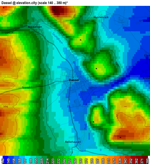
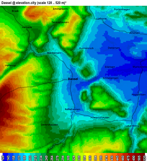
Below is the Elevation map of Dassel, which displays elevation range with different colors. Scale of the first map is from 140 to 380 m (459 to 1247 ft) with average elevation of 222.1 meters (=729 ft) [note 1]
These maps also provides idea of topography and contour of this city, they are displayed at different zoom levels. More info about maps, scale and edge coordinates you can find below images.
| \ | Map #1 | Map #2 | Topo.Map |
| Scale [m] | 140..380 m | 128..520 m | × |
| Scale [ft] | 459..1247 ft | 420..1706 ft | × |
| Average | 222.1 m = 729 ft | 264.1 m = 866 ft | × |
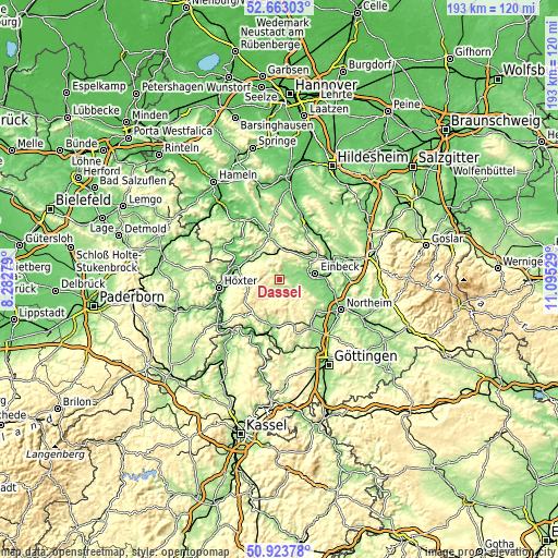
| Width | 6.04 km = 3.8 mi | 12.09 km = 7.5 mi | 193.4 km = 120.2 mi |
| Height | 6.04 km = 3.8 mi | 12.09 km = 7.5 mi | 193.4 km = 120.2 mi |
| ↑Max Latitude | 51.828957° | 51.856107° | 52.66303° |
| Latitude at center | 51.80179° | 51.80179° | 51.80179° |
| ↓Min Latitude | 51.774607° | 51.747407° | 50.92378° |
| ← Min Longitude | 9.645095° | 9.601149° | 8.28279° |
| Longitude center | 9.68904° | 9.68904° | 9.68904° |
| →Max Longitude | 9.732985° | 9.776931° | 11.09529° |
Nearby cities:
Cities around Dassel sort by population:
• Einbeck elevation 115 m
12.6 km,  80°
80°
• Holzminden 91 m
17 km,  279°
279°
• Uslar 167 m
16.5 km,  193°
193°
• Delligsen 124 m
17.4 km,  26°
26°
• Moringen 179 m
16.9 km,  132°
132°
• Stadtoldendorf 219 m
9.9 km,  334°
334°
• Bevern 100 m
14.8 km,  295°
295°
• Eschershausen 155 m
14.2 km,  347°
347°
• Deensen 261 m
9.3 km,  314°
314°
• Eimen 216 m
11.1 km,  35°
35°
• Golmbach 138 m
14.5 km,  318°
318°
• Heinade 277 m
5.2 km, 312°
Multilingual:
 En español:
Dassel elevación 171 m.
 En France:
Dassel élévation 171 m.


Sources and notes:
- [note 1] Map square and city borders are not equal. Map elevation data is calculated only from area inside that square.
- [src 1] Elevation data from geonames database provided with same terms of usage.
- [src 2] The elevation map of Dassel is generated using elevation data from NASA's 3 arcsec (90m) resolution SRTM data.
- [src 3] Base (background) map © OpenStreetMap contributors tiles are generated by Geofabrik and OpenTopoMap.
Copyright & License:
This Dassel Elevation Map is licensed under CC BY-SA. You may reuse any part from this page, if you give a proper credit by linking to this URL:
 More info on terms of use page.