Diepholz elevation
Diepholz (Lower Saxony), Germany elevation is 40 meters and Diepholz elevation in feet is 131 ft above sea level [src 1]. Diepholz is a seat of a third-order administrative division (feature code) with elevation that is 218 meters (715 ft) smaller than average city elevation in Germany.
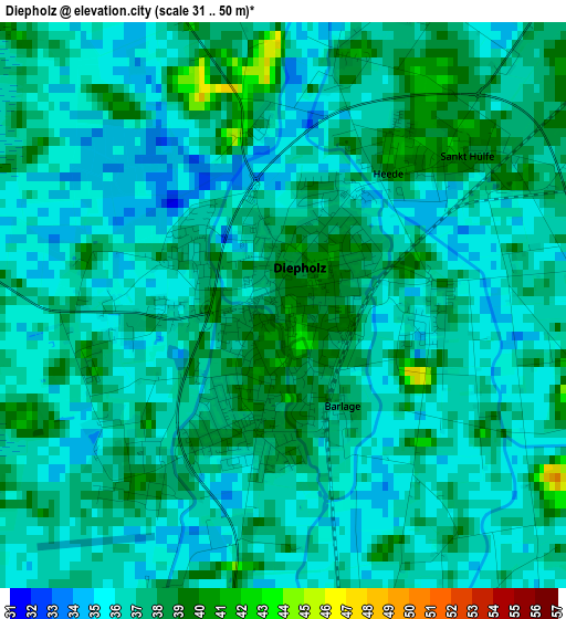
Below is the Elevation map of Diepholz, which displays elevation range with different colors. Scale of the first map is from 31 to 50 m (102 to 164 ft) with average elevation of 36.5 meters (=120 ft) [note 1]
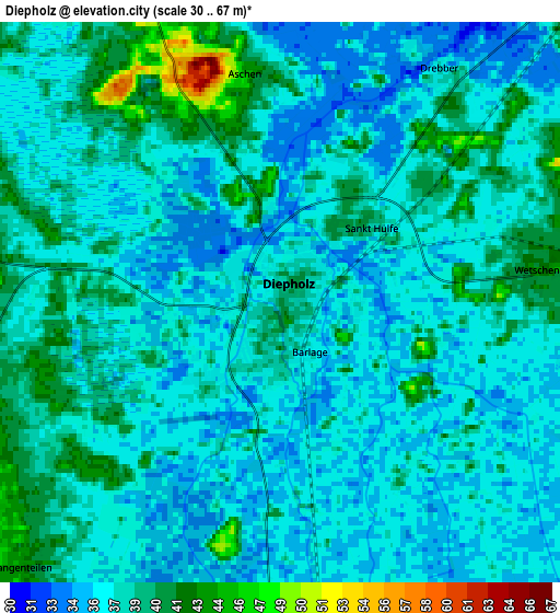
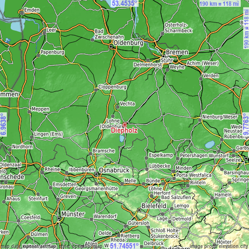
These maps also provides idea of topography and contour of this city, they are displayed at different zoom levels. More info about maps, scale and edge coordinates you can find below images.
| \ | Map #1 | Map #2 | Topo.Map |
| Scale [m] | 31..50 m | 30..67 m | × |
| Scale [ft] | 102..164 ft | 98..220 ft | × |
| Average | 36.5 m = 120 ft | 37.5 m = 123 ft | × |
| Width | 5.93 km = 3.7 mi | 11.87 km = 7.4 mi | 189.9 km = 118 mi |
| Height | 5.93 km = 3.7 mi | 11.87 km = 7.4 mi | 189.9 km = 118 mi |
| ↑Max Latitude | 52.634508° | 52.661171° | 53.4535° |
| Latitude at center | 52.60783° | 52.60783° | 52.60783° |
| ↓Min Latitude | 52.581135° | 52.554424° | 51.74551° |
| ← Min Longitude | 8.326105° | 8.282159° | 6.9638° |
| Longitude center | 8.37005° | 8.37005° | 8.37005° |
| →Max Longitude | 8.413995° | 8.457941° | 9.7763° |
Nearby cities:
Cities around Diepholz sort by population:
• Vechta elevation 36 m
14.3 km,  336°
336°
• Lohne 45 m
11.1 km,  305°
305°
• Damme 66 m
15.1 km,  230°
230°
• Steinfeld 58 m
10.8 km,  256°
256°
• Wagenfeld 40 m
15.8 km,  114°
114°
• Barnstorf 33 m
14.5 km,  38°
38°
• Lemförde 43 m
15.8 km,  178°
178°
• Eydelstedt 35 m
15.2 km,  51°
51°
• Rehden 44 m
7.5 km,  87°
87°
• Wetschen 42 m
5.3 km,  83°
83°
• Barver 36 m
15.1 km, 84°
• Huede 42 m
12.5 km, 183°
Multilingual:
 En español:
Diepholz elevación 40 m.
 En France:
Diepholz élévation 40 m.


Sources and notes:
- [note 1] Map square and city borders are not equal. Map elevation data is calculated only from area inside that square.
- [src 1] Elevation data from geonames database provided with same terms of usage.
- [src 2] The elevation map of Diepholz is generated using elevation data from NASA's 3 arcsec (90m) resolution SRTM data.
- [src 3] Base (background) map © OpenStreetMap contributors tiles are generated by Geofabrik and OpenTopoMap.
Copyright & License:
This Diepholz Elevation Map is licensed under CC BY-SA. You may reuse any part from this page, if you give a proper credit by linking to this URL:
 More info on terms of use page.