Steinfeld elevation
Steinfeld (Lower Saxony), Germany elevation is 58 meters and Steinfeld elevation in feet is 190 ft above sea level [src 1]. Steinfeld is a populated place (feature code) with elevation that is 200 meters (656 ft) smaller than average city elevation in Germany.
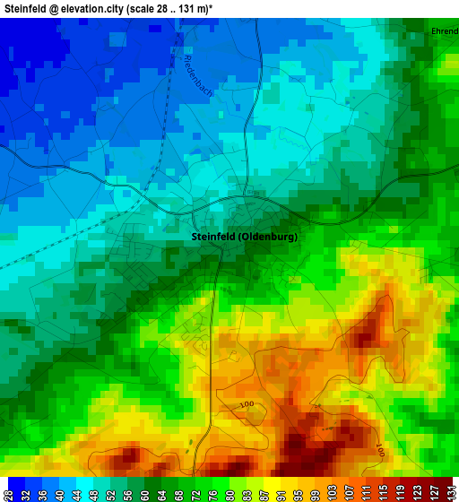
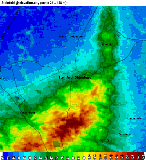
Below is the Elevation map of Steinfeld, which displays elevation range with different colors. Scale of the first map is from 28 to 131 m (92 to 430 ft) with average elevation of 65 meters (=213 ft) [note 1]
These maps also provides idea of topography and contour of this city, they are displayed at different zoom levels. More info about maps, scale and edge coordinates you can find below images.
| \ | Map #1 | Map #2 | Topo.Map |
| Scale [m] | 28..131 m | 24..148 m | × |
| Scale [ft] | 92..430 ft | 79..486 ft | × |
| Average | 65 m = 213 ft | 58.1 m = 191 ft | × |
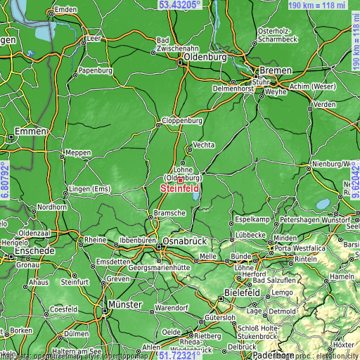
| Width | 5.94 km = 3.7 mi | 11.88 km = 7.4 mi | 190 km = 118.1 mi |
| Height | 5.94 km = 3.7 mi | 11.87 km = 7.4 mi | 190 km = 118.1 mi |
| ↑Max Latitude | 52.612652° | 52.639327° | 53.43205° |
| Latitude at center | 52.58596° | 52.58596° | 52.58596° |
| ↓Min Latitude | 52.559252° | 52.532528° | 51.72321° |
| ← Min Longitude | 8.170225° | 8.126279° | 6.80792° |
| Longitude center | 8.21417° | 8.21417° | 8.21417° |
| →Max Longitude | 8.258115° | 8.302061° | 9.62042° |
Nearby cities:
Cities around Steinfeld sort by population:
• Vechta elevation 36 m
16.3 km,  17°
17°
• Lohne 45 m
9.1 km,  10°
10°
• Diepholz 40 m
10.8 km,  76°
76°
• Damme 66 m
7.2 km,  188°
188°
• Dinklage 29 m
10.4 km,  324°
324°
• Holdorf 37 m
6.6 km,  267°
267°
• Badbergen 29 m
16.5 km,  288°
288°
• Lemförde 43 m
17.3 km,  140°
140°
• Neuenkirchen 41 m
13.2 km,  230°
230°
• Gehrde 31 m
14.3 km, 265°
• Wetschen 42 m
16.1 km, 79°
• Huede 42 m
14 km, 135°
Multilingual:
 En español:
Steinfeld elevación 58 m.
 En France:
Steinfeld élévation 58 m.
 Auf Deutsch:
Steinfeld höhe über dem Meeresspiegel ist 58 m.

Sources and notes:
- [note 1] Map square and city borders are not equal. Map elevation data is calculated only from area inside that square.
- [src 1] Elevation data from geonames database provided with same terms of usage.
- [src 2] The elevation map of Steinfeld is generated using elevation data from NASA's 3 arcsec (90m) resolution SRTM data.
- [src 3] Base (background) map © OpenStreetMap contributors tiles are generated by Geofabrik and OpenTopoMap.
Copyright & License:
This Steinfeld Elevation Map is licensed under CC BY-SA. You may reuse any part from this page, if you give a proper credit by linking to this URL:
 More info on terms of use page.