Falkenstein elevation
Falkenstein (Bavaria, Upper Palatinate), Germany elevation is 566 meters and Falkenstein elevation in feet is 1857 ft above sea level [src 1]. Falkenstein is a populated place (feature code) with elevation that is 308 meters (1010 ft) bigger than average city elevation in Germany.
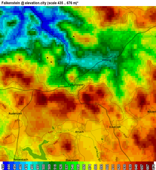
Below is the Elevation map of Falkenstein, which displays elevation range with different colors. Scale of the first map is from 435 to 676 m (1427 to 2218 ft) with average elevation of 573.1 meters (=1880 ft) [note 1]
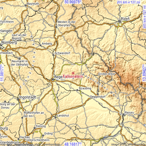
These maps also provides idea of topography and contour of this city, they are displayed at different zoom levels. More info about maps, scale and edge coordinates you can find below images.
| \ | Map #1 | Topo.Map |
| Scale [m] | 435..676 m | × |
| Scale [ft] | 1427..2218 ft | × |
| Average | 573.1 m = 1880 ft | × |
| Width | 6.4 km = 4 mi | 204.8 km = 127.3 mi |
| Height | 6.4 km = 4 mi | 204.7 km = 127.2 mi |
| ↑Max Latitude | 49.126266° | 50.00975° |
| Latitude at center | 49.0975° | 49.0975° |
| ↓Min Latitude | 49.068717° | 48.16817° |
| ← Min Longitude | 12.444075° | 11.08177° |
| Longitude center | 12.48802° | 12.48802° |
| →Max Longitude | 12.531965° | 13.89427° |
Nearby cities:
Cities around Falkenstein sort by population:
• Roding elevation 380 m
11 km,  12°
12°
• Wörth an der Donau 343 m
12.3 km,  209°
209°
• Traitsching 416 m
13.2 km,  63°
63°
• Wiesenfelden 606 m
7.4 km,  149°
149°
• Wald 552 m
11.6 km,  300°
300°
• Wiesent 331 m
11.8 km,  220°
220°
• Schorndorf 417 m
10.4 km,  47°
47°
• Walderbach 352 m
12.2 km,  321°
321°
• Rettenbach 590 m
4.4 km, 218°
• Brennberg 553 m
7.3 km,  241°
241°
• Michelsneukirchen 562 m
5.5 km, 59°
• Falkenfels 484 m
13 km,  143°
143°
Multilingual:
 En español:
Falkenstein elevación 566 m.
 En France:
Falkenstein élévation 566 m.
 Auf Deutsch:
Falkenstein höhe über dem Meeresspiegel ist 566 m.

Sources and notes:
- [note 1] Map square and city borders are not equal. Map elevation data is calculated only from area inside that square.
- [src 1] Elevation data from geonames database provided with same terms of usage.
- [src 2] The elevation map of Falkenstein is generated using elevation data from NASA's 3 arcsec (90m) resolution SRTM data.
- [src 3] Base (background) map © OpenStreetMap contributors tiles are generated by Geofabrik and OpenTopoMap.
Copyright & License:
This Falkenstein Elevation Map is licensed under CC BY-SA. You may reuse any part from this page, if you give a proper credit by linking to this URL:
 More info on terms of use page.