Wörth an der Donau elevation
Wörth an der Donau (Bavaria, Upper Palatinate), Germany elevation is 343 meters and Wörth an der Donau elevation in feet is 1125 ft above sea level [src 1]. Wörth an der Donau is a populated place (feature code) with elevation that is 85 meters (279 ft) bigger than average city elevation in Germany.
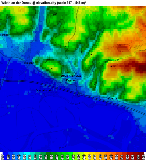
Below is the Elevation map of Wörth an der Donau, which displays elevation range with different colors. Scale of the first map is from 317 to 546 m (1040 to 1791 ft) with average elevation of 370.9 meters (=1217 ft) [note 1]
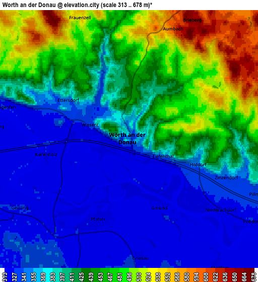
These maps also provides idea of topography and contour of this city, they are displayed at different zoom levels. More info about maps, scale and edge coordinates you can find below images.
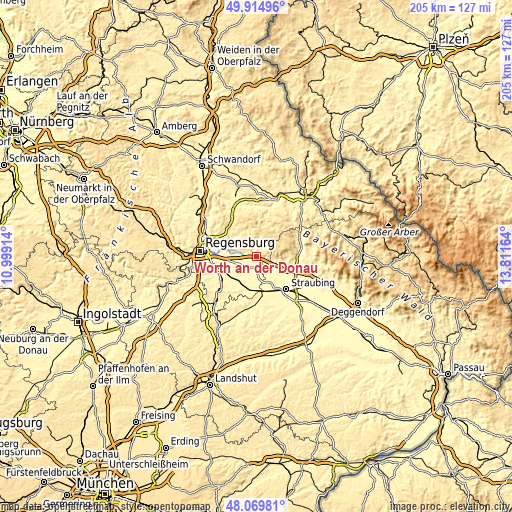
| \ | Map #1 | Map #2 | Topo.Map |
| Scale [m] | 317..546 m | 313..678 m | × |
| Scale [ft] | 1040..1791 ft | 1027..2224 ft | × |
| Average | 370.9 m = 1217 ft | 404.8 m = 1328 ft | × |
| Width | 6.41 km = 4 mi | 12.82 km = 8 mi | 205.2 km = 127.5 mi |
| Height | 6.41 km = 4 mi | 12.82 km = 8 mi | 205.1 km = 127.4 mi |
| ↑Max Latitude | 49.029752° | 49.058557° | 49.91496° |
| Latitude at center | 49.00093° | 49.00093° | 49.00093° |
| ↓Min Latitude | 48.972091° | 48.943236° | 48.06981° |
| ← Min Longitude | 12.361445° | 12.317499° | 10.99914° |
| Longitude center | 12.40539° | 12.40539° | 12.40539° |
| →Max Longitude | 12.449335° | 12.493281° | 13.81164° |
Nearby cities:
Cities around Wörth an der Donau sort by population:
• Mintraching elevation 331 m
13 km,  246°
246°
• Kirchroth 321 m
12 km,  118°
118°
• Wiesenfelden 606 m
10.8 km,  65°
65°
• Falkenstein 566 m
12.3 km,  29°
29°
• Pfatter 324 m
4.5 km,  201°
201°
• Rain 332 m
11.6 km,  156°
156°
• Wiesent 331 m
2.4 km,  317°
317°
• Rettenbach 590 m
8 km,  23°
23°
• Brennberg 553 m
7.3 km,  356°
356°
• Aholfing 323 m
7.9 km,  144°
144°
• Atting 334 m
13.3 km,  153°
153°
• Mötzing 335 m
12.2 km,  190°
190°
Multilingual:
 En español:
Wörth an der Donau elevación 343 m.
 En France:
Wörth an der Donau élévation 343 m.
 Auf Deutsch:
Wörth an der Donau höhe über dem Meeresspiegel ist 343 m.

Sources and notes:
- [note 1] Map square and city borders are not equal. Map elevation data is calculated only from area inside that square.
- [src 1] Elevation data from geonames database provided with same terms of usage.
- [src 2] The elevation map of Wörth an der Donau is generated using elevation data from NASA's 3 arcsec (90m) resolution SRTM data.
- [src 3] Base (background) map © OpenStreetMap contributors tiles are generated by Geofabrik and OpenTopoMap.
Copyright & License:
This Wörth an der Donau Elevation Map is licensed under CC BY-SA. You may reuse any part from this page, if you give a proper credit by linking to this URL:
 More info on terms of use page.