Aholfing elevation
Aholfing (Bavaria, Lower Bavaria), Germany elevation is 323 meters and Aholfing elevation in feet is 1060 ft above sea level [src 1]. Aholfing is a seat of a fourth-order administrative division (feature code) with elevation that is 65 meters (213 ft) bigger than average city elevation in Germany.
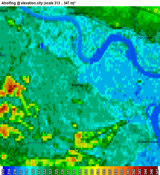
Below is the Elevation map of Aholfing, which displays elevation range with different colors. Scale of the first map is from 313 to 347 m (1027 to 1138 ft) with average elevation of 321.8 meters (=1056 ft) [note 1]
These maps also provides idea of topography and contour of this city, they are displayed at different zoom levels. More info about maps, scale and edge coordinates you can find below images.
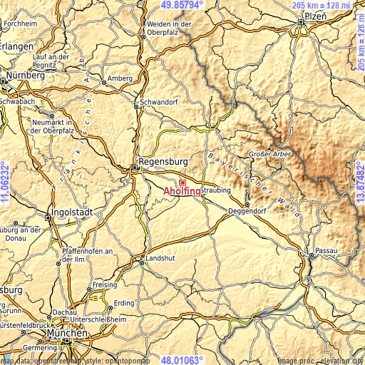
| \ | Map #1 | Topo.Map |
| Scale [m] | 313..347 m | × |
| Scale [ft] | 1027..1138 ft | × |
| Average | 321.8 m = 1056 ft | × |
| Width | 6.42 km = 4 mi | 205.4 km = 127.6 mi |
| Height | 6.42 km = 4 mi | 205.4 km = 127.6 mi |
| ↑Max Latitude | 48.971685° | 49.85794° |
| Latitude at center | 48.94283° | 48.94283° |
| ↓Min Latitude | 48.913958° | 48.01063° |
| ← Min Longitude | 12.424625° | 11.06232° |
| Longitude center | 12.46857° | 12.46857° |
| →Max Longitude | 12.512515° | 13.87482° |
Nearby cities:
Cities around Aholfing sort by population:
• Straubing elevation 333 m
10.3 km,  131°
131°
• Wörth an der Donau 343 m
7.9 km,  324°
324°
• Kirchroth 321 m
6 km,  82°
82°
• Pfatter 324 m
6.7 km,  289°
289°
• Parkstetten 320 m
10 km,  106°
106°
• Steinach 334 m
10.2 km, 82°
• Rain 332 m
4.2 km,  179°
179°
• Wiesent 331 m
10.3 km, 322°
• Sünching 341 m
11.2 km,  230°
230°
• Atting 334 m
5.6 km,  165°
165°
• Mötzing 335 m
8.8 km, 231°
• Perkam 356 m
10 km,  192°
192°
Multilingual:
 En español:
Aholfing elevación 323 m.
 En France:
Aholfing élévation 323 m.
 Auf Deutsch:
Aholfing höhe über dem Meeresspiegel ist 323 m.

Sources and notes:
- [note 1] Map square and city borders are not equal. Map elevation data is calculated only from area inside that square.
- [src 1] Elevation data from geonames database provided with same terms of usage.
- [src 2] The elevation map of Aholfing is generated using elevation data from NASA's 3 arcsec (90m) resolution SRTM data.
- [src 3] Base (background) map © OpenStreetMap contributors tiles are generated by Geofabrik and OpenTopoMap.
Copyright & License:
This Aholfing Elevation Map is licensed under CC BY-SA. You may reuse any part from this page, if you give a proper credit by linking to this URL:
 More info on terms of use page.