Floß elevation
Floß (Bavaria, Upper Palatinate), Germany elevation is 479 meters and Floß elevation in feet is 1572 ft above sea level [src 1]. Floß is a populated place (feature code) with elevation that is 221 meters (725 ft) bigger than average city elevation in Germany.
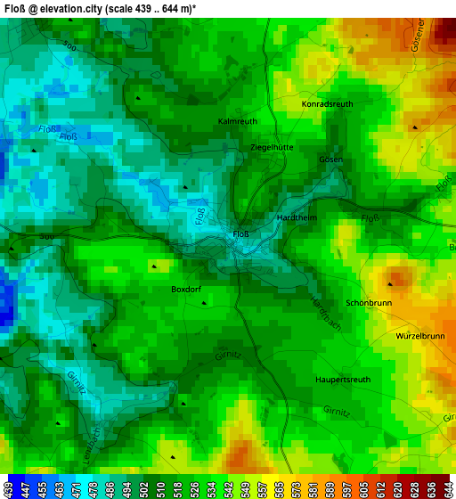
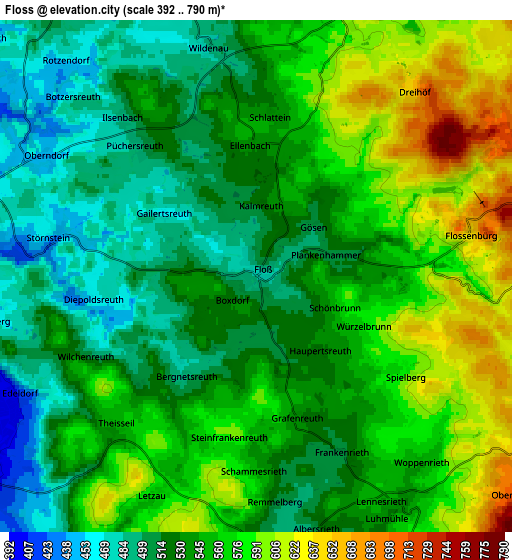
Below is the Elevation map of Floß, which displays elevation range with different colors. Scale of the first map is from 439 to 644 m (1440 to 2113 ft) with average elevation of 520.2 meters (=1707 ft) [note 1]
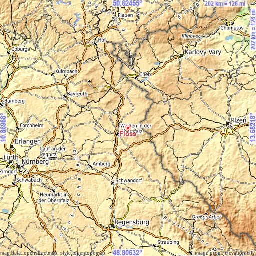
These maps also provides idea of topography and contour of this city, they are displayed at different zoom levels. More info about maps, scale and edge coordinates you can find below images.
| \ | Map #1 | Map #2 | Topo.Map |
| Scale [m] | 439..644 m | 392..790 m | × |
| Scale [ft] | 1440..2113 ft | 1286..2592 ft | × |
| Average | 520.2 m = 1707 ft | 546.6 m = 1793 ft | × |
| Width | 6.32 km = 3.9 mi | 12.64 km = 7.9 mi | 202.2 km = 125.6 mi |
| Height | 6.32 km = 3.9 mi | 12.64 km = 7.9 mi | 202.2 km = 125.6 mi |
| ↑Max Latitude | 49.752351° | 49.780735° | 50.62455° |
| Latitude at center | 49.72395° | 49.72395° | 49.72395° |
| ↓Min Latitude | 49.695532° | 49.667098° | 48.80632° |
| ← Min Longitude | 12.231985° | 12.188039° | 10.86968° |
| Longitude center | 12.27593° | 12.27593° | 12.27593° |
| →Max Longitude | 12.319875° | 12.363821° | 13.68218° |
Nearby cities:
Cities around Floß sort by population:
• Weiden elevation 397 m
10.1 km,  238°
238°
• Neustadt an der Waldnaab 428 m
7.1 km,  277°
277°
• Waldthurn 554 m
6.9 km,  146°
146°
• Schirmitz 393 m
11.4 km,  223°
223°
• Konradsreuth 520 m
2.5 km,  36°
36°
• Flossenbürg 644 m
5.4 km,  78°
78°
• Püchersreuth 494 m
4.2 km,  313°
313°
• Georgenberg 601 m
10.7 km,  102°
102°
• Störnstein 442 m
5.1 km, 280°
• Theisseil 545 m
5.1 km, 223°
• Irchenrieth 431 m
11.8 km,  198°
198°
• Bechtsrieth 447 m
10 km,  208°
208°
Multilingual:
 En español:
Floß elevación 479 m.
 En France:
Floß élévation 479 m.


Sources and notes:
- [note 1] Map square and city borders are not equal. Map elevation data is calculated only from area inside that square.
- [src 1] Elevation data from geonames database provided with same terms of usage.
- [src 2] The elevation map of Floß is generated using elevation data from NASA's 3 arcsec (90m) resolution SRTM data.
- [src 3] Base (background) map © OpenStreetMap contributors tiles are generated by Geofabrik and OpenTopoMap.
Copyright & License:
This Floß Elevation Map is licensed under CC BY-SA. You may reuse any part from this page, if you give a proper credit by linking to this URL:
 More info on terms of use page.