Gelenau elevation
Gelenau (Saxony), Germany elevation is 460 meters and Gelenau elevation in feet is 1509 ft above sea level [src 1]. Gelenau is a populated place (feature code) with elevation that is 202 meters (663 ft) bigger than average city elevation in Germany.
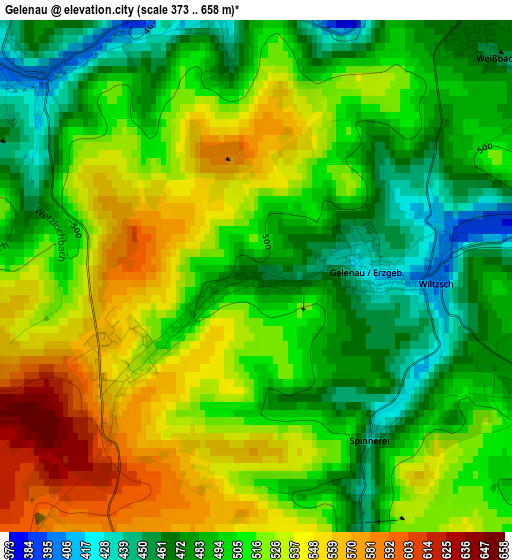
Below is the Elevation map of Gelenau, which displays elevation range with different colors. Scale of the first map is from 373 to 658 m (1224 to 2159 ft) with average elevation of 509.3 meters (=1671 ft) [note 1]
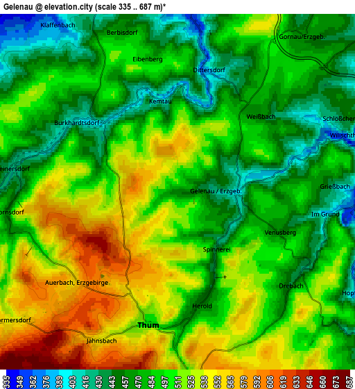
These maps also provides idea of topography and contour of this city, they are displayed at different zoom levels. More info about maps, scale and edge coordinates you can find below images.
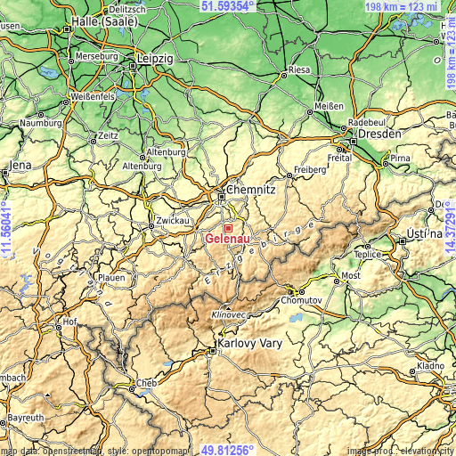
| \ | Map #1 | Map #2 | Topo.Map |
| Scale [m] | 373..658 m | 335..687 m | × |
| Scale [ft] | 1224..2159 ft | 1099..2254 ft | × |
| Average | 509.3 m = 1671 ft | 497.6 m = 1633 ft | × |
| Width | 6.19 km = 3.8 mi | 12.38 km = 7.7 mi | 198 km = 123 mi |
| Height | 6.19 km = 3.8 mi | 12.38 km = 7.7 mi | 198 km = 123 mi |
| ↑Max Latitude | 50.739329° | 50.767132° | 51.59354° |
| Latitude at center | 50.71151° | 50.71151° | 50.71151° |
| ↓Min Latitude | 50.683674° | 50.655822° | 49.81256° |
| ← Min Longitude | 12.922715° | 12.878769° | 11.56041° |
| Longitude center | 12.96666° | 12.96666° | 12.96666° |
| →Max Longitude | 13.010605° | 13.054551° | 14.37291° |
Nearby cities:
Cities around Gelenau sort by population:
• Zschopau elevation 355 m
8.8 km,  62°
62°
• Thalheim 443 m
8.3 km,  261°
261°
• Burkhardtsdorf 405 m
4.3 km,  304°
304°
• Thum 509 m
4.7 km,  193°
193°
• Ehrenfriedersdorf 532 m
6.9 km,  177°
177°
• Gornau 445 m
7.3 km,  43°
43°
• Großolbersdorf 504 m
8.3 km,  98°
98°
• Drebach 479 m
5.3 km,  138°
138°
• Venusberg 449 m
3.9 km,  110°
110°
• Gornsdorf 461 m
6 km, 257°
• Hormersdorf 528 m
7.3 km,  235°
235°
• Scharfenstein 380 m
6.4 km, 97°
Multilingual:
 En español:
Gelenau elevación 460 m.
 En France:
Gelenau élévation 460 m.


Sources and notes:
- [note 1] Map square and city borders are not equal. Map elevation data is calculated only from area inside that square.
- [src 1] Elevation data from geonames database provided with same terms of usage.
- [src 2] The elevation map of Gelenau is generated using elevation data from NASA's 3 arcsec (90m) resolution SRTM data.
- [src 3] Base (background) map © OpenStreetMap contributors tiles are generated by Geofabrik and OpenTopoMap.
Copyright & License:
This Gelenau Elevation Map is licensed under CC BY-SA. You may reuse any part from this page, if you give a proper credit by linking to this URL:
 More info on terms of use page.