Zschopau elevation
Zschopau (Saxony), Germany elevation is 355 meters and Zschopau elevation in feet is 1165 ft above sea level [src 1]. Zschopau is a populated place (feature code) with elevation that is 97 meters (318 ft) bigger than average city elevation in Germany.
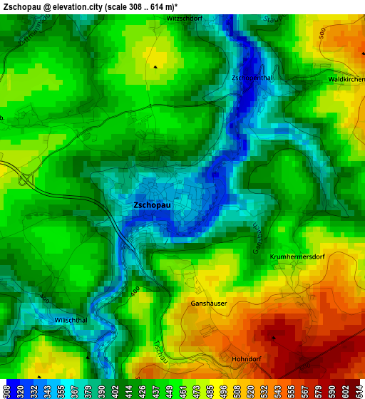
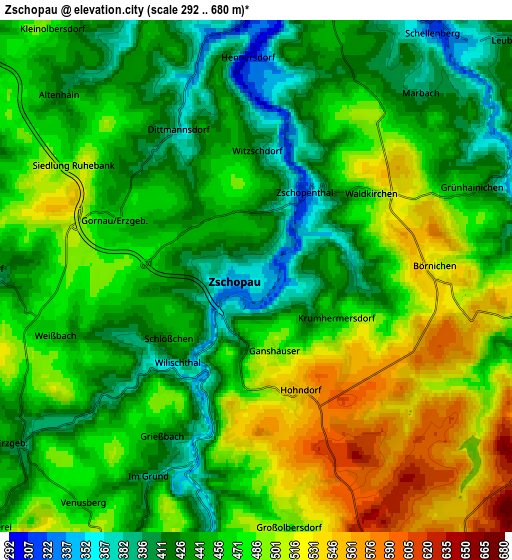
Below is the Elevation map of Zschopau, which displays elevation range with different colors. Scale of the first map is from 308 to 614 m (1010 to 2014 ft) with average elevation of 440.6 meters (=1446 ft) [note 1]
These maps also provides idea of topography and contour of this city, they are displayed at different zoom levels. More info about maps, scale and edge coordinates you can find below images.
| \ | Map #1 | Map #2 | Topo.Map |
| Scale [m] | 308..614 m | 292..680 m | × |
| Scale [ft] | 1010..2014 ft | 958..2231 ft | × |
| Average | 440.6 m = 1446 ft | 463.9 m = 1522 ft | × |
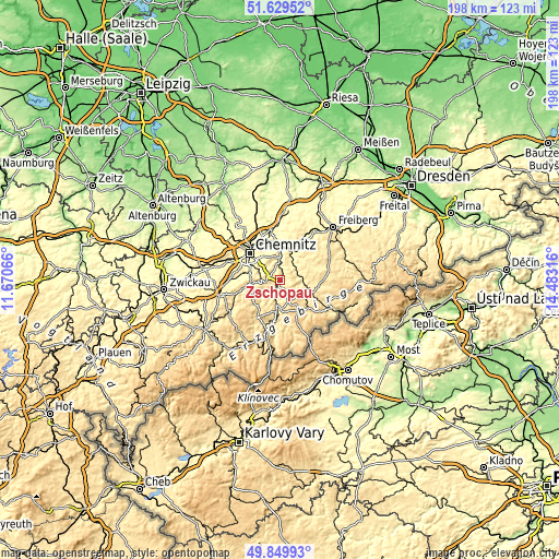
| Width | 6.18 km = 3.8 mi | 12.37 km = 7.7 mi | 197.9 km = 123 mi |
| Height | 6.18 km = 3.8 mi | 12.37 km = 7.7 mi | 197.9 km = 123 mi |
| ↑Max Latitude | 50.775977° | 50.803758° | 51.62952° |
| Latitude at center | 50.74818° | 50.74818° | 50.74818° |
| ↓Min Latitude | 50.720366° | 50.692536° | 49.84993° |
| ← Min Longitude | 13.032965° | 12.989019° | 11.67066° |
| Longitude center | 13.07691° | 13.07691° | 13.07691° |
| →Max Longitude | 13.120855° | 13.164801° | 14.48316° |
Nearby cities:
Cities around Zschopau sort by population:
• Augustusburg elevation 479 m
7.3 km,  13°
13°
• Gelenau 460 m
8.8 km,  242°
242°
• Lengefeld 487 m
8.8 km,  111°
111°
• Gornau 445 m
3 km,  293°
293°
• Leubsdorf 407 m
8.5 km,  47°
47°
• Großolbersdorf 504 m
5.4 km,  175°
175°
• Drebach 479 m
9.1 km,  207°
207°
• Venusberg 449 m
6.8 km,  217°
217°
• Grünhainichen 427 m
5.8 km,  68°
68°
• Borstendorf 399 m
7.7 km, 68°
• Börnichen 513 m
4.5 km,  87°
87°
• Scharfenstein 380 m
5.1 km,  196°
196°
Multilingual:
 En español:
Zschopau elevación 355 m.
 En France:
Zschopau élévation 355 m.
 Auf Deutsch:
Zschopau höhe über dem Meeresspiegel ist 355 m.

Sources and notes:
- [note 1] Map square and city borders are not equal. Map elevation data is calculated only from area inside that square.
- [src 1] Elevation data from geonames database provided with same terms of usage.
- [src 2] The elevation map of Zschopau is generated using elevation data from NASA's 3 arcsec (90m) resolution SRTM data.
- [src 3] Base (background) map © OpenStreetMap contributors tiles are generated by Geofabrik and OpenTopoMap.
Copyright & License:
This Zschopau Elevation Map is licensed under CC BY-SA. You may reuse any part from this page, if you give a proper credit by linking to this URL:
 More info on terms of use page.