Thum elevation
Thum (Saxony), Germany elevation is 509 meters and Thum elevation in feet is 1670 ft above sea level [src 1]. Thum is a populated place (feature code) with elevation that is 251 meters (823 ft) bigger than average city elevation in Germany.
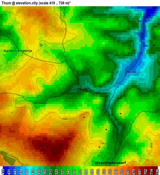
Below is the Elevation map of Thum, which displays elevation range with different colors. Scale of the first map is from 419 to 726 m (1375 to 2382 ft) with average elevation of 575.2 meters (=1887 ft) [note 1]
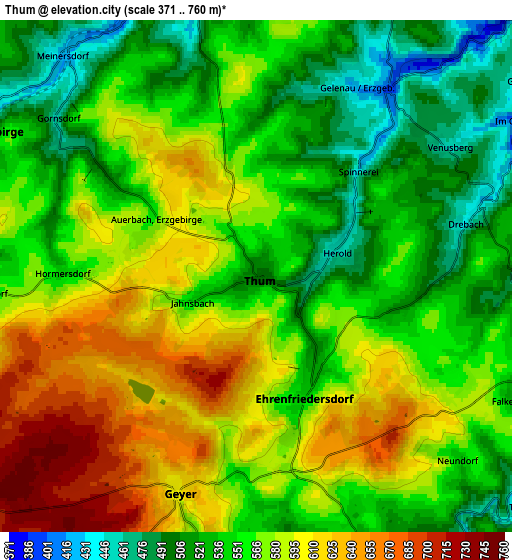
These maps also provides idea of topography and contour of this city, they are displayed at different zoom levels. More info about maps, scale and edge coordinates you can find below images.
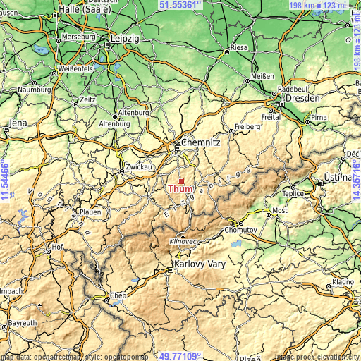
| \ | Map #1 | Map #2 | Topo.Map |
| Scale [m] | 419..726 m | 371..760 m | × |
| Scale [ft] | 1375..2382 ft | 1217..2493 ft | × |
| Average | 575.2 m = 1887 ft | 564.6 m = 1852 ft | × |
| Width | 6.19 km = 3.8 mi | 12.39 km = 7.7 mi | 198.2 km = 123.2 mi |
| Height | 6.19 km = 3.8 mi | 12.39 km = 7.7 mi | 198.2 km = 123.2 mi |
| ↑Max Latitude | 50.698653° | 50.72648° | 51.55361° |
| Latitude at center | 50.67081° | 50.67081° | 50.67081° |
| ↓Min Latitude | 50.64295° | 50.615074° | 49.77109° |
| ← Min Longitude | 12.906965° | 12.863019° | 11.54466° |
| Longitude center | 12.95091° | 12.95091° | 12.95091° |
| →Max Longitude | 12.994855° | 13.038801° | 14.35716° |
Nearby cities:
Cities around Thum sort by population:
• Thalheim elevation 443 m
7.9 km,  295°
295°
• Burkhardtsdorf 405 m
7.4 km,  340°
340°
• Ehrenfriedersdorf 532 m
2.7 km,  150°
150°
• Gelenau 460 m
4.7 km,  13°
13°
• Geyer 610 m
5.4 km,  203°
203°
• Wiesa 458 m
8 km, 146°
• Drebach 479 m
4.6 km,  83°
83°
• Venusberg 449 m
5.7 km,  56°
56°
• Gornsdorf 461 m
5.8 km, 304°
• Dorfchemnitz 474 m
8.1 km,  264°
264°
• Hormersdorf 528 m
4.9 km,  274°
274°
• Tannenberg 526 m
7.1 km,  187°
187°
Multilingual:
 En español:
Thum elevación 509 m.
 En France:
Thum élévation 509 m.


Sources and notes:
- [note 1] Map square and city borders are not equal. Map elevation data is calculated only from area inside that square.
- [src 1] Elevation data from geonames database provided with same terms of usage.
- [src 2] The elevation map of Thum is generated using elevation data from NASA's 3 arcsec (90m) resolution SRTM data.
- [src 3] Base (background) map © OpenStreetMap contributors tiles are generated by Geofabrik and OpenTopoMap.
Copyright & License:
This Thum Elevation Map is licensed under CC BY-SA. You may reuse any part from this page, if you give a proper credit by linking to this URL:
 More info on terms of use page.