Wiesa elevation
Wiesa (Saxony), Germany elevation is 458 meters and Wiesa elevation in feet is 1503 ft above sea level [src 1]. Wiesa is a populated place (feature code) with elevation that is 200 meters (656 ft) bigger than average city elevation in Germany.
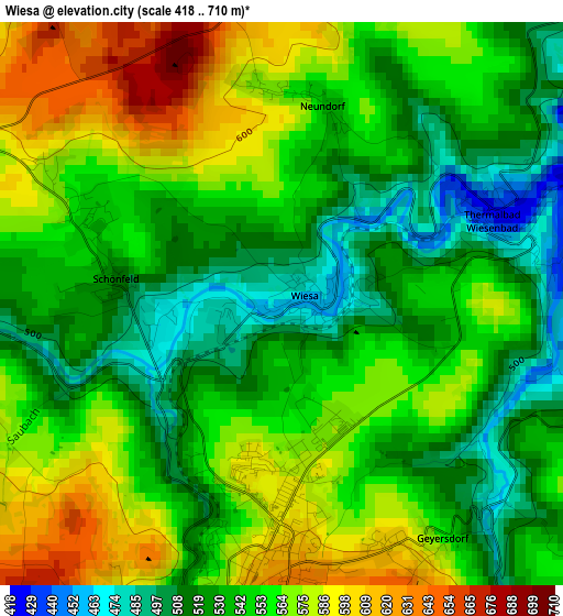
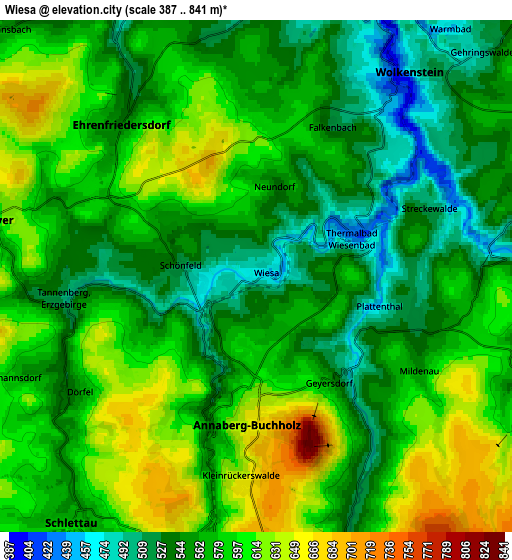
Below is the Elevation map of Wiesa, which displays elevation range with different colors. Scale of the first map is from 418 to 710 m (1371 to 2329 ft) with average elevation of 548.8 meters (=1801 ft) [note 1]
These maps also provides idea of topography and contour of this city, they are displayed at different zoom levels. More info about maps, scale and edge coordinates you can find below images.
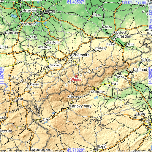
| \ | Map #1 | Map #2 | Topo.Map |
| Scale [m] | 418..710 m | 387..841 m | × |
| Scale [ft] | 1371..2329 ft | 1270..2759 ft | × |
| Average | 548.8 m = 1801 ft | 573.8 m = 1883 ft | × |
| Width | 6.2 km = 3.9 mi | 12.4 km = 7.7 mi | 198.5 km = 123.3 mi |
| Height | 6.2 km = 3.9 mi | 12.4 km = 7.7 mi | 198.4 km = 123.3 mi |
| ↑Max Latitude | 50.639019° | 50.666881° | 51.49507° |
| Latitude at center | 50.61114° | 50.61114° | 50.61114° |
| ↓Min Latitude | 50.583245° | 50.555333° | 49.71028° |
| ← Min Longitude | 12.969825° | 12.925879° | 11.60752° |
| Longitude center | 13.01377° | 13.01377° | 13.01377° |
| →Max Longitude | 13.057715° | 13.101661° | 14.42002° |
Nearby cities:
Cities around Wiesa sort by population:
• Annaberg-Buchholz elevation 627 m
3.6 km,  188°
188°
• Thum 509 m
8 km,  326°
326°
• Ehrenfriedersdorf 532 m
5.2 km,  324°
324°
• Wolkenstein 504 m
6.4 km,  39°
39°
• Geyer 610 m
6.8 km,  284°
284°
• Großrückerswalde 615 m
7.7 km,  71°
71°
• Mildenau 583 m
5 km,  122°
122°
• Schlettau 564 m
7.2 km,  216°
216°
• Drebach 479 m
7.2 km,  1°
1°
• Königswalde 562 m
7.3 km,  159°
159°
• Venusberg 449 m
9.8 km, 1°
• Tannenberg 526 m
5.4 km,  265°
265°
Multilingual:
 En español:
Wiesa elevación 458 m.
 En France:
Wiesa élévation 458 m.


Sources and notes:
- [note 1] Map square and city borders are not equal. Map elevation data is calculated only from area inside that square.
- [src 1] Elevation data from geonames database provided with same terms of usage.
- [src 2] The elevation map of Wiesa is generated using elevation data from NASA's 3 arcsec (90m) resolution SRTM data.
- [src 3] Base (background) map © OpenStreetMap contributors tiles are generated by Geofabrik and OpenTopoMap.
Copyright & License:
This Wiesa Elevation Map is licensed under CC BY-SA. You may reuse any part from this page, if you give a proper credit by linking to this URL:
 More info on terms of use page.