Göllheim elevation
Göllheim (Rheinland-Pfalz), Germany elevation is 247 meters and Göllheim elevation in feet is 810 ft above sea level [src 1]. Göllheim is a seat of a fourth-order administrative division (feature code) with elevation that is 11 meters (36 ft) smaller than average city elevation in Germany.
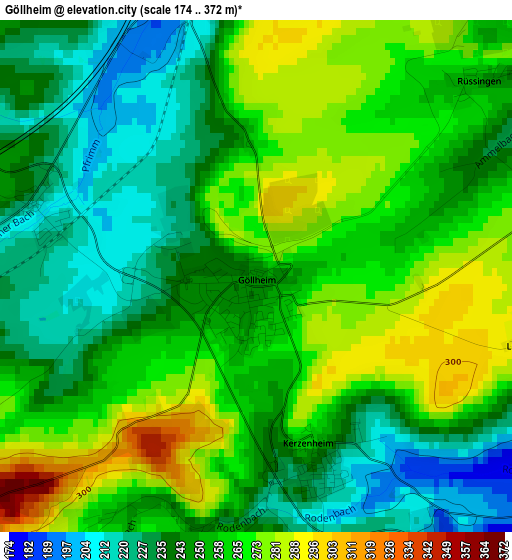
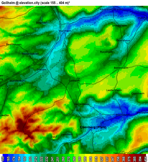
Below is the Elevation map of Göllheim, which displays elevation range with different colors. Scale of the first map is from 174 to 372 m (571 to 1220 ft) with average elevation of 253.4 meters (=831 ft) [note 1]
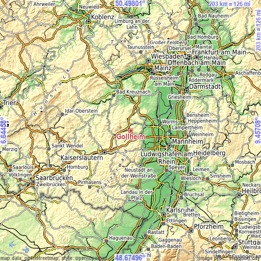
These maps also provides idea of topography and contour of this city, they are displayed at different zoom levels. More info about maps, scale and edge coordinates you can find below images.
| \ | Map #1 | Map #2 | Topo.Map |
| Scale [m] | 174..372 m | 155..404 m | × |
| Scale [ft] | 571..1220 ft | 509..1325 ft | × |
| Average | 253.4 m = 831 ft | 254.9 m = 836 ft | × |
| Width | 6.33 km = 3.9 mi | 12.67 km = 7.9 mi | 202.7 km = 126 mi |
| Height | 6.33 km = 3.9 mi | 12.67 km = 7.9 mi | 202.7 km = 126 mi |
| ↑Max Latitude | 49.623476° | 49.651936° | 50.49801° |
| Latitude at center | 49.595° | 49.595° | 49.595° |
| ↓Min Latitude | 49.566507° | 49.537997° | 48.67496° |
| ← Min Longitude | 8.006885° | 7.962939° | 6.64458° |
| Longitude center | 8.05083° | 8.05083° | 8.05083° |
| →Max Longitude | 8.094775° | 8.138721° | 9.45708° |
Nearby cities:
Cities around Göllheim sort by population:
• Eisenberg elevation 188 m
4.3 km,  159°
159°
• Kirchheimbolanden 255 m
7.9 km,  341°
341°
• Rodenbach 173 m
4.7 km,  119°
119°
• Hettenleidelheim 251 m
6.8 km,  166°
166°
• Bolanden 224 m
5.7 km,  330°
330°
• Kerzenheim 258 m
2.2 km, 162°
• Ramsen 216 m
7 km,  202°
202°
• Albisheim 177 m
6.8 km,  27°
27°
• Marnheim 190 m
4.3 km,  349°
349°
• Wattenheim 328 m
8.2 km, 174°
• Ebertsheim 173 m
5.1 km,  125°
125°
• Dreisen 230 m
3 km,  287°
287°
Multilingual:
 En español:
Göllheim elevación 247 m.
 En France:
Göllheim élévation 247 m.
 Auf Deutsch:
Göllheim höhe über dem Meeresspiegel ist 247 m.

Sources and notes:
- [note 1] Map square and city borders are not equal. Map elevation data is calculated only from area inside that square.
- [src 1] Elevation data from geonames database provided with same terms of usage.
- [src 2] The elevation map of Göllheim is generated using elevation data from NASA's 3 arcsec (90m) resolution SRTM data.
- [src 3] Base (background) map © OpenStreetMap contributors tiles are generated by Geofabrik and OpenTopoMap.
Copyright & License:
This Göllheim Elevation Map is licensed under CC BY-SA. You may reuse any part from this page, if you give a proper credit by linking to this URL:
 More info on terms of use page.