Kirchheimbolanden elevation
Kirchheimbolanden (Rheinland-Pfalz), Germany elevation is 255 meters and Kirchheimbolanden elevation in feet is 837 ft above sea level [src 1]. Kirchheimbolanden is a seat of a third-order administrative division (feature code) with elevation that is 3 meters (10 ft) smaller than average city elevation in Germany.
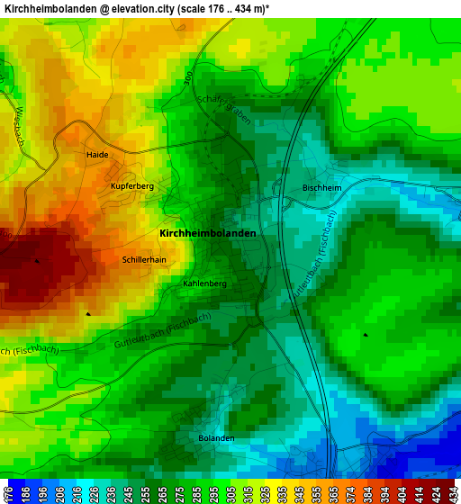
Below is the Elevation map of Kirchheimbolanden, which displays elevation range with different colors. Scale of the first map is from 176 to 434 m (577 to 1424 ft) with average elevation of 289.1 meters (=948 ft) [note 1]
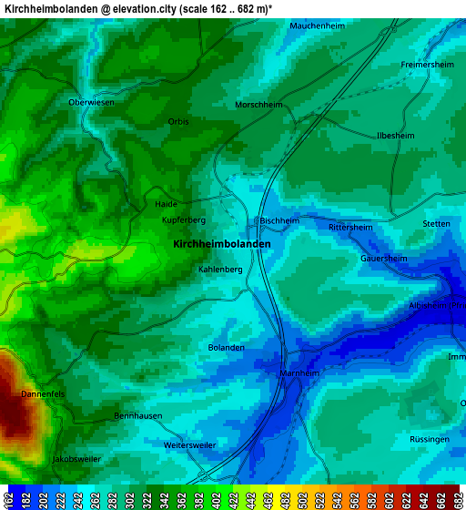
These maps also provides idea of topography and contour of this city, they are displayed at different zoom levels. More info about maps, scale and edge coordinates you can find below images.
| \ | Map #1 | Map #2 | Topo.Map |
| Scale [m] | 176..434 m | 162..682 m | × |
| Scale [ft] | 577..1424 ft | 531..2238 ft | × |
| Average | 289.1 m = 948 ft | 297.4 m = 976 ft | × |
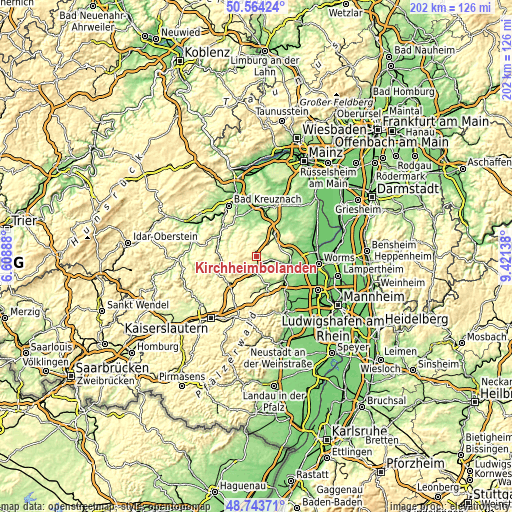
| Width | 6.33 km = 3.9 mi | 12.65 km = 7.9 mi | 202.4 km = 125.8 mi |
| Height | 6.33 km = 3.9 mi | 12.65 km = 7.9 mi | 202.4 km = 125.8 mi |
| ↑Max Latitude | 49.690927° | 49.719347° | 50.56424° |
| Latitude at center | 49.66249° | 49.66249° | 49.66249° |
| ↓Min Latitude | 49.634036° | 49.605566° | 48.74371° |
| ← Min Longitude | 7.971185° | 7.927239° | 6.60888° |
| Longitude center | 8.01513° | 8.01513° | 8.01513° |
| →Max Longitude | 8.059075° | 8.103021° | 9.42138° |
Nearby cities:
Cities around Kirchheimbolanden sort by population:
• Alzey elevation 173 m
11.8 km,  37°
37°
• Göllheim 247 m
7.9 km,  161°
161°
• Bolanden 224 m
2.6 km,  185°
185°
• Kerzenheim 258 m
10.1 km, 161°
• Albisheim 177 m
5.9 km,  104°
104°
• Marnheim 190 m
3.8 km,  151°
151°
• Wendelsheim 172 m
11.6 km,  354°
354°
• Erbes-Büdesheim 262 m
10.3 km,  6°
6°
• Ober-Flörsheim 266 m
10.3 km,  77°
77°
• Kriegsfeld 341 m
8.8 km,  306°
306°
• Flomborn 251 m
10.1 km,  72°
72°
• Dreisen 230 m
6.6 km,  182°
182°
Multilingual:
 En español:
Kirchheimbolanden elevación 255 m.
 En France:
Kirchheimbolanden élévation 255 m.
 Auf Deutsch:
Kirchheimbolanden höhe über dem Meeresspiegel ist 255 m.

Sources and notes:
- [note 1] Map square and city borders are not equal. Map elevation data is calculated only from area inside that square.
- [src 1] Elevation data from geonames database provided with same terms of usage.
- [src 2] The elevation map of Kirchheimbolanden is generated using elevation data from NASA's 3 arcsec (90m) resolution SRTM data.
- [src 3] Base (background) map © OpenStreetMap contributors tiles are generated by Geofabrik and OpenTopoMap.
Copyright & License:
This Kirchheimbolanden Elevation Map is licensed under CC BY-SA. You may reuse any part from this page, if you give a proper credit by linking to this URL:
 More info on terms of use page.