Alzey elevation
Alzey (Rheinland-Pfalz), Germany elevation is 173 meters and Alzey elevation in feet is 568 ft above sea level [src 1]. Alzey is a seat of a third-order administrative division (feature code) with elevation that is 85 meters (279 ft) smaller than average city elevation in Germany.
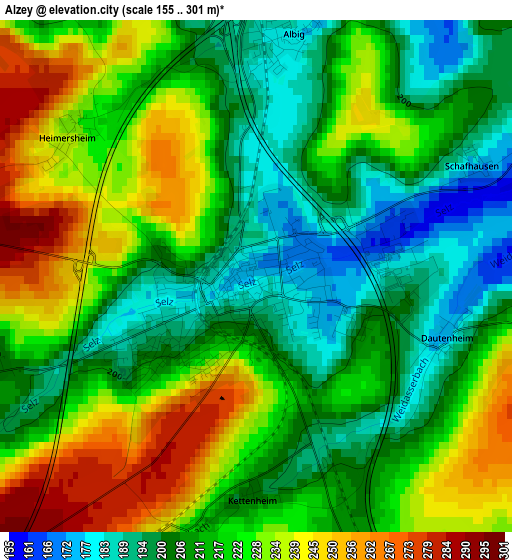
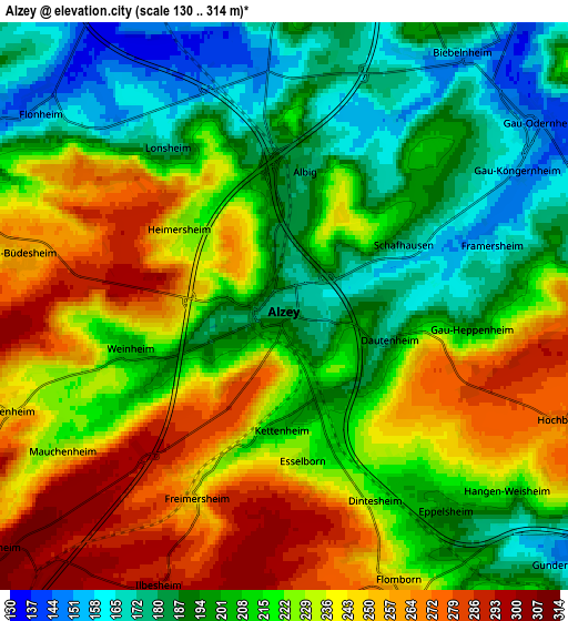
Below is the Elevation map of Alzey, which displays elevation range with different colors. Scale of the first map is from 155 to 301 m (509 to 988 ft) with average elevation of 217.8 meters (=715 ft) [note 1]
These maps also provides idea of topography and contour of this city, they are displayed at different zoom levels. More info about maps, scale and edge coordinates you can find below images.
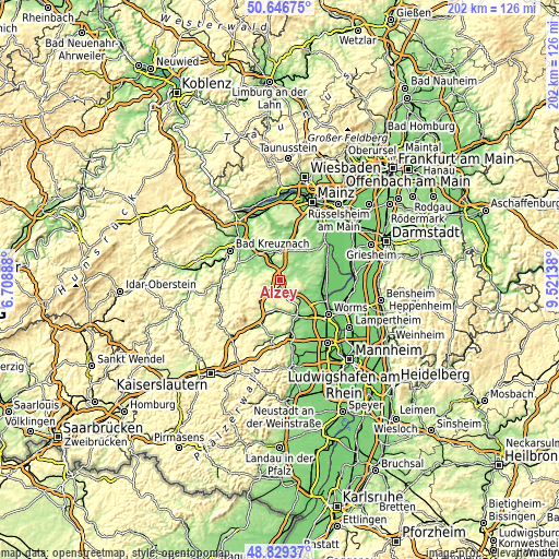
| \ | Map #1 | Map #2 | Topo.Map |
| Scale [m] | 155..301 m | 130..314 m | × |
| Scale [ft] | 509..988 ft | 427..1030 ft | × |
| Average | 217.8 m = 715 ft | 219 m = 719 ft | × |
| Width | 6.31 km = 3.9 mi | 12.63 km = 7.8 mi | 202.1 km = 125.6 mi |
| Height | 6.31 km = 3.9 mi | 12.63 km = 7.8 mi | 202.1 km = 125.6 mi |
| ↑Max Latitude | 49.774958° | 49.803329° | 50.64675° |
| Latitude at center | 49.74657° | 49.74657° | 49.74657° |
| ↓Min Latitude | 49.718166° | 49.689744° | 48.82937° |
| ← Min Longitude | 8.071185° | 8.027239° | 6.70888° |
| Longitude center | 8.11513° | 8.11513° | 8.11513° |
| →Max Longitude | 8.159075° | 8.203021° | 9.52138° |
Nearby cities:
Cities around Alzey sort by population:
• Gau-Odernheim elevation 145 m
7.1 km,  53°
53°
• Armsheim 141 m
8.2 km,  329°
329°
• Flonheim 154 m
6.9 km,  308°
308°
• Framersheim 159 m
4.4 km,  73°
73°
• Albig 178 m
3 km,  8°
8°
• Gundersheim 148 m
8.4 km,  131°
131°
• Bechtolsheim 144 m
8.5 km,  41°
41°
• Erbes-Büdesheim 262 m
6.1 km,  278°
278°
• Eppelsheim 194 m
5.8 km,  141°
141°
• Ober-Flörsheim 266 m
7.6 km,  157°
157°
• Flomborn 251 m
6.7 km, 158°
• Spiesheim 205 m
7.1 km, 7°
Multilingual:
 En español:
Alzey elevación 173 m.
 En France:
Alzey élévation 173 m.


Sources and notes:
- [note 1] Map square and city borders are not equal. Map elevation data is calculated only from area inside that square.
- [src 1] Elevation data from geonames database provided with same terms of usage.
- [src 2] The elevation map of Alzey is generated using elevation data from NASA's 3 arcsec (90m) resolution SRTM data.
- [src 3] Base (background) map © OpenStreetMap contributors tiles are generated by Geofabrik and OpenTopoMap.
Copyright & License:
This Alzey Elevation Map is licensed under CC BY-SA. You may reuse any part from this page, if you give a proper credit by linking to this URL:
 More info on terms of use page.