Gotteszell elevation
Gotteszell (Bavaria, Lower Bavaria), Germany elevation is 552 meters and Gotteszell elevation in feet is 1811 ft above sea level [src 1]. Gotteszell is a seat of a fourth-order administrative division (feature code) with elevation that is 294 meters (965 ft) bigger than average city elevation in Germany.
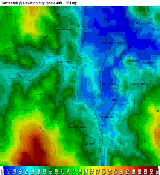
Below is the Elevation map of Gotteszell, which displays elevation range with different colors. Scale of the first map is from 499 to 961 m (1637 to 3153 ft) with average elevation of 641 meters (=2103 ft) [note 1]
These maps also provides idea of topography and contour of this city, they are displayed at different zoom levels. More info about maps, scale and edge coordinates you can find below images.
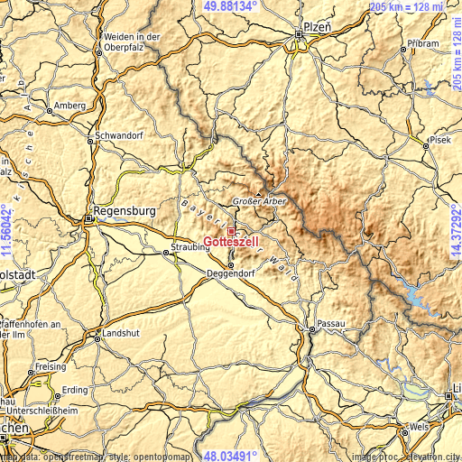
| \ | Map #1 | Topo.Map |
| Scale [m] | 499..961 m | × |
| Scale [ft] | 1637..3153 ft | × |
| Average | 641 m = 2103 ft | × |
| Width | 6.42 km = 4 mi | 205.3 km = 127.6 mi |
| Height | 6.42 km = 4 mi | 205.3 km = 127.6 mi |
| ↑Max Latitude | 48.995512° | 49.88134° |
| Latitude at center | 48.96667° | 48.96667° |
| ↓Min Latitude | 48.937812° | 48.03491° |
| ← Min Longitude | 12.922725° | 11.56042° |
| Longitude center | 12.96667° | 12.96667° |
| →Max Longitude | 13.010615° | 14.37292° |
Nearby cities:
Cities around Gotteszell sort by population:
• Regen elevation 544 m
11.8 km,  87°
87°
• Bernried 382 m
8.2 km,  227°
227°
• Bischofsmais 680 m
10 km,  122°
122°
• Teisnach 465 m
8.4 km,  10°
10°
• Kollnburg 649 m
11.8 km,  319°
319°
• Geiersthal 517 m
8.9 km, 7°
• Ruhmannsfelden 530 m
2.2 km,  33°
33°
• Zachenberg 608 m
2.4 km, 90°
• Patersdorf 523 m
5.7 km, 12°
• Böbrach 464 m
7.2 km,  238°
238°
• Sankt Englmar 840 m
11 km,  291°
291°
• Achslach 595 m
2.4 km,  283°
283°
Multilingual:
 En español:
Gotteszell elevación 552 m.
 En France:
Gotteszell élévation 552 m.
 Auf Deutsch:
Gotteszell höhe über dem Meeresspiegel ist 552 m.

Sources and notes:
- [note 1] Map square and city borders are not equal. Map elevation data is calculated only from area inside that square.
- [src 1] Elevation data from geonames database provided with same terms of usage.
- [src 2] The elevation map of Gotteszell is generated using elevation data from NASA's 3 arcsec (90m) resolution SRTM data.
- [src 3] Base (background) map © OpenStreetMap contributors tiles are generated by Geofabrik and OpenTopoMap.
Copyright & License:
This Gotteszell Elevation Map is licensed under CC BY-SA. You may reuse any part from this page, if you give a proper credit by linking to this URL:
 More info on terms of use page.