Greußenheim elevation
Greußenheim (Bavaria, Regierungsbezirk Unterfranken), Germany elevation is 268 meters and Greußenheim elevation in feet is 879 ft above sea level [src 1]. Greußenheim is a seat of a fourth-order administrative division (feature code) with elevation that is 10 meters (33 ft) bigger than average city elevation in Germany.
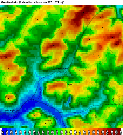
Below is the Elevation map of Greußenheim, which displays elevation range with different colors. Scale of the first map is from 227 to 371 m (745 to 1217 ft) with average elevation of 293.9 meters (=964 ft) [note 1]
These maps also provides idea of topography and contour of this city, they are displayed at different zoom levels. More info about maps, scale and edge coordinates you can find below images.
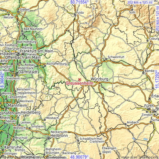
| \ | Map #1 | Topo.Map |
| Scale [m] | 227..371 m | × |
| Scale [ft] | 745..1217 ft | × |
| Average | 293.9 m = 964 ft | × |
| Width | 6.31 km = 3.9 mi | 201.8 km = 125.4 mi |
| Height | 6.31 km = 3.9 mi | 201.8 km = 125.4 mi |
| ↑Max Latitude | 49.845017° | 50.71554° |
| Latitude at center | 49.81667° | 49.81667° |
| ↓Min Latitude | 49.788307° | 48.90079° |
| ← Min Longitude | 9.722725° | 8.36042° |
| Longitude center | 9.76667° | 9.76667° |
| →Max Longitude | 9.810615° | 11.17292° |
Nearby cities:
Cities around Greußenheim sort by population:
• Veitshöchheim elevation 215 m
8.4 km,  77°
77°
• Waldbüttelbrunn 323 m
6.5 km,  118°
118°
• Zell am Main 177 m
7.4 km,  93°
93°
• Hettstadt 285 m
4 km, 118°
• Eisingen 316 m
7.8 km,  143°
143°
• Margetshöchheim 176 m
7.3 km,  71°
71°
• Waldbrunn 316 m
7 km,  157°
157°
• Helmstadt 302 m
7.4 km,  214°
214°
• Birkenfeld 210 m
6.9 km,  312°
312°
• Uettingen 241 m
3.6 km,  226°
226°
• Erlabrunn 170 m
7.3 km,  49°
49°
• Remlingen 259 m
5.3 km,  255°
255°
Multilingual:
 En español:
Greußenheim elevación 268 m.
 En France:
Greußenheim élévation 268 m.
 Auf Deutsch:
Greußenheim höhe über dem Meeresspiegel ist 268 m.

Sources and notes:
- [note 1] Map square and city borders are not equal. Map elevation data is calculated only from area inside that square.
- [src 1] Elevation data from geonames database provided with same terms of usage.
- [src 2] The elevation map of Greußenheim is generated using elevation data from NASA's 3 arcsec (90m) resolution SRTM data.
- [src 3] Base (background) map © OpenStreetMap contributors tiles are generated by Geofabrik and OpenTopoMap.
Copyright & License:
This Greußenheim Elevation Map is licensed under CC BY-SA. You may reuse any part from this page, if you give a proper credit by linking to this URL:
 More info on terms of use page.