Zell am Main elevation
Zell am Main (Bavaria, Regierungsbezirk Unterfranken), Germany elevation is 177 meters and Zell am Main elevation in feet is 581 ft above sea level [src 1]. Zell am Main is a populated place (feature code) with elevation that is 81 meters (266 ft) smaller than average city elevation in Germany.
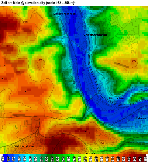
Below is the Elevation map of Zell am Main, which displays elevation range with different colors. Scale of the first map is from 162 to 358 m (531 to 1175 ft) with average elevation of 260.9 meters (=856 ft) [note 1]
These maps also provides idea of topography and contour of this city, they are displayed at different zoom levels. More info about maps, scale and edge coordinates you can find below images.
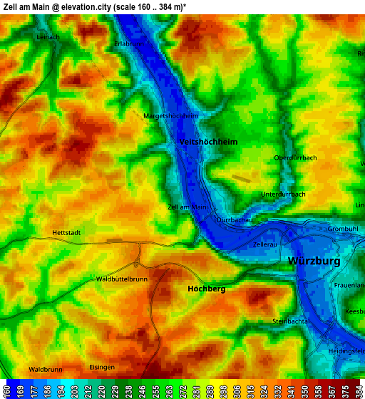
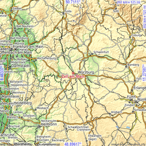
| \ | Map #1 | Map #2 | Topo.Map |
| Scale [m] | 162..358 m | 160..384 m | × |
| Scale [ft] | 531..1175 ft | 525..1260 ft | × |
| Average | 260.9 m = 856 ft | 274.9 m = 902 ft | × |
| Width | 6.31 km = 3.9 mi | 12.61 km = 7.8 mi | 201.8 km = 125.4 mi |
| Height | 6.31 km = 3.9 mi | 12.61 km = 7.8 mi | 201.8 km = 125.4 mi |
| ↑Max Latitude | 49.840489° | 49.868822° | 50.7111° |
| Latitude at center | 49.81214° | 49.81214° | 49.81214° |
| ↓Min Latitude | 49.783774° | 49.755391° | 48.89617° |
| ← Min Longitude | 9.825675° | 9.781729° | 8.46337° |
| Longitude center | 9.86962° | 9.86962° | 9.86962° |
| →Max Longitude | 9.913565° | 9.957511° | 11.27587° |
Nearby cities:
Cities around Zell am Main sort by population:
• Würzburg elevation 204 m
6.2 km,  109°
109°
• Veitshöchheim 215 m
2.5 km,  20°
20°
• Höchberg 265 m
3.2 km,  163°
163°
• Waldbüttelbrunn 323 m
3.1 km,  211°
211°
• Güntersleben 267 m
6.9 km, 21°
• Hettstadt 285 m
4.2 km,  250°
250°
• Eisingen 316 m
6.5 km, 205°
• Margetshöchheim 176 m
2.8 km,  351°
351°
• Thüngersheim 190 m
7.5 km, 348°
• Greußenheim 268 m
7.4 km,  273°
273°
• Erlabrunn 170 m
5.6 km,  340°
340°
• Gadheim 275 m
4.6 km,  34°
34°
Multilingual:
 En español:
Zell am Main elevación 177 m.
 En France:
Zell am Main élévation 177 m.
 Auf Deutsch:
Zell am Main höhe über dem Meeresspiegel ist 177 m.

Sources and notes:
- [note 1] Map square and city borders are not equal. Map elevation data is calculated only from area inside that square.
- [src 1] Elevation data from geonames database provided with same terms of usage.
- [src 2] The elevation map of Zell am Main is generated using elevation data from NASA's 3 arcsec (90m) resolution SRTM data.
- [src 3] Base (background) map © OpenStreetMap contributors tiles are generated by Geofabrik and OpenTopoMap.
Copyright & License:
This Zell am Main Elevation Map is licensed under CC BY-SA. You may reuse any part from this page, if you give a proper credit by linking to this URL:
 More info on terms of use page.