Groß Quenstedt elevation
Groß Quenstedt (Saxony-Anhalt), Germany elevation is 101 meters and Groß Quenstedt elevation in feet is 331 ft above sea level [src 1]. Groß Quenstedt is a seat of a fourth-order administrative division (feature code) with elevation that is 157 meters (515 ft) smaller than average city elevation in Germany.
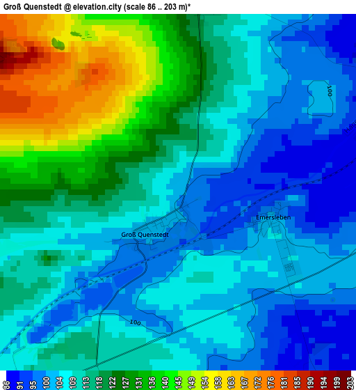
Below is the Elevation map of Groß Quenstedt, which displays elevation range with different colors. Scale of the first map is from 86 to 203 m (282 to 666 ft) with average elevation of 114.4 meters (=375 ft) [note 1]
These maps also provides idea of topography and contour of this city, they are displayed at different zoom levels. More info about maps, scale and edge coordinates you can find below images.
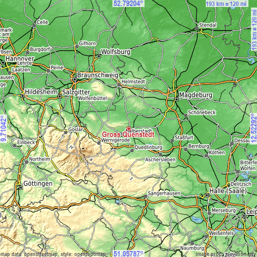
| \ | Map #1 | Topo.Map |
| Scale [m] | 86..203 m | × |
| Scale [ft] | 282..666 ft | × |
| Average | 114.4 m = 375 ft | × |
| Width | 6.03 km = 3.7 mi | 192.8 km = 119.8 mi |
| Height | 6.03 km = 3.7 mi | 192.8 km = 119.8 mi |
| ↑Max Latitude | 51.960418° | 52.79204° |
| Latitude at center | 51.93333° | 51.93333° |
| ↓Min Latitude | 51.906226° | 51.05787° |
| ← Min Longitude | 11.072725° | 9.71042° |
| Longitude center | 11.11667° | 11.11667° |
| →Max Longitude | 11.160615° | 12.52292° |
Nearby cities:
Cities around Groß Quenstedt sort by population:
• Halberstadt elevation 123 m
5.9 km,  224°
224°
• Oschersleben 82 m
13.3 km,  35°
35°
• Gröningen 92 m
6.8 km,  86°
86°
• Wegeleben 100 m
6.7 km,  144°
144°
• Schwanebeck 112 m
3.9 km,  7°
7°
• Harsleben 117 m
7.5 km,  188°
188°
• Langenstein 149 m
12.4 km,  225°
225°
• Ditfurt 123 m
12.5 km,  152°
152°
• Hedersleben 106 m
12.3 km,  131°
131°
• Hornhausen 85 m
13 km,  16°
16°
• Kroppenstedt 95 m
13.2 km, 85°
• Ströbeck 149 m
12 km,  259°
259°
Multilingual:
 En español:
Groß Quenstedt elevación 101 m.
 En France:
Groß Quenstedt élévation 101 m.
 Auf Deutsch:
Groß Quenstedt höhe über dem Meeresspiegel ist 101 m.

Sources and notes:
- [note 1] Map square and city borders are not equal. Map elevation data is calculated only from area inside that square.
- [src 1] Elevation data from geonames database provided with same terms of usage.
- [src 2] The elevation map of Groß Quenstedt is generated using elevation data from NASA's 3 arcsec (90m) resolution SRTM data.
- [src 3] Base (background) map © OpenStreetMap contributors tiles are generated by Geofabrik and OpenTopoMap.
Copyright & License:
This Groß Quenstedt Elevation Map is licensed under CC BY-SA. You may reuse any part from this page, if you give a proper credit by linking to this URL:
 More info on terms of use page.