Großröhrsdorf elevation
Großröhrsdorf (Saxony), Germany elevation is 271 meters and Großröhrsdorf elevation in feet is 889 ft above sea level [src 1]. Großröhrsdorf is a populated place (feature code) with elevation that is 13 meters (43 ft) bigger than average city elevation in Germany.
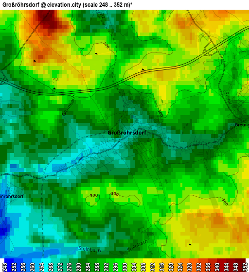
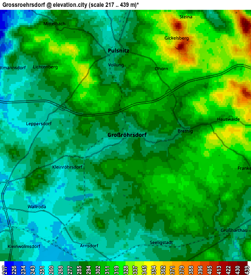
Below is the Elevation map of Großröhrsdorf, which displays elevation range with different colors. Scale of the first map is from 248 to 352 m (814 to 1155 ft) with average elevation of 291.6 meters (=957 ft) [note 1]
These maps also provides idea of topography and contour of this city, they are displayed at different zoom levels. More info about maps, scale and edge coordinates you can find below images.
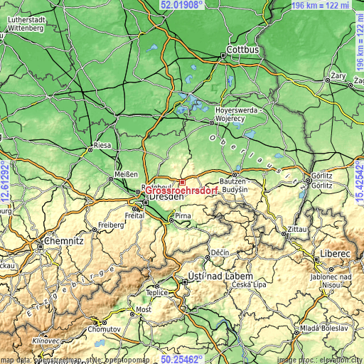
| \ | Map #1 | Map #2 | Topo.Map |
| Scale [m] | 248..352 m | 217..439 m | × |
| Scale [ft] | 814..1155 ft | 712..1440 ft | × |
| Average | 291.6 m = 957 ft | 292.5 m = 960 ft | × |
| Width | 6.13 km = 3.8 mi | 12.26 km = 7.6 mi | 196.2 km = 121.9 mi |
| Height | 6.13 km = 3.8 mi | 12.26 km = 7.6 mi | 196.2 km = 121.9 mi |
| ↑Max Latitude | 51.172841° | 51.200385° | 52.01908° |
| Latitude at center | 51.14528° | 51.14528° | 51.14528° |
| ↓Min Latitude | 51.117703° | 51.090109° | 50.25462° |
| ← Min Longitude | 13.975225° | 13.931279° | 12.61292° |
| Longitude center | 14.01917° | 14.01917° | 14.01917° |
| →Max Longitude | 14.063115° | 14.107061° | 15.42542° |
Nearby cities:
Cities around Großröhrsdorf sort by population:
• Radeberg elevation 241 m
8.4 km,  243°
243°
• Wachau 222 m
8.1 km,  283°
283°
• Großharthau 278 m
7 km,  127°
127°
• Hauswalde 300 m
4.7 km,  80°
80°
• Ohorn 318 m
3.5 km,  32°
32°
• Steina 320 m
6.5 km,  19°
19°
• Lichtenberg 341 m
5.6 km,  319°
319°
• Oberlichtenau 246 m
8.4 km,  345°
345°
• Rammenau 303 m
8 km,  86°
86°
• Großnaundorf 221 m
8.5 km, 315°
• Frankenthal 300 m
6.5 km,  103°
103°
• Haselbachtal 224 m
10.1 km,  2°
2°
Multilingual:
 En español:
Großröhrsdorf elevación 271 m.
 En France:
Großröhrsdorf élévation 271 m.
 Auf Deutsch:
Großröhrsdorf höhe über dem Meeresspiegel ist 271 m.

Sources and notes:
- [note 1] Map square and city borders are not equal. Map elevation data is calculated only from area inside that square.
- [src 1] Elevation data from geonames database provided with same terms of usage.
- [src 2] The elevation map of Großröhrsdorf is generated using elevation data from NASA's 3 arcsec (90m) resolution SRTM data.
- [src 3] Base (background) map © OpenStreetMap contributors tiles are generated by Geofabrik and OpenTopoMap.
Copyright & License:
This Großröhrsdorf Elevation Map is licensed under CC BY-SA. You may reuse any part from this page, if you give a proper credit by linking to this URL:
 More info on terms of use page.