Wachau elevation
Wachau (Saxony), Germany elevation is 222 meters and Wachau elevation in feet is 728 ft above sea level [src 1]. Wachau is a seat of a fourth-order administrative division (feature code) with elevation that is 36 meters (118 ft) smaller than average city elevation in Germany.
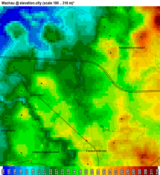
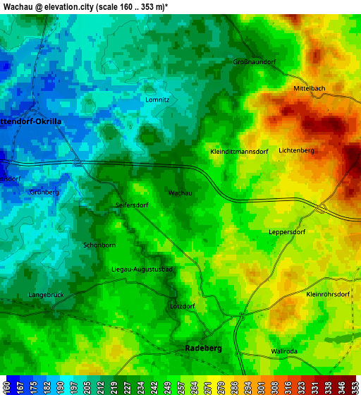
Below is the Elevation map of Wachau, which displays elevation range with different colors. Scale of the first map is from 180 to 316 m (591 to 1037 ft) with average elevation of 239 meters (=784 ft) [note 1]
These maps also provides idea of topography and contour of this city, they are displayed at different zoom levels. More info about maps, scale and edge coordinates you can find below images.
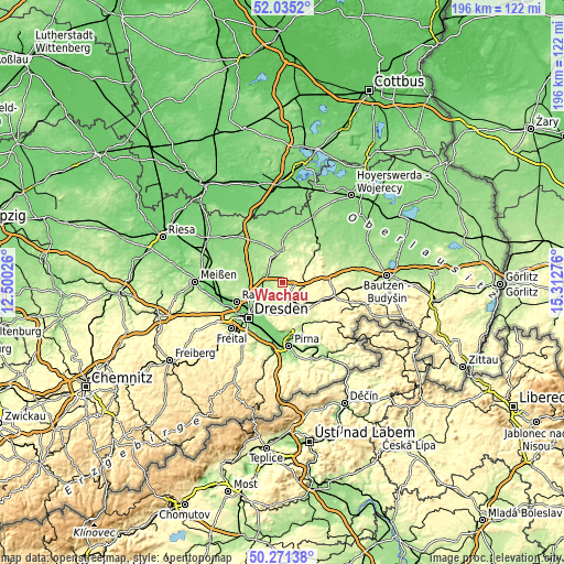
| \ | Map #1 | Map #2 | Topo.Map |
| Scale [m] | 180..316 m | 160..353 m | × |
| Scale [ft] | 591..1037 ft | 525..1158 ft | × |
| Average | 239 m = 784 ft | 238.9 m = 784 ft | × |
| Width | 6.13 km = 3.8 mi | 12.26 km = 7.6 mi | 196.1 km = 121.9 mi |
| Height | 6.13 km = 3.8 mi | 12.26 km = 7.6 mi | 196.1 km = 121.9 mi |
| ↑Max Latitude | 51.189271° | 51.216805° | 52.0352° |
| Latitude at center | 51.16172° | 51.16172° | 51.16172° |
| ↓Min Latitude | 51.134153° | 51.106569° | 50.27138° |
| ← Min Longitude | 13.862565° | 13.818619° | 12.50026° |
| Longitude center | 13.90651° | 13.90651° | 13.90651° |
| →Max Longitude | 13.950455° | 13.994401° | 15.31276° |
Nearby cities:
Cities around Wachau sort by population:
• Radeberg elevation 241 m
5.6 km,  176°
176°
• Ottendorf-Okrilla 176 m
5.6 km,  295°
295°
• Großröhrsdorf 271 m
8.1 km,  103°
103°
• Königsbrück 178 m
11.4 km,  359°
359°
• Höckendorf 199 m
7 km,  1°
1°
• Ohorn 318 m
9.8 km,  83°
83°
• Laußnitz 183 m
9.9 km,  350°
350°
• Steina 320 m
10.9 km,  66°
66°
• Lichtenberg 341 m
4.8 km,  60°
60°
• Oberlichtenau 246 m
8.6 km,  42°
42°
• Großnaundorf 221 m
4.6 km,  23°
23°
• Haselbachtal 224 m
11.7 km,  45°
45°
Multilingual:
 En español:
Wachau elevación 222 m.
 En France:
Wachau élévation 222 m.


Sources and notes:
- [note 1] Map square and city borders are not equal. Map elevation data is calculated only from area inside that square.
- [src 1] Elevation data from geonames database provided with same terms of usage.
- [src 2] The elevation map of Wachau is generated using elevation data from NASA's 3 arcsec (90m) resolution SRTM data.
- [src 3] Base (background) map © OpenStreetMap contributors tiles are generated by Geofabrik and OpenTopoMap.
Copyright & License:
This Wachau Elevation Map is licensed under CC BY-SA. You may reuse any part from this page, if you give a proper credit by linking to this URL:
 More info on terms of use page.